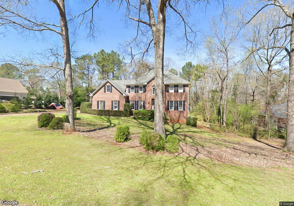
219 Ashford Cir Lagrange, GA 30240
Estimated Value: $463,000 - $520,000
5
Beds
4
Baths
3,319
Sq Ft
$147/Sq Ft
Est. Value
About This Home
This home is located at 219 Ashford Cir, Lagrange, GA 30240 and is currently estimated at $488,335, approximately $147 per square foot. 219 Ashford Cir is a home located in Troup County with nearby schools including Franklin Forest Elementary School, Hollis Hand Elementary School, and Ethel W. Kight Elementary School.
Ownership History
Date
Name
Owned For
Owner Type
Purchase Details
Closed on
Dec 12, 2002
Sold by
Fiona Fiona and Fiona Brian
Bought by
Wilson Brian M
Current Estimated Value
Purchase Details
Closed on
Dec 31, 1999
Sold by
Brian M Wilson
Bought by
Fiona Fiona and Fiona Brian
Purchase Details
Closed on
Oct 4, 1999
Sold by
John Babcock and Judith Skinner
Bought by
Brian M Wilson
Purchase Details
Closed on
Sep 24, 1993
Sold by
Eric D Tucker
Bought by
John Babcock and Judith Skinner
Purchase Details
Closed on
Jun 12, 1991
Sold by
West Ga Estates Inc
Bought by
Eric D Tucker
Purchase Details
Closed on
Jun 14, 1985
Sold by
Heinrich J Boggess
Bought by
West Ga Estates Inc
Create a Home Valuation Report for This Property
The Home Valuation Report is an in-depth analysis detailing your home's value as well as a comparison with similar homes in the area
Purchase History
| Date | Buyer | Sale Price | Title Company |
|---|---|---|---|
| Wilson Brian M | -- | -- | |
| Fiona Fiona | -- | -- | |
| Brian M Wilson | $231,000 | -- | |
| John Babcock | $185,000 | -- | |
| Eric D Tucker | $168,000 | -- | |
| West Ga Estates Inc | -- | -- |
Source: Public Records
Tax History
| Year | Tax Paid | Tax Assessment Tax Assessment Total Assessment is a certain percentage of the fair market value that is determined by local assessors to be the total taxable value of land and additions on the property. | Land | Improvement |
|---|---|---|---|---|
| 2025 | $4,440 | $170,920 | $18,000 | $152,920 |
| 2024 | $4,136 | $153,640 | $18,000 | $135,640 |
| 2023 | $3,129 | $134,640 | $14,000 | $120,640 |
| 2022 | $3,444 | $125,400 | $14,000 | $111,400 |
| 2021 | $3,213 | $108,520 | $14,000 | $94,520 |
| 2020 | $3,213 | $108,520 | $14,000 | $94,520 |
| 2019 | $3,086 | $104,320 | $14,000 | $90,320 |
| 2018 | $3,086 | $104,320 | $14,000 | $90,320 |
| 2017 | $3,086 | $104,320 | $14,000 | $90,320 |
| 2016 | $3,052 | $101,207 | $9,200 | $92,007 |
| 2015 | $3,057 | $101,207 | $9,200 | $92,007 |
| 2014 | $3,005 | $99,310 | $9,200 | $90,110 |
| 2013 | -- | $101,412 | $9,200 | $92,212 |
Source: Public Records
Map
Nearby Homes
- 103 Windridge
- 107 Windridge
- 205 River Oaks Dr
- 109 Windridge
- 114 Red Oak Trail
- 209 River Oaks Dr
- 103 Woodchase
- 103 Powers Ct
- 130 Sunny Point Cir
- 127 Ashling Dr
- 91 Richmond Dr
- 110 Pond View Point
- 1784 Mooty Bridge Rd
- 115 Meadowland Trail
- 1351 New Franklin Rd
- 203 View Pointe Ln
- 100 Deer Creek Dr
- 1218 New Franklin Rd
- 204 Dixie Creek Dr
- 102 Beech Creek Dr
- 217 Ashford Cir
- 221 Ashford Cir
- 218 Ashford Cir
- 220 Ashford Cir
- 215 Ashford Cir
- 223 Ashford Cir
- 216 Ashford Cir
- 120 Moss Creek Dr
- 116 Moss Creek Dr
- 222 Ashford Cir
- 225 Ashford Cir
- 214 Ashford Cir
- 213 Ashford Cir
- 97 Windridge
- 114 Moss Creek Dr
- 102 Saint Angela Merici Ct
- 100 Saint Angela Merici Ct
- 122 Moss Creek Dr
- 104 Saint Angela Merici Ct
- 104 St Angela Merici
Your Personal Tour Guide
Ask me questions while you tour the home.