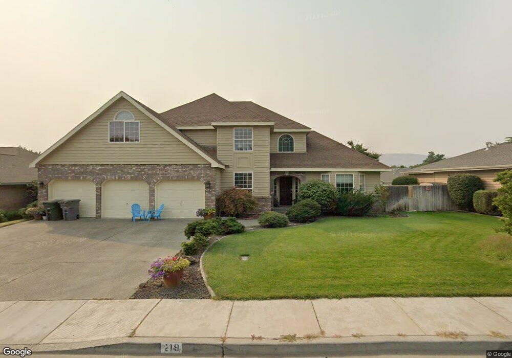
219 Ashwood St Unit One Owner! Richland, WA 99352
Estimated Value: $531,989 - $584,000
3
Beds
2
Baths
2,471
Sq Ft
$228/Sq Ft
Est. Value
About This Home
This home is located at 219 Ashwood St Unit One Owner!, Richland, WA 99352 and is currently estimated at $563,247, approximately $227 per square foot. 219 Ashwood St Unit One Owner! is a home located in Benton County with nearby schools including Badger Mountain Elementary School, Carmichael Middle School, and Richland High School.
Ownership History
Date
Name
Owned For
Owner Type
Purchase Details
Closed on
May 21, 2020
Sold by
Jones Ernest M and Jones Kari L
Bought by
Jones Kari L
Current Estimated Value
Home Financials for this Owner
Home Financials are based on the most recent Mortgage that was taken out on this home.
Original Mortgage
$297,600
Outstanding Balance
$263,715
Interest Rate
3.3%
Mortgage Type
New Conventional
Estimated Equity
$299,532
Purchase Details
Closed on
Mar 29, 2016
Sold by
Jones Glen F and Jones Un B
Bought by
Jones Ernest M and Jones Kari L
Home Financials for this Owner
Home Financials are based on the most recent Mortgage that was taken out on this home.
Original Mortgage
$288,000
Interest Rate
3.62%
Mortgage Type
New Conventional
Create a Home Valuation Report for This Property
The Home Valuation Report is an in-depth analysis detailing your home's value as well as a comparison with similar homes in the area
Home Values in the Area
Average Home Value in this Area
Purchase History
| Date | Buyer | Sale Price | Title Company |
|---|---|---|---|
| Jones Kari L | -- | Chicago Title | |
| Jones Ernest M | $320,000 | Tri City Title & Escrow Llc |
Source: Public Records
Mortgage History
| Date | Status | Borrower | Loan Amount |
|---|---|---|---|
| Open | Jones Kari L | $297,600 | |
| Closed | Jones Ernest M | $288,000 |
Source: Public Records
Tax History Compared to Growth
Tax History
| Year | Tax Paid | Tax Assessment Tax Assessment Total Assessment is a certain percentage of the fair market value that is determined by local assessors to be the total taxable value of land and additions on the property. | Land | Improvement |
|---|---|---|---|---|
| 2024 | $4,243 | $500,160 | $50,000 | $450,160 |
| 2023 | $4,243 | $453,990 | $50,000 | $403,990 |
| 2022 | $3,876 | $384,730 | $50,000 | $334,730 |
| 2021 | $3,511 | $350,110 | $50,000 | $300,110 |
| 2020 | $3,849 | $303,940 | $50,000 | $253,940 |
| 2019 | $3,346 | $315,370 | $46,000 | $269,370 |
| 2018 | $3,438 | $294,650 | $46,000 | $248,650 |
| 2017 | $3,034 | $253,210 | $46,000 | $207,210 |
| 2016 | $3,385 | $253,210 | $46,000 | $207,210 |
| 2015 | $3,433 | $253,210 | $46,000 | $207,210 |
| 2014 | -- | $253,210 | $46,000 | $207,210 |
| 2013 | -- | $253,210 | $46,000 | $207,210 |
Source: Public Records
Map
Nearby Homes
- 201 Ashwood St
- 1325 Brookwood Ave
- 1606 Elementary St
- 179 Englewood Dr
- 1219 Brentwood Ave
- 100 Hills Way W
- 430 Keene Rd
- 225 Rockwood Dr
- 190 Edgewood Dr
- 1125 Hills West Way
- 1 Keene Rd Unit Lot 1
- 2 Keene Rd Unit Lot 2
- 3 Keene Rd Unit Lot 3
- 260 Rockwood Dr
- 1640 Palermo Ave
- 552 Lazio Way
- 1557 Livorno Ave
- 325 Rockwood Dr
- 0 Keene Rd
- 312 Rockwood Dr
- 219 Ashwood St
- 225 Ashwood St
- 213 Ashwood St
- 220 Hartwood St
- 226 Hartwood St
- 214 Hartwood St
- 1331 Brentwood Ave
- 207 Ashwood St
- 231 Ashwood St
- 232 Hartwood St
- 208 Hartwood St
- 1328 Rathwood Ave
- 1332 Brentwood Ave
- 1325 Brentwood Ave
- 237 Ashwood St
- 238 Hartwood St
- 202 Hartwood St
- 225 Hartwood St
- 1322 Rathwood Ave
- 1326 Brentwood Ave