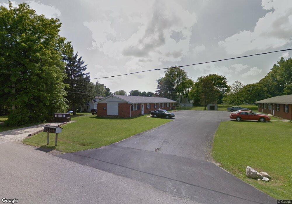
219 Boston Ave Mansfield, OH 44906
Estimated Value: $169,000 - $798,000
3
Beds
3
Baths
2,340
Sq Ft
$164/Sq Ft
Est. Value
About This Home
This home is located at 219 Boston Ave, Mansfield, OH 44906 and is currently estimated at $382,667, approximately $163 per square foot. 219 Boston Ave is a home located in Richland County with nearby schools including Mansfield Elective Academy, Goal Digital Academy, and Foundation Academy.
Ownership History
Date
Name
Owned For
Owner Type
Purchase Details
Closed on
Jun 3, 2002
Sold by
Boebel Robert E
Bought by
Cunningham H Lee N Diane
Current Estimated Value
Home Financials for this Owner
Home Financials are based on the most recent Mortgage that was taken out on this home.
Original Mortgage
$94,000
Outstanding Balance
$40,279
Interest Rate
7%
Mortgage Type
New Conventional
Estimated Equity
$342,388
Purchase Details
Closed on
Oct 14, 1994
Sold by
Boebel Barbara J
Bought by
Lee Cunningham H
Purchase Details
Closed on
Jan 8, 1990
Create a Home Valuation Report for This Property
The Home Valuation Report is an in-depth analysis detailing your home's value as well as a comparison with similar homes in the area
Home Values in the Area
Average Home Value in this Area
Purchase History
| Date | Buyer | Sale Price | Title Company |
|---|---|---|---|
| Cunningham H Lee N Diane | $140,000 | -- | |
| Lee Cunningham H | $140,000 | -- | |
| -- | $110,000 | -- |
Source: Public Records
Mortgage History
| Date | Status | Borrower | Loan Amount |
|---|---|---|---|
| Open | Cunningham H Lee N Diane | $94,000 |
Source: Public Records
Tax History Compared to Growth
Tax History
| Year | Tax Paid | Tax Assessment Tax Assessment Total Assessment is a certain percentage of the fair market value that is determined by local assessors to be the total taxable value of land and additions on the property. | Land | Improvement |
|---|---|---|---|---|
| 2024 | $1,908 | $39,850 | $2,000 | $37,850 |
| 2023 | $1,908 | $39,850 | $2,000 | $37,850 |
| 2022 | $1,721 | $30,130 | $1,680 | $28,450 |
| 2021 | $1,733 | $30,130 | $1,680 | $28,450 |
| 2020 | $1,773 | $30,130 | $1,680 | $28,450 |
| 2019 | $1,965 | $30,130 | $1,680 | $28,450 |
| 2018 | $1,939 | $30,130 | $1,680 | $28,450 |
| 2017 | $1,920 | $30,130 | $1,680 | $28,450 |
| 2016 | $1,954 | $30,260 | $1,600 | $28,660 |
| 2015 | $1,866 | $30,260 | $1,600 | $28,660 |
| 2014 | $1,842 | $30,260 | $1,600 | $28,660 |
| 2012 | $743 | $31,850 | $1,680 | $30,170 |
Source: Public Records
Map
Nearby Homes
- 0 W Fourth St - Trimble Lenox
- 143 Buckeye Ave
- 340 Boston Ave
- 147 Wimbledon Dr
- 37 S Linden Rd
- 1431 Silver Ln
- 1496 W 4th St
- 142 Grasmere Ave
- 2585 Deerfield Ln
- 143 Kingwood Place
- 216 S Trimble Rd Unit 218
- 190 S Linden Rd
- 232 S Trimble Rd Unit 234
- 170 Western Ave
- 129 Fairlawn Ave
- 244 S Trimble Rd Unit 246
- 135 Fairlawn Ave
- 269 Parkway Dr
- 143 Fairlawn Ave
- 1068 Linwood Place
- 217 Boston Ave
- 221 Boston Ave
- 00 Boston Ave
- 222 Concord Ave
- 214 Boston Ave
- 214 Boston Ave
- 214 Boston Ave
- 214 Boston Ave
- 238 Concord Ave
- 1111 W 4th St
- 200 Boston Ave
- 192 Boston Ave
- 227 Concord Ave
- 213 Oxford Ave Unit 15
- 209 Oxford Ave
- 186 Boston Ave
- 239 Concord Ave
- 203 Concord Ave
- 203 Oxford Ave
- 205 Oxford Ave