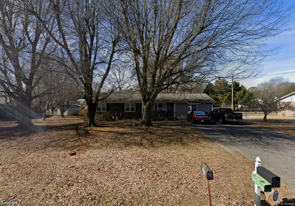
219 Brian Dr SW Calhoun, GA 30701
Estimated Value: $246,000 - $267,000
3
Beds
2
Baths
1,881
Sq Ft
$135/Sq Ft
Est. Value
About This Home
This home is located at 219 Brian Dr SW, Calhoun, GA 30701 and is currently estimated at $253,507, approximately $134 per square foot. 219 Brian Dr SW is a home located in Gordon County with nearby schools including Calhoun Elementary School, Calhoun Middle School, and Calhoun High School.
Ownership History
Date
Name
Owned For
Owner Type
Purchase Details
Closed on
May 6, 2025
Sold by
Warren Steven L
Bought by
Warren Steven L and Warren Vickie G
Current Estimated Value
Home Financials for this Owner
Home Financials are based on the most recent Mortgage that was taken out on this home.
Original Mortgage
$50,000
Outstanding Balance
$47,305
Interest Rate
6.76%
Mortgage Type
New Conventional
Estimated Equity
$206,202
Purchase Details
Closed on
May 9, 1988
Sold by
Burnette Marvin
Bought by
Warren Steven L
Create a Home Valuation Report for This Property
The Home Valuation Report is an in-depth analysis detailing your home's value as well as a comparison with similar homes in the area
Purchase History
| Date | Buyer | Sale Price | Title Company |
|---|---|---|---|
| Warren Steven L | -- | -- | |
| Warren Steven L | -- | -- |
Source: Public Records
Mortgage History
| Date | Status | Borrower | Loan Amount |
|---|---|---|---|
| Open | Warren Steven L | $50,000 |
Source: Public Records
Tax History
| Year | Tax Paid | Tax Assessment Tax Assessment Total Assessment is a certain percentage of the fair market value that is determined by local assessors to be the total taxable value of land and additions on the property. | Land | Improvement |
|---|---|---|---|---|
| 2025 | $744 | $69,360 | $5,200 | $64,160 |
| 2024 | $726 | $60,800 | $5,200 | $55,600 |
| 2023 | $677 | $56,800 | $5,200 | $51,600 |
| 2022 | $486 | $53,120 | $5,200 | $47,920 |
| 2021 | $599 | $44,360 | $5,200 | $39,160 |
| 2020 | $589 | $43,880 | $5,200 | $38,680 |
| 2019 | $1,296 | $43,880 | $5,200 | $38,680 |
| 2018 | $354 | $38,760 | $5,040 | $33,720 |
| 2017 | $340 | $36,640 | $5,040 | $31,600 |
| 2016 | $341 | $36,640 | $5,040 | $31,600 |
| 2015 | $339 | $35,920 | $5,040 | $30,880 |
| 2014 | $325 | $34,954 | $5,040 | $29,914 |
Source: Public Records
Map
Nearby Homes
- 425 McDaniel Station Rd SW
- 153 Thelma Rd SW
- 490 McDaniel Station Rd SW
- 506 McDaniel Station Rd SW
- 458 McDaniel Station Rd SW
- 474 McDaniel Station Rd SW
- 0 Reeves Station Rd SW Unit 10548197
- 0 Reeves Station Rd SW Unit 7601645
- 00 Reeves Station Rd SW
- 0 Reeves Station Rd SW Unit 10690545
- 219 Regency Ln SW
- 120 Dan Cheri Dr
- 1401 U S 41
- 1311 Us Highway 41
- 0 S Wall St Unit 10665175
- 0 W Belmont Dr Unit 10703135
- 0 W Belmont Dr Unit 7729054
- 1136 S Wall St
- 119 Peters St
- 111 Koufax Dr SW
- 231 Brian Dr SW
- 207 Brian Dr SW
- 220 Donna St SW
- 232 Donna St SW
- 204 Donna St SW
- 208 Brian Dr SW
- 246 Brian Dr SW
- 195 Brian Dr SW
- 220 Brian Dr SW
- 232 Brian Dr SW
- 196 Donna St SW
- 242 Donna St SW
- 247 Brian Dr SW
- 196 Brian Dr SW
- 183 Brian Dr SW
- 375 Stewart Dr SW
- 213 Donna St SW
- 182 Donna St SW
- 395 Stewart Dr SW
- 227 Donna St SW
Your Personal Tour Guide
Ask me questions while you tour the home.