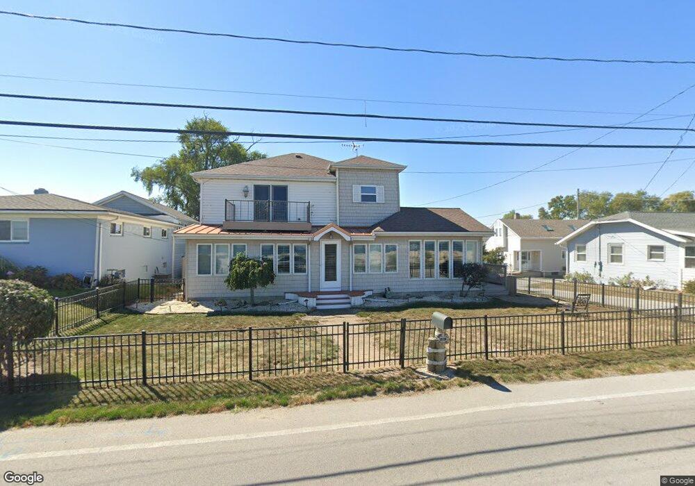
219 Cedar Point Rd Sandusky, OH 44870
Estimated Value: $356,176 - $646,000
3
Beds
3
Baths
2,222
Sq Ft
$242/Sq Ft
Est. Value
About This Home
This home is located at 219 Cedar Point Rd, Sandusky, OH 44870 and is currently estimated at $537,544, approximately $241 per square foot. 219 Cedar Point Rd is a home located in Erie County with nearby schools including Sandusky High School.
Ownership History
Date
Name
Owned For
Owner Type
Purchase Details
Closed on
Mar 3, 2023
Sold by
Richter Carl S and Richter Denise M
Bought by
Richter Living Trust and Richter
Current Estimated Value
Purchase Details
Closed on
May 27, 2010
Sold by
Wargo Armstrong Alice
Bought by
Richter Carl S and Richter Denise M
Home Financials for this Owner
Home Financials are based on the most recent Mortgage that was taken out on this home.
Original Mortgage
$175,000
Interest Rate
5.12%
Mortgage Type
New Conventional
Create a Home Valuation Report for This Property
The Home Valuation Report is an in-depth analysis detailing your home's value as well as a comparison with similar homes in the area
Purchase History
| Date | Buyer | Sale Price | Title Company |
|---|---|---|---|
| Richter Living Trust | $166 | None Listed On Document | |
| Richter Carl S | $264,830 | Hartung Title |
Source: Public Records
Mortgage History
| Date | Status | Borrower | Loan Amount |
|---|---|---|---|
| Previous Owner | Richter Carl S | $175,000 |
Source: Public Records
Tax History
| Year | Tax Paid | Tax Assessment Tax Assessment Total Assessment is a certain percentage of the fair market value that is determined by local assessors to be the total taxable value of land and additions on the property. | Land | Improvement |
|---|---|---|---|---|
| 2024 | $3,267 | $83,758 | $39,984 | $43,774 |
| 2023 | $3,298 | $66,409 | $28,560 | $37,849 |
| 2022 | $3,366 | $66,409 | $28,560 | $37,849 |
| 2021 | $3,397 | $66,410 | $28,560 | $37,850 |
| 2020 | $3,376 | $60,660 | $28,560 | $32,100 |
| 2019 | $3,471 | $60,660 | $28,560 | $32,100 |
| 2018 | $3,475 | $60,660 | $28,560 | $32,100 |
| 2017 | $3,517 | $61,200 | $31,130 | $30,070 |
| 2016 | $3,516 | $61,200 | $31,130 | $30,070 |
| 2015 | $3,185 | $61,200 | $31,130 | $30,070 |
| 2014 | $3,166 | $61,200 | $31,130 | $30,070 |
| 2013 | $3,134 | $61,200 | $31,130 | $30,070 |
Source: Public Records
Map
Nearby Homes
- 139 Cedar Point Rd
- 939 Cedar Point Rd
- 2912 Park Ln
- 3110 Gabriels Place
- 2802 N Bayview Ln
- 720 Tracht Meadows Dr
- 2815 E Perkins Ave
- 2906 E Perkins Ave
- 2707 Highland Dr
- 0 Turfside Cir
- 21 Turfside Cir
- 0 Galloway Rd Unit 5196064
- 0 Galloway Rd Unit 20260998
- 3014 Angels Pointe Dr
- 3037 Lauras Ln
- 3135 Lauras Ln
- 3132 Lauras Ln
- 0 Cleveland Rd W
- 1640 Cleveland Rd W
- 712 Elizabeth Dr
- 104 Lane c
- 104 Lane c
- 217 Cedar Point Rd
- 223 Cedar Point Rd
- 105 Lane c
- 106 Lane c
- 109 Lane c
- 225 Cedar Point Rd
- 215 Cedar Point Rd
- 108 Lane D
- 211 Cedar Point Dr
- 211 Cedar Point Rd
- 229 Cedar Point Rd
- 105 Lane D
- 107 Lane D
- 233 Cedar Point Rd
- 207 Cedar Point Rd
- 205 Cedar Point Rd
- 235 Cedar Point Rd
- 201 Cedar Point Rd
Your Personal Tour Guide
Ask me questions while you tour the home.