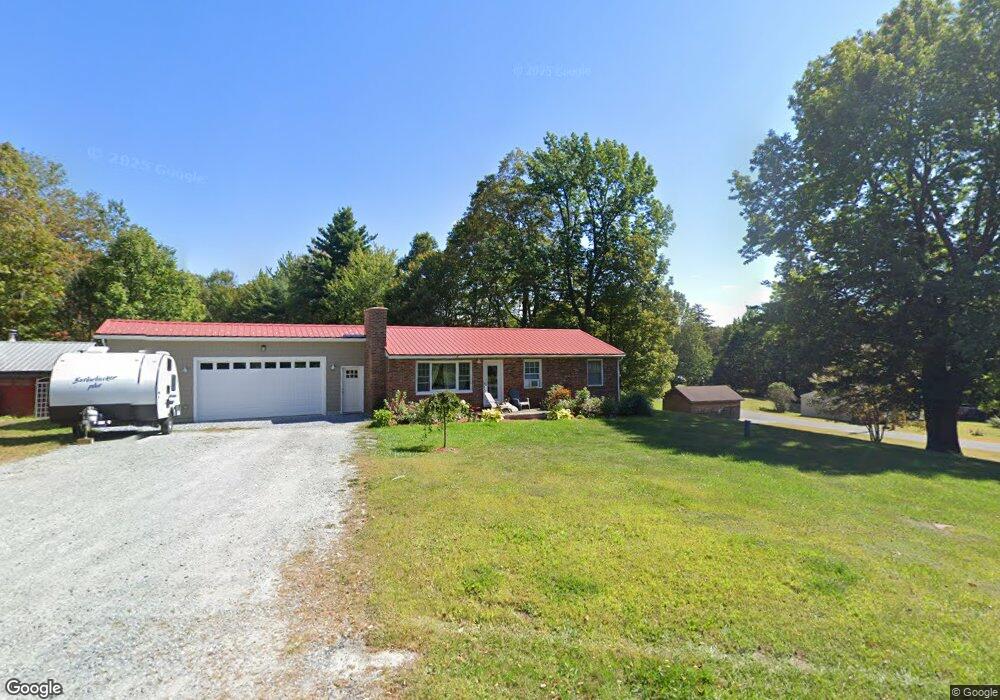
219 Central Shaft Rd Florida, MA 01247
Estimated Value: $145,000 - $282,000
3
Beds
2
Baths
1,170
Sq Ft
$196/Sq Ft
Est. Value
About This Home
This home is located at 219 Central Shaft Rd, Florida, MA 01247 and is currently estimated at $229,441, approximately $196 per square foot. 219 Central Shaft Rd is a home located in Berkshire County with nearby schools including Gabriel Abbott Memorial School.
Ownership History
Date
Name
Owned For
Owner Type
Purchase Details
Closed on
Feb 28, 2025
Sold by
Rougeau Daryl J
Bought by
Rougeau Daryl J and Rougeau Andrea M
Current Estimated Value
Purchase Details
Closed on
Jul 29, 2021
Sold by
Smith Diane M
Bought by
Rougeau Daryl J
Home Financials for this Owner
Home Financials are based on the most recent Mortgage that was taken out on this home.
Original Mortgage
$69,200
Interest Rate
2.99%
Mortgage Type
Purchase Money Mortgage
Create a Home Valuation Report for This Property
The Home Valuation Report is an in-depth analysis detailing your home's value as well as a comparison with similar homes in the area
Home Values in the Area
Average Home Value in this Area
Purchase History
| Date | Buyer | Sale Price | Title Company |
|---|---|---|---|
| Rougeau Daryl J | -- | None Available | |
| Rougeau Daryl J | -- | None Available | |
| Rougeau Daryl J | $58,500 | None Available | |
| Rougeau Daryl J | $58,500 | None Available |
Source: Public Records
Mortgage History
| Date | Status | Borrower | Loan Amount |
|---|---|---|---|
| Previous Owner | Rougeau Daryl J | $69,200 |
Source: Public Records
Tax History Compared to Growth
Tax History
| Year | Tax Paid | Tax Assessment Tax Assessment Total Assessment is a certain percentage of the fair market value that is determined by local assessors to be the total taxable value of land and additions on the property. | Land | Improvement |
|---|---|---|---|---|
| 2025 | $1,337 | $172,100 | $32,000 | $140,100 |
| 2023 | $1,041 | $123,100 | $27,200 | $95,900 |
| 2022 | $1,072 | $121,500 | $26,700 | $94,800 |
| 2021 | $1,023 | $120,200 | $25,400 | $94,800 |
| 2019 | $1,111 | $114,300 | $24,900 | $89,400 |
| 2018 | $1,083 | $104,200 | $24,900 | $79,300 |
| 2017 | $979 | $102,700 | $24,500 | $78,200 |
| 2016 | $957 | $102,700 | $24,500 | $78,200 |
| 2015 | $942 | $104,300 | $24,500 | $79,800 |
Source: Public Records
Map
Nearby Homes
- 0 Central Shaft Rd
- 117 Strykers Rd
- 0 Strykers Rd
- 214 Mohawk Trail
- 70 Mohawk Trail
- 00 Mohawk Trail
- 2438 Mohawk Trail
- 477 Mohawk Trail
- 0 Moores Rd Unit 247336
- 8 Apache Dr
- 350 Mohawk Trail
- 12 Aztec Dr
- 360 Mohawk Trail
- 921 Mohawk Trail
- 1320 Church St
- 0 Oak Hill Unit 237953
- 17 A St
- 100 Autumn Dr
- 54 Pine Hill Terrace
- 0 Tunnel Rd
- 2 Poirot Rd
- 7 Poirot Rd
- 229 Central Shaft Rd
- 6 Poirot Rd
- 202 Central Shaft Rd
- 231 Central Shaft Rd
- 0 Poirot Rd
- 212 Central Shaft Rd
- 13 Poirot Rd
- 217 Central Shaft Rd
- 10 Poirot Rd
- 237 Central Shaft Rd
- 194 Central Shaft Rd
- 24 Poirot Rd
- 230 Central Shaft Rd
- 243 Central Shaft Rd
- 190 Central Shaft Rd
- 6 S County Rd
- 6 S County Rd
- 16 S County Rd