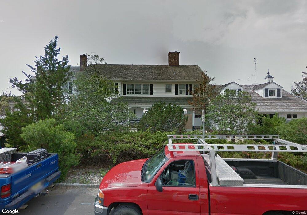
219 Channel Ln Mantoloking, NJ 08738
Estimated Value: $5,153,000 - $9,199,000
5
Beds
7
Baths
5,546
Sq Ft
$1,273/Sq Ft
Est. Value
About This Home
This home is located at 219 Channel Ln, Mantoloking, NJ 08738 and is currently estimated at $7,057,428, approximately $1,272 per square foot. 219 Channel Ln is a home with nearby schools including G Harold Antrim Elementary School, Point Pleasant Beach High School, and St. Peter School.
Ownership History
Date
Name
Owned For
Owner Type
Purchase Details
Closed on
Jul 20, 2017
Sold by
Brand William A and Brand Helen E
Bought by
Snyder John Harper and Snyder Harriet Tuck
Current Estimated Value
Purchase Details
Closed on
Dec 28, 2016
Sold by
Brand Residence Trust
Bought by
Brand William A and Brand Helen Elizabeth
Purchase Details
Closed on
May 28, 2003
Sold by
Brand William A
Bought by
Dean Helen E and Brand William A
Create a Home Valuation Report for This Property
The Home Valuation Report is an in-depth analysis detailing your home's value as well as a comparison with similar homes in the area
Home Values in the Area
Average Home Value in this Area
Purchase History
| Date | Buyer | Sale Price | Title Company |
|---|---|---|---|
| Snyder John Harper | $3,200,000 | First American Title | |
| Brand William A | -- | -- | |
| Dean Helen E | -- | -- |
Source: Public Records
Mortgage History
| Date | Status | Borrower | Loan Amount |
|---|---|---|---|
| Closed | Dean Helen E | $0 |
Source: Public Records
Tax History Compared to Growth
Tax History
| Year | Tax Paid | Tax Assessment Tax Assessment Total Assessment is a certain percentage of the fair market value that is determined by local assessors to be the total taxable value of land and additions on the property. | Land | Improvement |
|---|---|---|---|---|
| 2025 | $47,800 | $5,571,100 | $2,855,500 | $2,715,600 |
| 2024 | $45,421 | $5,571,100 | $2,855,500 | $2,715,600 |
| 2023 | $38,972 | $5,566,300 | $2,855,500 | $2,710,800 |
| 2022 | $38,972 | $5,567,400 | $2,855,500 | $2,711,900 |
| 2021 | $33,195 | $5,567,400 | $2,855,500 | $2,711,900 |
| 2020 | $39,640 | $5,567,400 | $2,855,500 | $2,711,900 |
| 2019 | $20,046 | $2,855,500 | $2,855,500 | $0 |
| 2018 | $19,760 | $2,855,500 | $2,855,500 | $0 |
| 2017 | $19,903 | $2,855,500 | $2,855,500 | $0 |
| 2016 | $29,510 | $4,252,200 | $2,855,500 | $1,396,700 |
| 2015 | $29,043 | $4,252,200 | $2,855,500 | $1,396,700 |
| 2014 | $25,187 | $4,017,000 | $2,855,500 | $1,161,500 |
Source: Public Records
Map
Nearby Homes
- 948 Lagoon Ln S
- 940 Barnegat Ln
- 954 Barnegat Ln
- 829 East Ave
- 767 East Ave
- 1027 Ocean Ave
- 1730 Bay Blvd
- 1731 Bay Isle Dr
- 674 Lake Ave
- 1025 Barnegat Ln Unit B
- 1720 Riviera Ct
- 1800 Boat Point Dr
- 829 South Dr
- 634 East Ave
- 1819 Boat Point Dr
- 1055 N Ocean Ave
- 1421 Rue Mirador
- 776 South Dr
- 1063 Ocean Ave
- 787 Princeton Ave
- 215 Channel Ln
- 222 Channel Ln
- 225 Channel Ln
- 216 Channel Ln
- 213 Channel Ln
- 214 Channel Ln
- 209 Channel Ln
- 210 Channel Ln
- 938 Lagoon Ln S
- 206 Channel Ln
- 934 Lagoon Ln S
- 940 Lagoon Ln S
- 946 Lagoon Ln S
- 202 Channel Ln
- 920 Lagoon Ln N
- 918 Lagoon Ln N
- 950 Lagoon Ln S
- 937 Lagoon Ln S
- 916 Lagoon Ln N
- 939 Lagoon Ln S