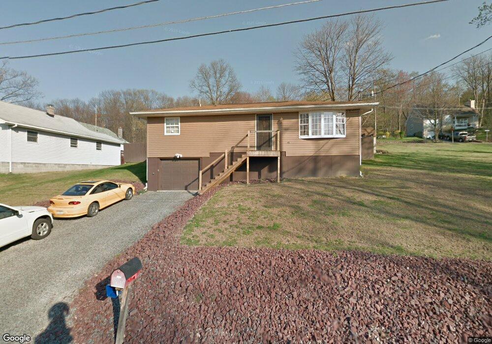
219 Clearview Ave Shavertown, PA 18708
Estimated Value: $232,000 - $268,000
2
Beds
2
Baths
1,558
Sq Ft
$164/Sq Ft
Est. Value
About This Home
This home is located at 219 Clearview Ave, Shavertown, PA 18708 and is currently estimated at $255,864, approximately $164 per square foot. 219 Clearview Ave is a home located in Luzerne County with nearby schools including Dallas Senior High School and Cornerstone Christian Academy.
Ownership History
Date
Name
Owned For
Owner Type
Purchase Details
Closed on
Apr 5, 2021
Sold by
Bolton Donald D and Bolton Lisa A
Bought by
Austin Brittany and Austin Christopher
Current Estimated Value
Home Financials for this Owner
Home Financials are based on the most recent Mortgage that was taken out on this home.
Original Mortgage
$194,750
Outstanding Balance
$173,611
Interest Rate
2.9%
Mortgage Type
New Conventional
Estimated Equity
$82,253
Purchase Details
Closed on
Aug 16, 1996
Bought by
Bolton Donald D
Create a Home Valuation Report for This Property
The Home Valuation Report is an in-depth analysis detailing your home's value as well as a comparison with similar homes in the area
Home Values in the Area
Average Home Value in this Area
Purchase History
| Date | Buyer | Sale Price | Title Company |
|---|---|---|---|
| Austin Brittany | $205,000 | Blue Star Setmnt Svcs Llc | |
| Bolton Donald D | $75,000 | -- |
Source: Public Records
Mortgage History
| Date | Status | Borrower | Loan Amount |
|---|---|---|---|
| Open | Austin Brittany | $194,750 |
Source: Public Records
Tax History
| Year | Tax Paid | Tax Assessment Tax Assessment Total Assessment is a certain percentage of the fair market value that is determined by local assessors to be the total taxable value of land and additions on the property. | Land | Improvement |
|---|---|---|---|---|
| 2026 | $2,649 | $115,500 | $27,100 | $88,400 |
| 2025 | $2,501 | $115,500 | $27,100 | $88,400 |
| 2024 | $2,424 | $115,500 | $27,100 | $88,400 |
| 2023 | $2,424 | $115,500 | $27,100 | $88,400 |
| 2022 | $2,403 | $115,500 | $27,100 | $88,400 |
| 2021 | $2,403 | $115,500 | $27,100 | $88,400 |
| 2020 | $2,403 | $115,500 | $27,100 | $88,400 |
| 2019 | $2,380 | $115,500 | $27,100 | $88,400 |
| 2018 | $2,357 | $115,500 | $27,100 | $88,400 |
| 2017 | $2,323 | $115,500 | $27,100 | $88,400 |
| 2016 | -- | $115,500 | $27,100 | $88,400 |
| 2015 | $1,881 | $115,500 | $27,100 | $88,400 |
| 2014 | $1,881 | $115,500 | $27,100 | $88,400 |
Source: Public Records
Map
Nearby Homes
- 39 Cardinal Dr
- 315 Echo Valley Dr
- Lot # 4 Pioneer Ave
- 3 N Pioneer Ave
- 665 Sparrow Dr
- 235 E Center St
- 175 N Pioneer Ave
- 179 N Pioneer Ave
- 695 Main St
- 1000 Lower Demunds Rd
- 1004 Lower Demunds Rd
- 680 Main Rd
- 1021 Lower Demunds Rd
- 256 Kelly St
- 1074 Lower Demunds Rd
- 18 Linden St
- Lot 12 Cobblestone Ln
- Dev 4 Jackson Hill Estates
- 645 Rear Main St
- 0 Lt Michael Cleary Dr
- 223 Clearview Ave
- 196 Hillside St
- 187 Skyline Dr
- 196 E Hillside St
- 221 Skyline Dr
- 215 Skyline Dr
- 192 Hillside St
- 227 Skyline Dr
- 224 Clearview Ave
- 192 E Hillside St
- 210 Clearview Ave
- 207 Clearview Ave
- 228 Clearview Ave
- 200 Clearview Ave
- 231 Clearview Ave
- 231 Skyline Dr
- 209 Highland Ave
- 213 Highland Ave
- 209 Skyline Dr
- 197 Highland Ave
Your Personal Tour Guide
Ask me questions while you tour the home.