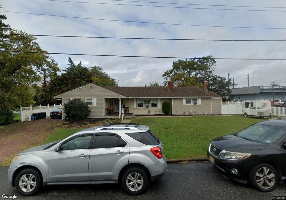
219 Crest Rd Cape May Court House, NJ 08210
Estimated Value: $462,535 - $537,000
--
Bed
--
Bath
2,120
Sq Ft
$231/Sq Ft
Est. Value
About This Home
This home is located at 219 Crest Rd, Cape May Court House, NJ 08210 and is currently estimated at $489,384, approximately $230 per square foot. 219 Crest Rd is a home located in Cape May County with nearby schools including Middle Township Elementary No. 1, Middle Township Elementary No. 2, and Middle Township Middle School.
Ownership History
Date
Name
Owned For
Owner Type
Purchase Details
Closed on
Aug 14, 2001
Sold by
Martin Chris
Bought by
Mallous Soterios N and Mallous Helen
Current Estimated Value
Home Financials for this Owner
Home Financials are based on the most recent Mortgage that was taken out on this home.
Original Mortgage
$75,000
Outstanding Balance
$29,277
Interest Rate
7.16%
Estimated Equity
$460,107
Create a Home Valuation Report for This Property
The Home Valuation Report is an in-depth analysis detailing your home's value as well as a comparison with similar homes in the area
Home Values in the Area
Average Home Value in this Area
Purchase History
| Date | Buyer | Sale Price | Title Company |
|---|---|---|---|
| Mallous Soterios N | $145,000 | -- |
Source: Public Records
Mortgage History
| Date | Status | Borrower | Loan Amount |
|---|---|---|---|
| Open | Mallous Soterios N | $75,000 |
Source: Public Records
Tax History Compared to Growth
Tax History
| Year | Tax Paid | Tax Assessment Tax Assessment Total Assessment is a certain percentage of the fair market value that is determined by local assessors to be the total taxable value of land and additions on the property. | Land | Improvement |
|---|---|---|---|---|
| 2025 | $5,239 | $248,400 | $128,800 | $119,600 |
| 2024 | $5,239 | $248,400 | $128,800 | $119,600 |
| 2023 | $5,107 | $248,400 | $128,800 | $119,600 |
| 2022 | $4,961 | $248,400 | $128,800 | $119,600 |
| 2021 | $4,841 | $248,400 | $128,800 | $119,600 |
| 2020 | $4,742 | $248,400 | $128,800 | $119,600 |
| 2019 | $4,620 | $248,400 | $128,800 | $119,600 |
| 2018 | $4,548 | $248,400 | $128,800 | $119,600 |
| 2017 | $4,456 | $248,400 | $128,800 | $119,600 |
| 2016 | $4,345 | $248,400 | $128,800 | $119,600 |
| 2015 | $4,312 | $248,400 | $128,800 | $119,600 |
| 2014 | $4,285 | $248,400 | $128,800 | $119,600 |
Source: Public Records
Map
Nearby Homes
- 26 Crest Rd
- 24 Church St
- 33 E Mechanic St
- 13 Poplar St
- 100 Osprey Dr Unit 100
- 530 Stone Harbor Blvd
- 308 Osprey Dr Unit 1003E1
- 3 Whimbrel Way Unit B1
- 3 Whimbrel Way Unit 3 Whimbrel
- 430 Route 9 N
- 430 Route 9 N Unit 45
- 215 S Boyd St
- 220 Hand Ave
- 706 Bennett Rd
- 300 Court House South Dennis Rd
- 212 Shunpike Rd
- 105 E Atlantic Ave
- 4 Railroad Ave
- 311 S Dennis Rd
- 306 3rd St