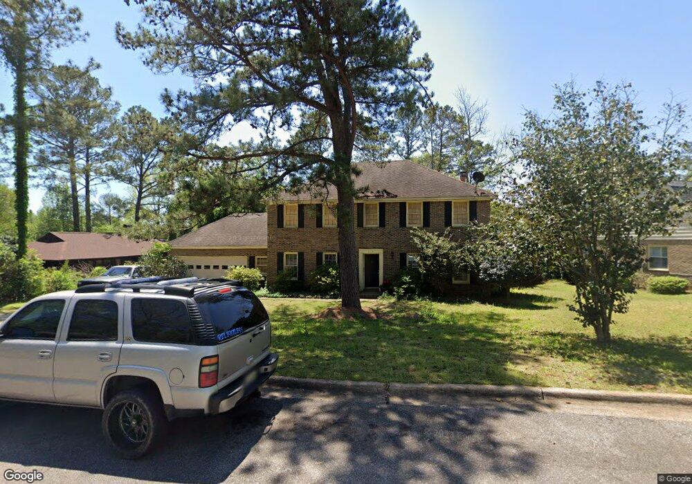
219 Deer Trace Prattville, AL 36067
Estimated Value: $331,190 - $357,000
3
Beds
3
Baths
2,846
Sq Ft
$121/Sq Ft
Est. Value
About This Home
This home is located at 219 Deer Trace, Prattville, AL 36067 and is currently estimated at $343,798, approximately $120 per square foot. 219 Deer Trace is a home located in Autauga County with nearby schools including Prattville Primary School, Prattville Elementary School, and Prattville Intermediate School.
Ownership History
Date
Name
Owned For
Owner Type
Purchase Details
Closed on
Feb 22, 2024
Sold by
Allen Tom and Allen Thomas L
Bought by
Tom Allen Llc
Current Estimated Value
Purchase Details
Closed on
Apr 24, 2015
Sold by
Staggers Willene Little and Allen Willene Little
Bought by
Allen Thomas L
Home Financials for this Owner
Home Financials are based on the most recent Mortgage that was taken out on this home.
Original Mortgage
$185,400
Interest Rate
3.87%
Mortgage Type
New Conventional
Purchase Details
Closed on
Apr 17, 2015
Sold by
Allen Thomas L
Bought by
Pye Andrew A and Pye Jonna D
Home Financials for this Owner
Home Financials are based on the most recent Mortgage that was taken out on this home.
Original Mortgage
$185,400
Interest Rate
3.87%
Mortgage Type
New Conventional
Create a Home Valuation Report for This Property
The Home Valuation Report is an in-depth analysis detailing your home's value as well as a comparison with similar homes in the area
Home Values in the Area
Average Home Value in this Area
Purchase History
| Date | Buyer | Sale Price | Title Company |
|---|---|---|---|
| Tom Allen Llc | $587,300 | None Listed On Document | |
| Allen Thomas L | $189,900 | -- | |
| Pye Andrew A | $189,900 | -- |
Source: Public Records
Mortgage History
| Date | Status | Borrower | Loan Amount |
|---|---|---|---|
| Previous Owner | Allen Thomas L | $185,400 |
Source: Public Records
Tax History Compared to Growth
Tax History
| Year | Tax Paid | Tax Assessment Tax Assessment Total Assessment is a certain percentage of the fair market value that is determined by local assessors to be the total taxable value of land and additions on the property. | Land | Improvement |
|---|---|---|---|---|
| 2025 | $1,916 | $61,820 | $0 | $0 |
| 2024 | $1,925 | $62,100 | $0 | $0 |
| 2023 | $1,881 | $60,680 | $0 | $0 |
| 2022 | $1,738 | $56,080 | $0 | $0 |
| 2021 | $1,567 | $50,560 | $0 | $0 |
| 2020 | $1,456 | $46,960 | $0 | $0 |
| 2019 | $1,435 | $46,300 | $0 | $0 |
| 2018 | $1,451 | $46,800 | $0 | $0 |
| 2017 | $1,347 | $43,440 | $0 | $0 |
| 2015 | -- | $0 | $0 | $0 |
| 2014 | -- | $22,400 | $3,000 | $19,400 |
| 2013 | $1,441 | $46,480 | $6,000 | $40,480 |
Source: Public Records
Map
Nearby Homes
- 134 Quail Run
- 110 Quail Run
- 131 Bridge St
- 203 Evergreen St
- 112 Chimney Ridge
- Lot 2 Oak Creek Cir
- 962 Fireside Dr
- 221 Doe Dr
- 529 Weatherby Trail
- 0 Doster St
- 315 S Northington St
- 811 Mountain Lake Ct
- 701 Emerald Dr Unit LOT 10
- 425 Water St
- 813 Carter Rd
- 307 Pratt St
- 624 Lower Kingston Rd Unit Lot 1
- 320 E 6th St
- 1405 Indian Hills Rd
- Cr 21