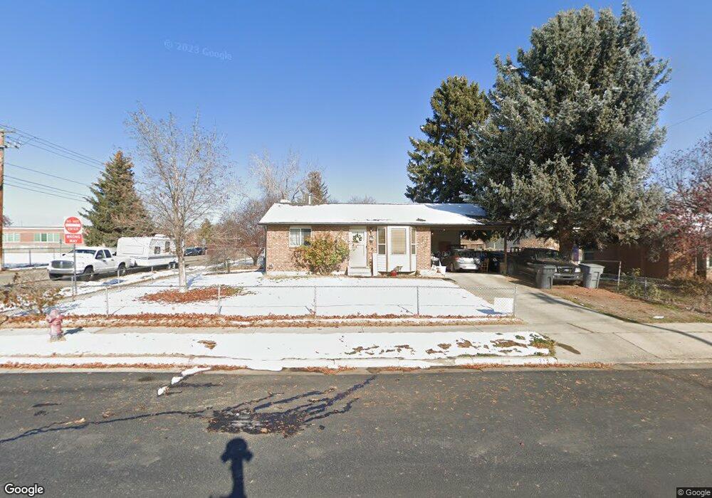
219 E 200 N American Fork, UT 84003
Estimated Value: $452,000 - $508,000
3
Beds
2
Baths
1,872
Sq Ft
$259/Sq Ft
Est. Value
About This Home
This home is located at 219 E 200 N, American Fork, UT 84003 and is currently estimated at $484,846, approximately $258 per square foot. 219 E 200 N is a home located in Utah County with nearby schools including Forbes Elementary School, American Fork Junior High School, and American Fork High School.
Ownership History
Date
Name
Owned For
Owner Type
Purchase Details
Closed on
Mar 18, 2013
Sold by
Crofts Randy L
Bought by
Crofts Randy L and Crofts Diana Lynn
Current Estimated Value
Home Financials for this Owner
Home Financials are based on the most recent Mortgage that was taken out on this home.
Original Mortgage
$146,870
Outstanding Balance
$103,595
Interest Rate
3.53%
Mortgage Type
New Conventional
Estimated Equity
$381,251
Purchase Details
Closed on
Mar 4, 2013
Sold by
Sectary Of Hud
Bought by
Crofts Randy L
Home Financials for this Owner
Home Financials are based on the most recent Mortgage that was taken out on this home.
Original Mortgage
$146,870
Outstanding Balance
$103,595
Interest Rate
3.53%
Mortgage Type
New Conventional
Estimated Equity
$381,251
Purchase Details
Closed on
Dec 7, 2012
Sold by
Jpmorgan Chase Bank Na
Bought by
Secretary Of Hud
Purchase Details
Closed on
Oct 2, 2012
Sold by
Cordner Brandon
Bought by
Jpmorgan Chase Bank N A
Purchase Details
Closed on
Feb 22, 2008
Sold by
Cheney Stephen L and Cheney Gabrielle L
Bought by
Cordner Brandon
Home Financials for this Owner
Home Financials are based on the most recent Mortgage that was taken out on this home.
Original Mortgage
$183,618
Interest Rate
5.85%
Mortgage Type
FHA
Purchase Details
Closed on
Oct 30, 2003
Sold by
Harding Helen Dawn
Bought by
Cheney Stephen L and Cheney Gabrielle L
Purchase Details
Closed on
Oct 28, 2003
Sold by
Reynolds George H and Reynolds Doris
Bought by
Harding Helen Dawn
Purchase Details
Closed on
Sep 15, 1998
Sold by
Reynolds George H and Reynolds Doris M
Bought by
Harding Helen Dawn
Home Financials for this Owner
Home Financials are based on the most recent Mortgage that was taken out on this home.
Original Mortgage
$70,000
Interest Rate
6.89%
Create a Home Valuation Report for This Property
The Home Valuation Report is an in-depth analysis detailing your home's value as well as a comparison with similar homes in the area
Home Values in the Area
Average Home Value in this Area
Purchase History
| Date | Buyer | Sale Price | Title Company |
|---|---|---|---|
| Crofts Randy L | -- | Accommodation | |
| Crofts Randy L | -- | Cornerstone Title Ins Ag | |
| Secretary Of Hud | -- | None Available | |
| Jpmorgan Chase Bank N A | -- | None Available | |
| Cordner Brandon | -- | Select Title Insurance Agen | |
| Cheney Stephen L | -- | Guardian Title Company Of U | |
| Harding Helen Dawn | -- | Guardian Title Company Of U | |
| Harding Helen Dawn | -- | -- |
Source: Public Records
Mortgage History
| Date | Status | Borrower | Loan Amount |
|---|---|---|---|
| Open | Crofts Randy L | $146,870 | |
| Previous Owner | Cordner Brandon | $183,618 | |
| Previous Owner | Harding Helen Dawn | $70,000 |
Source: Public Records
Tax History
| Year | Tax Paid | Tax Assessment Tax Assessment Total Assessment is a certain percentage of the fair market value that is determined by local assessors to be the total taxable value of land and additions on the property. | Land | Improvement |
|---|---|---|---|---|
| 2025 | $1,988 | $243,045 | -- | -- |
| 2024 | $1,988 | $220,935 | $0 | $0 |
| 2023 | $1,850 | $217,910 | $0 | $0 |
| 2022 | $1,871 | $217,525 | $0 | $0 |
| 2021 | $1,600 | $290,600 | $129,100 | $161,500 |
| 2020 | $1,496 | $263,500 | $115,300 | $148,200 |
| 2019 | $1,356 | $247,000 | $98,800 | $148,200 |
| 2018 | $1,251 | $217,800 | $88,900 | $128,900 |
| 2017 | $1,157 | $108,735 | $0 | $0 |
| 2016 | $1,075 | $93,885 | $0 | $0 |
| 2015 | $1,122 | $93,005 | $0 | $0 |
| 2014 | $1,115 | $91,190 | $0 | $0 |
Source: Public Records
Map
Nearby Homes
Your Personal Tour Guide
Ask me questions while you tour the home.