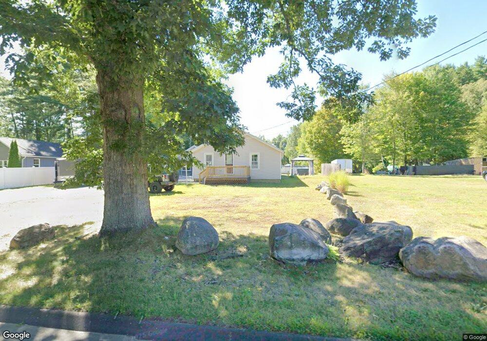
219 Glendale Rd Florence, MA 01062
Florence NeighborhoodEstimated Value: $357,146 - $443,000
2
Beds
1
Bath
1,040
Sq Ft
$380/Sq Ft
Est. Value
About This Home
This home is located at 219 Glendale Rd, Florence, MA 01062 and is currently estimated at $395,037, approximately $379 per square foot. 219 Glendale Rd is a home located in Hampshire County with nearby schools including Northampton High School, Calvary Baptist Christian School, and The Williston Northampton School.
Ownership History
Date
Name
Owned For
Owner Type
Purchase Details
Closed on
Jan 17, 2023
Sold by
Baranowski Marian K
Bought by
Baranowski Ronald L and Baranowski Glenda M
Current Estimated Value
Purchase Details
Closed on
Jun 20, 2005
Sold by
Griswold Keith R and Griswold Laurie M
Bought by
Baranowski Linda and Baranowski Marian K
Purchase Details
Closed on
Aug 4, 1993
Sold by
Mimitz Sidney H and Mimitz Sidney H
Bought by
Griswold Keith R and Griswold Laurie
Home Financials for this Owner
Home Financials are based on the most recent Mortgage that was taken out on this home.
Original Mortgage
$73,933
Interest Rate
7.29%
Mortgage Type
Purchase Money Mortgage
Create a Home Valuation Report for This Property
The Home Valuation Report is an in-depth analysis detailing your home's value as well as a comparison with similar homes in the area
Home Values in the Area
Average Home Value in this Area
Purchase History
We collect this data history from publicly available records. To have your information removed, we recommend requesting removal directly through your county’s website.
| Date | Buyer | Sale Price | Title Company |
|---|---|---|---|
| Baranowski Ronald L | -- | None Available | |
| Baranowski Linda | $69,200 | -- | |
| Griswold Keith R | $74,000 | -- |
Source: Public Records
Mortgage History
We collect this data history from publicly available records. To have your information removed, we recommend requesting removal directly through your county’s website.
| Date | Status | Borrower | Loan Amount |
|---|---|---|---|
| Previous Owner | Griswold Keith R | $73,933 |
Source: Public Records
Tax History
| Year | Tax Paid | Tax Assessment Tax Assessment Total Assessment is a certain percentage of the fair market value that is determined by local assessors to be the total taxable value of land and additions on the property. | Land | Improvement |
|---|---|---|---|---|
| 2025 | $4,587 | $329,300 | $101,000 | $228,300 |
| 2024 | $4,518 | $297,400 | $96,800 | $200,600 |
| 2023 | $4,397 | $277,600 | $87,600 | $190,000 |
| 2022 | $3,997 | $223,400 | $82,600 | $140,800 |
| 2021 | $3,731 | $214,800 | $79,200 | $135,600 |
| 2020 | $3,609 | $214,800 | $79,200 | $135,600 |
| 2019 | $3,957 | $227,800 | $91,700 | $136,100 |
| 2018 | $3,877 | $227,500 | $91,700 | $135,800 |
| 2017 | $3,797 | $227,500 | $91,700 | $135,800 |
| 2016 | $3,027 | $187,300 | $91,700 | $95,600 |
| 2015 | $2,959 | $187,300 | $96,700 | $90,600 |
| 2014 | $2,883 | $187,300 | $96,700 | $90,600 |
Source: Public Records
Map
Nearby Homes
- 1024 Westhampton Rd
- 1260 Westhampton Rd
- 36 Torrey St
- 0 W Farms Rd
- 5 Torrey St
- 75 Lead Mine Rd
- 16 Steplar Crossing Unit 16
- 71 Mine Rd
- 13 Drewsen Dr
- 249 Sylvester Rd
- 138 West St
- 194 Brookside Cir
- 0 Glendale Rd
- 20 Meadowbrook Dr
- 723 Lot B Ryan Rd
- 44 Westhampton Rd
- 404 Sylvester Rd
- 329 Southampton Rd
- M143 &152 Glendale St
- 20-11 Sylvester Rd
- 229 Glendale Rd
- 209 Glendale Rd
- 235 Glendale Rd
- 193 Glendale Rd
- 220 Glendale Rd
- 206 Glendale Rd
- 245 Glendale Rd
- 241 Glendale Rd
- 196 Glendale Rd
- 250 Glendale Rd
- 183 Glendale Rd
- 255 Glendale Rd
- 186 Glendale Rd
- 259 Glendale Rd
- 16 Glendale Rd
- 258 Glendale Rd
- 165 Glendale Rd
- 285 Glendale Rd
- 160 Glendale Rd
- 282 Glendale Rd
Your Personal Tour Guide
Ask me questions while you tour the home.