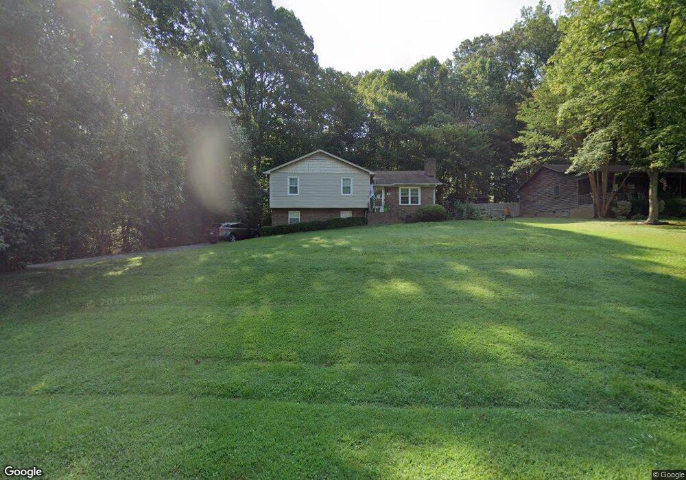
219 Howard Black Rd Lexington, NC 27292
Estimated Value: $130,000 - $364,000
3
Beds
2
Baths
2,236
Sq Ft
$105/Sq Ft
Est. Value
About This Home
This home is located at 219 Howard Black Rd, Lexington, NC 27292 and is currently estimated at $234,440, approximately $104 per square foot. 219 Howard Black Rd is a home located in Davidson County with nearby schools including Davis-Townsend Elementary School, Central Davidson Middle School, and Central Davidson High School.
Ownership History
Date
Name
Owned For
Owner Type
Purchase Details
Closed on
Jun 28, 2016
Sold by
Doris L Crotts
Bought by
Tesh Pamela
Current Estimated Value
Home Financials for this Owner
Home Financials are based on the most recent Mortgage that was taken out on this home.
Original Mortgage
$54,000
Outstanding Balance
$43,080
Interest Rate
3.56%
Estimated Equity
$191,360
Purchase Details
Closed on
Feb 10, 2006
Sold by
Crotts Bruce S and Crotts Doris L
Bought by
Tesh Pamela C
Purchase Details
Closed on
Mar 1, 1989
Purchase Details
Closed on
Aug 1, 1986
Purchase Details
Closed on
Aug 1, 1984
Create a Home Valuation Report for This Property
The Home Valuation Report is an in-depth analysis detailing your home's value as well as a comparison with similar homes in the area
Home Values in the Area
Average Home Value in this Area
Purchase History
| Date | Buyer | Sale Price | Title Company |
|---|---|---|---|
| Tesh Pamela | -- | -- | |
| Tesh Pamela C | -- | None Available | |
| -- | $40,500 | -- | |
| -- | $60,000 | -- | |
| -- | $2,500 | -- |
Source: Public Records
Mortgage History
| Date | Status | Borrower | Loan Amount |
|---|---|---|---|
| Open | Tesh Pamela | $54,000 | |
| Closed | Tesh Pamela | -- |
Source: Public Records
Tax History Compared to Growth
Tax History
| Year | Tax Paid | Tax Assessment Tax Assessment Total Assessment is a certain percentage of the fair market value that is determined by local assessors to be the total taxable value of land and additions on the property. | Land | Improvement |
|---|---|---|---|---|
| 2025 | $746 | $118,280 | $0 | $0 |
| 2024 | $746 | $118,280 | $0 | $0 |
| 2023 | $757 | $118,280 | $0 | $0 |
| 2022 | $746 | $118,280 | $0 | $0 |
| 2021 | $722 | $118,280 | $0 | $0 |
| 2020 | $636 | $104,160 | $0 | $0 |
| 2019 | $646 | $104,160 | $0 | $0 |
| 2018 | $646 | $104,160 | $0 | $0 |
| 2017 | $646 | $104,160 | $0 | $0 |
| 2016 | $646 | $104,160 | $0 | $0 |
| 2015 | $646 | $104,160 | $0 | $0 |
| 2014 | $630 | $101,610 | $0 | $0 |
Source: Public Records
Map
Nearby Homes
- 102 Theodore Ave
- 193 Young Dr
- 191 Young Dr
- 402 Martin Luther King jr Blvd
- 322 Bristol St
- 257 N County Home Rd
- 116 Pond St
- 113 Pond St
- 1130 Greensboro Street Extension
- 206 Abbotts Ave
- 7 Dora Ln
- 1014 E Center St
- 14 Arbor Dr
- 521 E 1st St
- 56 E 4th St
- 301 Queens Dr
- 125 Eastside Dr
- 13290 N Carolina 8
- 5150 N Carolina 8
- 433 N State St
- 237 Howard Black Rd
- 220 Howard Black Rd
- 242 Howard Black Rd
- 279 Howard Black Rd
- 268 Howard Black Rd
- 1224 E Us Highway 64
- 292 Howard Black Rd
- 279 Owens Farm
- 267 Quiet Dr
- 281 Locust Dr
- 382 Howard Black Rd
- 382 Howard Black Rd
- 275 Locust Dr
- 129 E Holly Grove Rd
- 313 Quiet Dr
- 1706 E Holly Grove Rd
- 300 Locust Dr
- 294 Locust Dr
- 171 E Holly Grove Rd
- 246 Locust Dr