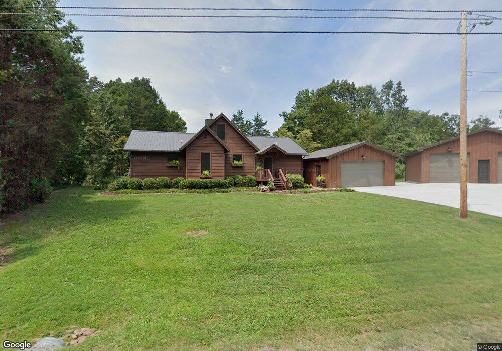
219 Jared Cir Big Rock, TN 37023
Estimated Value: $297,089 - $355,000
Studio
2
Baths
1,848
Sq Ft
$179/Sq Ft
Est. Value
About This Home
This home is located at 219 Jared Cir, Big Rock, TN 37023 and is currently estimated at $330,022, approximately $178 per square foot. 219 Jared Cir is a home located in Stewart County with nearby schools including North Stewart Elementary School, Stewart County Middle School, and Stewart County High School.
Ownership History
Date
Name
Owned For
Owner Type
Purchase Details
Closed on
Nov 27, 2002
Bought by
Barber Eric L and Barber Patty K
Current Estimated Value
Purchase Details
Closed on
Apr 23, 1999
Bought by
Barber Eric L and Barber Patty K
Purchase Details
Closed on
Aug 16, 1993
Bought by
Rosetti Frank M
Purchase Details
Closed on
Aug 20, 1989
Bought by
C & D Const Co
Create a Home Valuation Report for This Property
The Home Valuation Report is an in-depth analysis detailing your home's value as well as a comparison with similar homes in the area
Purchase History
| Date | Buyer | Sale Price | Title Company |
|---|---|---|---|
| Barber Eric L | -- | -- | |
| Barber Eric L | $110,000 | -- | |
| Rosetti Frank M | $76,000 | -- | |
| C & D Const Co | -- | -- |
Source: Public Records
Tax History
| Year | Tax Paid | Tax Assessment Tax Assessment Total Assessment is a certain percentage of the fair market value that is determined by local assessors to be the total taxable value of land and additions on the property. | Land | Improvement |
|---|---|---|---|---|
| 2025 | $1,157 | $77,850 | $4,550 | $73,300 |
| 2024 | $1,157 | $77,850 | $4,550 | $73,300 |
| 2023 | $797 | $33,775 | $3,025 | $30,750 |
| 2022 | $797 | $33,775 | $3,025 | $30,750 |
| 2021 | $797 | $33,775 | $3,025 | $30,750 |
| 2020 | $791 | $33,775 | $3,025 | $30,750 |
| 2019 | $791 | $31,050 | $3,025 | $28,025 |
| 2018 | $791 | $31,050 | $3,025 | $28,025 |
| 2017 | $851 | $31,050 | $3,025 | $28,025 |
| 2016 | $851 | $33,375 | $3,025 | $30,350 |
| 2015 | $824 | $33,375 | $3,025 | $30,350 |
| 2014 | $854 | $33,375 | $3,025 | $30,350 |
| 2013 | $854 | $34,563 | $0 | $0 |
Source: Public Records
Map
Nearby Homes
- 116 Lee Ln
- 1520 Tennessee 120
- 2447 Highway 120
- 124 Hayes Fork Creek Rd
- 124 Old Lafayette Rd
- 201 Norris Hancock Rd
- 1146 Bumpus Mills Rd
- 531 Big Rock Rd
- 416 Walker Ridge Rd
- 608 Big Rock Rd
- 55-56 Old Tobaccoport Rd
- 1822 Old Highway 79
- 130 Wayne Threatt Rd
- 683 Highway 79
- 1 Highway 79
- 3989 Cadiz Rd
- 326 Hargis Rd Unit 328
- 111 Mud Hill Rd
- 162 Bagsby Hill Ln
- 164 Lewis Cir
- 228 Jared Cir
- 218 Jared Cir
- 234 Jared Cir
- 134 Jared Cir
- 210 Jared Cir
- 246 Jared Cir
- 128 Jared Cir
- 116 Jared Cir
- 309 Sandy Kay Rd
- 1821 Highway 120
- 319 Sandy Kaye Rd
- 1803 Highway 120
- 1839 Highway 120
- 1794 Highway 120
- 301 Sandy Kay Rd
- 1810 Tennessee 120
- 1816 Highway 120
- 1786 Highway 120
- 1786 Highway 120
- 207 Sandy Kaye Rd
Your Personal Tour Guide
Ask me questions while you tour the home.