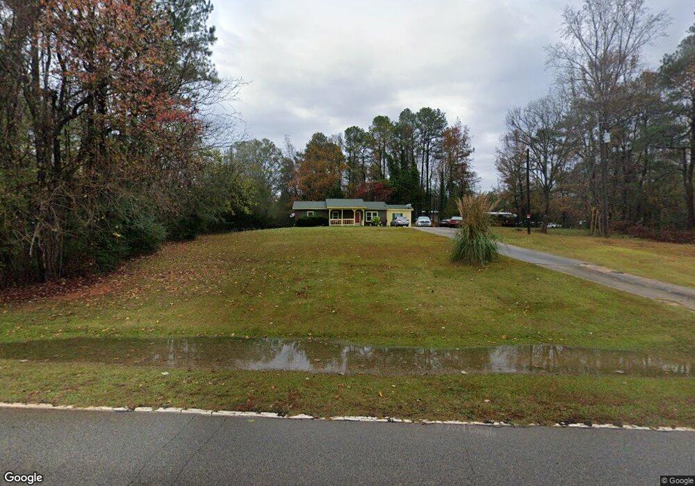
219 Knott Rd Lagrange, GA 30241
Estimated Value: $160,000 - $264,000
3
Beds
1
Bath
1,448
Sq Ft
$147/Sq Ft
Est. Value
About This Home
This home is located at 219 Knott Rd, Lagrange, GA 30241 and is currently estimated at $212,490, approximately $146 per square foot. 219 Knott Rd is a home located in Troup County with nearby schools including Callaway Elementary School, Hogansville Elementary School, and Callaway Middle School.
Ownership History
Date
Name
Owned For
Owner Type
Purchase Details
Closed on
Apr 4, 1996
Sold by
Cheryl H Reece
Bought by
Gholston Christine and Gholston Kendall
Current Estimated Value
Purchase Details
Closed on
Dec 14, 1993
Sold by
Reece C
Bought by
Cheryl H Reece
Purchase Details
Closed on
Feb 1, 1988
Sold by
Barnes Thomas N
Bought by
Reece C
Purchase Details
Closed on
Aug 1, 1985
Bought by
Barnes Thomas N
Purchase Details
Closed on
Mar 1, 1985
Create a Home Valuation Report for This Property
The Home Valuation Report is an in-depth analysis detailing your home's value as well as a comparison with similar homes in the area
Purchase History
| Date | Buyer | Sale Price | Title Company |
|---|---|---|---|
| Gholston Christine | $61,900 | -- | |
| Cheryl H Reece | -- | -- | |
| Reece C | $7,300 | -- | |
| Barnes Thomas N | $36,800 | -- | |
| -- | $2,500 | -- |
Source: Public Records
Tax History
| Year | Tax Paid | Tax Assessment Tax Assessment Total Assessment is a certain percentage of the fair market value that is determined by local assessors to be the total taxable value of land and additions on the property. | Land | Improvement |
|---|---|---|---|---|
| 2025 | $1,168 | $50,992 | $5,000 | $45,992 |
| 2024 | $1,168 | $44,832 | $5,000 | $39,832 |
| 2023 | $826 | $32,272 | $5,000 | $27,272 |
| 2022 | $778 | $29,872 | $4,000 | $25,872 |
| 2021 | $775 | $27,672 | $3,600 | $24,072 |
| 2020 | $775 | $27,672 | $3,600 | $24,072 |
| 2019 | $800 | $28,516 | $3,600 | $24,916 |
| 2018 | $735 | $26,360 | $3,600 | $22,760 |
| 2017 | $735 | $26,360 | $3,600 | $22,760 |
| 2016 | $737 | $26,417 | $3,600 | $22,817 |
| 2015 | $738 | $26,417 | $3,600 | $22,817 |
| 2014 | $703 | $25,217 | $3,600 | $21,617 |
| 2013 | -- | $26,694 | $3,600 | $23,094 |
Source: Public Records
Map
Nearby Homes
- 2477 Upper Big Springs Rd
- 737 John Lovelace Rd
- 830 John Lovelace Rd
- 56 John Lovelace Rd
- 810 Callaway Church Rd
- 15 Frost School Rd
- 91 Almond Rd
- 37.23 ACRES / 0 Smokey Rd
- 403 Lexington Park Dr
- 0 Briley Rd Unit 10582531
- 0 Briley Rd Unit 214353
- 142 Carr Rd
- 111 Revere Ct
- 109 Nashua Dr
- 208 N Davis Rd
- 128 Jasmine Ln
- 430 Briley Rd
- 107 Beaver Creek Way
- 107 Beaver Creek Way Unit 249
- 105 Beaver Creek Way
- 181 Knott Rd
- 303 Knott Rd
- 145 Knott Rd
- 339 Knott Rd
- 1049 Stewart Rd
- 74 Knott Rd
- 1003 Stewart Rd
- 365 Knott Rd
- 1032 Stewart Rd
- 987 Stewart Rd
- 1018 Stewart Rd
- 977 Stewart Rd
- 151 Greenbriar Trail
- 998 Stewar Lagrange
- 998 Stewart Rd
- 149 Greenbriar Trail
- 984 Stewart Rd
- 3228 Upper Big Springs Rd
- 909 Stewart Rd
- 147 Greenbriar Trail