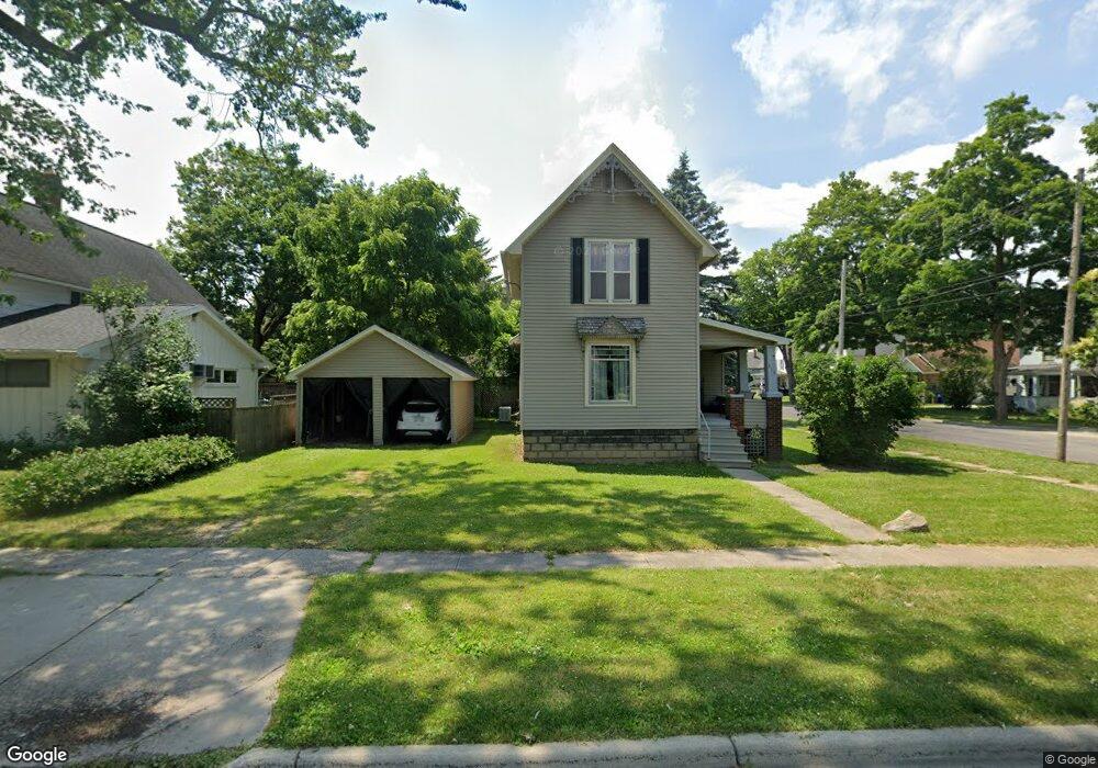
219 N Howell St Owosso, MI 48867
Estimated Value: $105,544 - $118,000
Studio
--
Bath
--
Sq Ft
5,227
Sq Ft Lot
About This Home
This home is located at 219 N Howell St, Owosso, MI 48867 and is currently estimated at $111,136. 219 N Howell St is a home located in Shiawassee County with nearby schools including Owosso High School, Salem Lutheran School, and St. Paul School.
Ownership History
Date
Name
Owned For
Owner Type
Purchase Details
Closed on
Oct 28, 2020
Sold by
Dodson Esther L
Bought by
Scheffer Dana L
Current Estimated Value
Purchase Details
Closed on
Jul 14, 2016
Sold by
Kerns Clarence 0 and Kerns Violet M
Bought by
Advisory Firm Llc
Purchase Details
Closed on
Jul 8, 2016
Sold by
Phillips Mary E
Bought by
Southwest Michigan Asset Management L
Purchase Details
Closed on
Nov 6, 2015
Sold by
Kearns Violet and Kearns Clarence Q
Bought by
Phillips Mary E
Purchase Details
Closed on
Nov 11, 2011
Sold by
Dodson Esther L
Bought by
Dodson Esther L
Purchase Details
Closed on
Jul 18, 2005
Sold by
Dodson Esther L and Janes Esther L
Bought by
Dodson Esther L
Home Financials for this Owner
Home Financials are based on the most recent Mortgage that was taken out on this home.
Original Mortgage
$94,350
Interest Rate
6.83%
Mortgage Type
New Conventional
Create a Home Valuation Report for This Property
The Home Valuation Report is an in-depth analysis detailing your home's value as well as a comparison with similar homes in the area
Home Values in the Area
Average Home Value in this Area
Purchase History
| Date | Buyer | Sale Price | Title Company |
|---|---|---|---|
| Scheffer Dana L | -- | None Available | |
| Dodson Esther L | -- | None Available | |
| Advisory Firm Llc | $15,251 | -- | |
| Southwest Michigan Asset Management L | $697,674 | -- | |
| Phillips Mary E | $116 | -- | |
| Dodson Esther L | -- | -- | |
| Dodson Esther L | -- | Netco |
Source: Public Records
Mortgage History
| Date | Status | Borrower | Loan Amount |
|---|---|---|---|
| Previous Owner | Dodson Esther L | $94,350 |
Source: Public Records
Tax History
| Year | Tax Paid | Tax Assessment Tax Assessment Total Assessment is a certain percentage of the fair market value that is determined by local assessors to be the total taxable value of land and additions on the property. | Land | Improvement |
|---|---|---|---|---|
| 2025 | $1,475 | $56,600 | $0 | $0 |
| 2024 | $1,475 | $49,900 | $0 | $0 |
| 2023 | $928 | $44,800 | $0 | $0 |
| 2022 | $1,427 | $40,200 | $0 | $0 |
| 2021 | $1,354 | $36,800 | $0 | $0 |
| 2020 | $1,397 | $33,100 | $0 | $0 |
| 2019 | $1,379 | $29,900 | $0 | $0 |
| 2018 | -- | $29,500 | $0 | $0 |
| 2017 | -- | $28,600 | $0 | $0 |
| 2016 | -- | $28,600 | $0 | $0 |
| 2015 | -- | $28,500 | $0 | $0 |
| 2014 | -- | $28,500 | $0 | $0 |
Source: Public Records
Map
Nearby Homes
- 206 N Howell St
- 528 River St
- 522 River St
- 512 Bradley St
- V/L Michigan 52
- V/L W South (1 6) Acres St
- 615 Clark Ave
- 303 W Williams St
- 321 N Ball St
- 211 N Ball St
- 5 E Main St
- 1408 W Main St
- 723 Adams St
- 6 E Main St
- 815 Pine St
- 118 E Oliver St
- 916 N Shiawassee St
- 1432 Young St
- 331 N Saginaw St
- 410 N Saginaw St
Your Personal Tour Guide
Ask me questions while you tour the home.