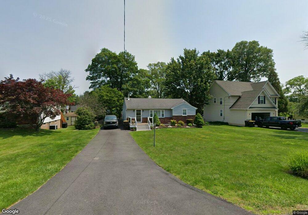
219 Pershing Ave Horsham, PA 19044
Estimated Value: $360,000 - $414,000
2
Beds
1
Bath
1,070
Sq Ft
$366/Sq Ft
Est. Value
About This Home
This home is located at 219 Pershing Ave, Horsham, PA 19044 and is currently estimated at $391,979, approximately $366 per square foot. 219 Pershing Ave is a home located in Montgomery County with nearby schools including Hallowell Elementary School, Keith Valley Middle School, and Hatboro-Horsham Senior High School.
Ownership History
Date
Name
Owned For
Owner Type
Purchase Details
Closed on
Feb 5, 2010
Sold by
Thayne Glenn
Bought by
Mayberry Thayne Laura P and Thayne Glenn M
Current Estimated Value
Home Financials for this Owner
Home Financials are based on the most recent Mortgage that was taken out on this home.
Original Mortgage
$222,718
Outstanding Balance
$149,015
Interest Rate
5.25%
Mortgage Type
FHA
Estimated Equity
$242,964
Purchase Details
Closed on
Nov 10, 2006
Sold by
Chapman Diane
Bought by
Thayne Glenn
Home Financials for this Owner
Home Financials are based on the most recent Mortgage that was taken out on this home.
Original Mortgage
$223,100
Interest Rate
6.39%
Create a Home Valuation Report for This Property
The Home Valuation Report is an in-depth analysis detailing your home's value as well as a comparison with similar homes in the area
Home Values in the Area
Average Home Value in this Area
Purchase History
| Date | Buyer | Sale Price | Title Company |
|---|---|---|---|
| Mayberry Thayne Laura P | -- | None Available | |
| Thayne Glenn | $230,000 | None Available |
Source: Public Records
Mortgage History
| Date | Status | Borrower | Loan Amount |
|---|---|---|---|
| Open | Mayberry Thayne Laura P | $222,718 | |
| Closed | Thayne Glenn | $223,100 |
Source: Public Records
Tax History Compared to Growth
Tax History
| Year | Tax Paid | Tax Assessment Tax Assessment Total Assessment is a certain percentage of the fair market value that is determined by local assessors to be the total taxable value of land and additions on the property. | Land | Improvement |
|---|---|---|---|---|
| 2025 | $4,235 | $107,760 | -- | -- |
| 2024 | $4,235 | $107,760 | -- | -- |
| 2023 | $4,032 | $107,760 | $0 | $0 |
| 2022 | $3,901 | $107,760 | $0 | $0 |
| 2021 | $3,809 | $107,760 | $0 | $0 |
| 2020 | $3,719 | $107,760 | $0 | $0 |
| 2019 | $3,648 | $107,760 | $0 | $0 |
| 2018 | $2,798 | $107,760 | $0 | $0 |
| 2017 | $3,485 | $107,760 | $0 | $0 |
| 2016 | $3,443 | $107,760 | $0 | $0 |
| 2015 | $3,288 | $107,760 | $0 | $0 |
| 2014 | $3,288 | $107,760 | $0 | $0 |
Source: Public Records
Map
Nearby Homes
- 414 Watson Ave
- 204 Wilson Ave
- 890 Easton Rd
- 125 Meetinghouse Rd
- 474 Easton Rd
- 236 Oak Hill Dr
- 336 Laurel Ave
- 243 Summer Ave
- 29 Patriot Ln
- 4 Beaver Hill Rd
- 454 1/2 Avenue A Unit A
- 18 Patriot Ln
- 604 Liberty Ridge Rd
- 616 Liberty Ridge Rd
- 603 Liberty Ridge Rd
- 605 Liberty Ridge Rd
- 607 Liberty Ridge Rd
- 611 Liberty Ridge Rd
- Faraday Plan at Liberty Ridge
- Westmont Plan at Liberty Ridge
- 217 Pershing Ave
- 221 Pershing Ave
- 220 Jefferson Ave
- 222 Jefferson Ave
- 218 Jefferson Ave
- 215 Pershing Ave
- 223 Pershing Ave
- 220 Pershing Ave
- 224 Jefferson Ave
- 222 Pershing Ave
- 216 Jefferson Ave
- 213 Pershing Ave
- 218 Pershing Ave
- 225 Pershing Ave
- 225 Pershing Ave Unit APARTMENT A
- 214 Jefferson Ave
- 226 Jefferson Ave
- 226 Pershing Ave
- 223 Jefferson Ave
- 221 Jefferson Ave