Estimated Value: $81,000 - $138,000
2
Beds
1
Bath
672
Sq Ft
$150/Sq Ft
Est. Value
About This Home
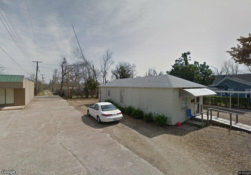
This home is located at 219 S 4th St, Yukon, OK 73099 and is currently estimated at $100,945, approximately $150 per square foot. 219 S 4th St is a home located in Canadian County with nearby schools including Central Elementary School, Independence Elementary School, and Yukon Middle School.
Ownership History
Date
Name
Owned For
Owner Type
Purchase Details
Closed on
May 31, 2016
Sold by
Swift Brian and Swift Jennifer
Bought by
The Swift Family Trust
Current Estimated Value
Purchase Details
Closed on
Sep 28, 2009
Sold by
White Alan and White Carolyn
Bought by
Swift Brian
Home Financials for this Owner
Home Financials are based on the most recent Mortgage that was taken out on this home.
Original Mortgage
$43,492
Interest Rate
5.12%
Mortgage Type
Unknown
Purchase Details
Closed on
Feb 13, 1997
Sold by
Foreman Donald and Y L
Create a Home Valuation Report for This Property
The Home Valuation Report is an in-depth analysis detailing your home's value as well as a comparison with similar homes in the area
Home Values in the Area
Average Home Value in this Area
Purchase History
| Date | Buyer | Sale Price | Title Company |
|---|---|---|---|
| The Swift Family Trust | $41,000 | Fatco | |
| Swift Brian | $40,500 | None Available | |
| -- | $20,000 | -- |
Source: Public Records
Mortgage History
| Date | Status | Borrower | Loan Amount |
|---|---|---|---|
| Previous Owner | Swift Brian | $43,492 |
Source: Public Records
Tax History Compared to Growth
Tax History
| Year | Tax Paid | Tax Assessment Tax Assessment Total Assessment is a certain percentage of the fair market value that is determined by local assessors to be the total taxable value of land and additions on the property. | Land | Improvement |
|---|---|---|---|---|
| 2024 | $479 | $4,642 | $991 | $3,651 |
| 2023 | $479 | $4,421 | $991 | $3,430 |
| 2022 | $458 | $4,211 | $991 | $3,220 |
| 2021 | $449 | $4,116 | $991 | $3,125 |
| 2020 | $423 | $3,920 | $991 | $2,929 |
| 2019 | $404 | $3,734 | $991 | $2,743 |
| 2018 | $388 | $3,580 | $991 | $2,589 |
| 2017 | $389 | $3,580 | $991 | $2,589 |
| 2016 | $377 | $3,475 | $991 | $2,484 |
| 2015 | -- | $3,337 | $991 | $2,346 |
| 2014 | -- | $3,386 | $991 | $2,395 |
Source: Public Records
Map
Nearby Homes
- 4601 Grassland Dr
- 11817 Corie Nicole Ln
- 12033 SW 31st St
- 2117 Aminas Way
- 3608 Northover Ridge Dr
- 3509 Sawtooth Ridge Dr
- 10401 NW 33rd St
- 11020 SW 34th Terrace
- 502 Walnut Ave
- 2001 Aminas Way
- 11033 NW 20th Terrace
- 210 N 4th St
- 12100 Birch Ave
- 12201 Birch Ave
- 224 N 3rd St
- 316 Ash Ave
- 621 Yukon Ave
- 601 S 8th St
- 121 Birch Ave
- 600 S 8th St
- 329 Oak Ave
- 329 Oak Ave
- 323 Oak Ave
- 211 S 4th St
- 11708 Corie Nicole Ln
- 11704 Corie Nicole Ln
- 11812 Corie Nicole Ln
- 10905 SW 22nd St
- 10936 SW 22nd St
- 10920 SW 22nd St
- 10925 SW 22nd St
- 10921 SW 22nd St
- 10917 SW 22nd St
- 10909 SW 22nd St
- 10901 SW 22nd St
- 10929 SW 22nd St
- 10933 SW 22nd St
- 11813 Corie Nicole Ln
- 11800 Corie Nicole Ln
- 11832 Corie Nicole Ln