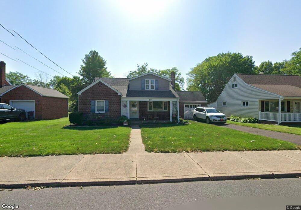
219 S 9th St Quakertown, PA 18951
Estimated Value: $332,000 - $393,000
2
Beds
1
Bath
1,078
Sq Ft
$348/Sq Ft
Est. Value
About This Home
This home is located at 219 S 9th St, Quakertown, PA 18951 and is currently estimated at $374,799, approximately $347 per square foot. 219 S 9th St is a home located in Bucks County with nearby schools including Quakertown Elementary School, Strayer Middle School, and Quakertown Community Senior High School.
Ownership History
Date
Name
Owned For
Owner Type
Purchase Details
Closed on
May 15, 2025
Sold by
Bergey Stephanie and Gerhart Jason A
Bought by
Bergey Stephanie
Current Estimated Value
Home Financials for this Owner
Home Financials are based on the most recent Mortgage that was taken out on this home.
Original Mortgage
$280,000
Outstanding Balance
$279,003
Interest Rate
6.62%
Mortgage Type
New Conventional
Estimated Equity
$95,796
Purchase Details
Closed on
Dec 12, 2008
Sold by
Fluck Bertha
Bought by
Gerhart Jason A and Gerhart Stephanie D
Home Financials for this Owner
Home Financials are based on the most recent Mortgage that was taken out on this home.
Original Mortgage
$178,929
Interest Rate
6.27%
Mortgage Type
FHA
Purchase Details
Closed on
May 29, 1948
Bought by
Fluck Herbert F and Fluck Bertha
Create a Home Valuation Report for This Property
The Home Valuation Report is an in-depth analysis detailing your home's value as well as a comparison with similar homes in the area
Home Values in the Area
Average Home Value in this Area
Purchase History
| Date | Buyer | Sale Price | Title Company |
|---|---|---|---|
| Bergey Stephanie | -- | None Listed On Document | |
| Gerhart Jason A | $179,900 | None Available | |
| Fluck Herbert F | -- | -- |
Source: Public Records
Mortgage History
| Date | Status | Borrower | Loan Amount |
|---|---|---|---|
| Open | Bergey Stephanie | $280,000 | |
| Previous Owner | Gerhart Jason A | $178,929 |
Source: Public Records
Tax History Compared to Growth
Tax History
| Year | Tax Paid | Tax Assessment Tax Assessment Total Assessment is a certain percentage of the fair market value that is determined by local assessors to be the total taxable value of land and additions on the property. | Land | Improvement |
|---|---|---|---|---|
| 2025 | $4,720 | $23,450 | $4,440 | $19,010 |
| 2024 | $4,720 | $23,450 | $4,440 | $19,010 |
| 2023 | $4,673 | $23,450 | $4,440 | $19,010 |
| 2022 | $4,594 | $23,450 | $4,440 | $19,010 |
| 2021 | $4,594 | $23,450 | $4,440 | $19,010 |
| 2020 | $4,594 | $23,450 | $4,440 | $19,010 |
| 2019 | $4,466 | $23,450 | $4,440 | $19,010 |
| 2018 | $4,311 | $23,450 | $4,440 | $19,010 |
| 2017 | $3,492 | $23,450 | $4,440 | $19,010 |
| 2016 | $3,492 | $19,600 | $4,440 | $15,160 |
| 2015 | -- | $19,600 | $4,440 | $15,160 |
| 2014 | -- | $19,600 | $4,440 | $15,160 |
Source: Public Records
Map
Nearby Homes
- 232 S 10th St
- 908 Juniper St
- 27 S 7th St
- 803 W Broad St
- 306 Juniper St
- 112 Jefferson Ct
- 36 S Main St
- 141 S 2nd St
- 811 W Mill St
- 21 Beaver Run Dr
- 1068 Freedom Ct
- 89 Braithwaite Ln
- 94 Braithwaite Ln
- 56 Dewsbury Ln
- 34 N Ambler St
- 92 Laurel Ct
- 262 Fairview Ave
- 1351 Creekside Ln
- 1086 Huntington Rd
- 1206 Arbor Ct