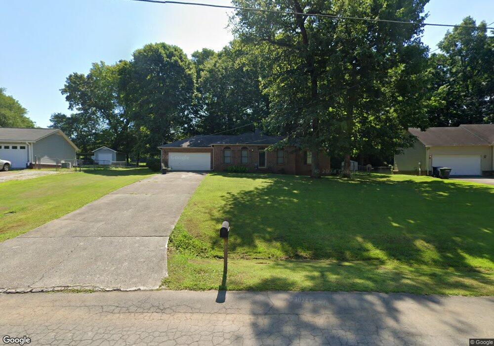
219 Stormy Dr New Market, AL 35761
Estimated Value: $148,000 - $229,000
3
Beds
2
Baths
1,200
Sq Ft
$153/Sq Ft
Est. Value
About This Home
This home is located at 219 Stormy Dr, New Market, AL 35761 and is currently estimated at $183,390, approximately $152 per square foot. 219 Stormy Dr is a home located in Madison County with nearby schools including Riverton Elementary School, Riverton Intermediate School, and Buckhorn Middle School.
Ownership History
Date
Name
Owned For
Owner Type
Purchase Details
Closed on
Apr 3, 2025
Sold by
Moore Jimmy F
Bought by
Landmark Property Investments Llc
Current Estimated Value
Home Financials for this Owner
Home Financials are based on the most recent Mortgage that was taken out on this home.
Original Mortgage
$155,000
Outstanding Balance
$154,068
Interest Rate
6.85%
Mortgage Type
New Conventional
Estimated Equity
$29,322
Purchase Details
Closed on
Nov 10, 2008
Sold by
Citimortgage Inc
Bought by
Moore Jimmy F
Home Financials for this Owner
Home Financials are based on the most recent Mortgage that was taken out on this home.
Original Mortgage
$77,900
Interest Rate
6.11%
Mortgage Type
New Conventional
Purchase Details
Closed on
Aug 28, 2008
Sold by
Clayborn Leon and Clayborn Janet
Bought by
Citimortgage Inc
Create a Home Valuation Report for This Property
The Home Valuation Report is an in-depth analysis detailing your home's value as well as a comparison with similar homes in the area
Home Values in the Area
Average Home Value in this Area
Purchase History
| Date | Buyer | Sale Price | Title Company |
|---|---|---|---|
| Landmark Property Investments Llc | $143,500 | Jacob Title | |
| Landmark Property Investments Llc | $143,500 | Jacob Title | |
| Moore Jimmy F | $82,000 | -- | |
| Citimortgage Inc | $74,891 | -- |
Source: Public Records
Mortgage History
| Date | Status | Borrower | Loan Amount |
|---|---|---|---|
| Open | Landmark Property Investments Llc | $155,000 | |
| Closed | Landmark Property Investments Llc | $155,000 | |
| Previous Owner | Moore Jimmy F | $77,900 |
Source: Public Records
Tax History Compared to Growth
Tax History
| Year | Tax Paid | Tax Assessment Tax Assessment Total Assessment is a certain percentage of the fair market value that is determined by local assessors to be the total taxable value of land and additions on the property. | Land | Improvement |
|---|---|---|---|---|
| 2024 | $466 | $13,980 | $2,500 | $11,480 |
| 2023 | $455 | $13,440 | $2,500 | $10,940 |
| 2022 | $397 | $12,400 | $2,500 | $9,900 |
| 2021 | $391 | $12,240 | $2,500 | $9,740 |
| 2020 | $343 | $10,630 | $2,000 | $8,630 |
| 2019 | $320 | $10,240 | $2,000 | $8,240 |
| 2018 | $300 | $9,700 | $0 | $0 |
| 2017 | $291 | $9,460 | $0 | $0 |
| 2016 | $291 | $9,460 | $0 | $0 |
| 2015 | $291 | $9,460 | $0 | $0 |
| 2014 | $288 | $9,380 | $0 | $0 |
Source: Public Records
Map
Nearby Homes
- 3492 Winchester Rd
- 5652 Maysville Rd
- 3424 Winchester Rd NE
- 146 Green Rd
- 158 Green Rd
- 109 Livy Lous Ln
- 206 Roman Randall Rd
- 1682 B Plan at McMullen Gardens
- 2143 A Plan at McMullen Gardens
- 1408 B Plan at McMullen Gardens
- 1748 A Plan at McMullen Gardens
- 2160 B Plan at McMullen Gardens
- 1963 A Plan at McMullen Gardens
- 1963 B Plan at McMullen Gardens
- 2373 B Plan at McMullen Gardens
- The Avery Plan at McMullen Gardens
- 2160 A Plan at McMullen Gardens
- 1408 A Plan at McMullen Gardens
- The McGinnis Plan at McMullen Gardens
- The Benson II Plan at McMullen Gardens