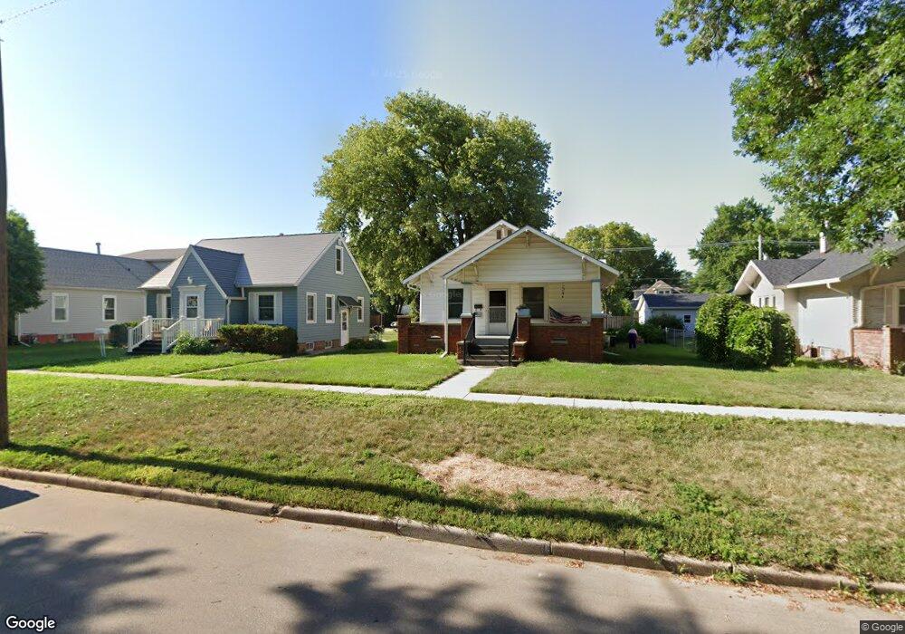
219 W 6th St Hastings, NE 68901
Estimated Value: $129,000 - $171,000
2
Beds
1
Bath
1,016
Sq Ft
$144/Sq Ft
Est. Value
About This Home
This home is located at 219 W 6th St, Hastings, NE 68901 and is currently estimated at $145,796, approximately $143 per square foot. 219 W 6th St is a home located in Adams County with nearby schools including Hastings Senior High School, St. Michael's Preschool & Elementary School, and St. Cecilia High School.
Ownership History
Date
Name
Owned For
Owner Type
Purchase Details
Closed on
Nov 24, 2020
Sold by
Miller Brett E and Miller Leanne K
Bought by
Miller Brett E and Miller Leanne K
Current Estimated Value
Purchase Details
Closed on
May 5, 2009
Sold by
Miller Mary C
Bought by
Miller Brett E
Home Financials for this Owner
Home Financials are based on the most recent Mortgage that was taken out on this home.
Original Mortgage
$28,000
Interest Rate
4.84%
Mortgage Type
Seller Take Back
Create a Home Valuation Report for This Property
The Home Valuation Report is an in-depth analysis detailing your home's value as well as a comparison with similar homes in the area
Home Values in the Area
Average Home Value in this Area
Purchase History
| Date | Buyer | Sale Price | Title Company |
|---|---|---|---|
| Miller Brett E | -- | Alexander Richard | |
| Miller Brett E | $40,000 | None Available |
Source: Public Records
Mortgage History
| Date | Status | Borrower | Loan Amount |
|---|---|---|---|
| Previous Owner | Miller Brett E | $28,000 |
Source: Public Records
Tax History Compared to Growth
Tax History
| Year | Tax Paid | Tax Assessment Tax Assessment Total Assessment is a certain percentage of the fair market value that is determined by local assessors to be the total taxable value of land and additions on the property. | Land | Improvement |
|---|---|---|---|---|
| 2024 | $1,626 | $101,628 | $16,875 | $84,753 |
| 2023 | $1,967 | $95,350 | $16,875 | $78,475 |
| 2022 | $2,024 | $89,851 | $16,875 | $72,976 |
| 2021 | $1,811 | $82,595 | $13,750 | $68,845 |
| 2020 | $1,710 | $79,317 | $13,750 | $65,567 |
| 2019 | $1,588 | $74,460 | $13,750 | $60,710 |
| 2018 | $1,443 | $67,275 | $6,565 | $60,710 |
| 2017 | $1,392 | $64,940 | $0 | $0 |
| 2016 | $1,393 | $64,940 | $6,565 | $58,375 |
| 2011 | -- | $0 | $0 | $0 |
Source: Public Records
Map
Nearby Homes
- 118 E 6th St
- 300 N Minnesota Ave
- 217 W 4th St
- 514 N Saint Joseph Ave Unit 516
- 820 N Minnesota Ave
- 302 E 6th St
- TBD Kansas Ave
- 315 N California Ave
- 406 E 6th St
- 914 N Colorado Ave
- 903 N Saint Joseph Ave
- 411 University Ave
- 814 N Lincoln Ave
- 216 Forest Blvd
- 234 Forest Blvd
- 831 N Cedar Ave
- 615 W 10th St
- 418 E 2nd St
- 1113 N Colorado Ave
- 919 N Hastings Ave