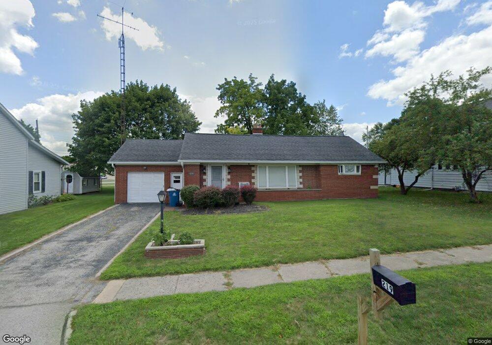
219 W Jackson St West Unity, OH 43570
Estimated Value: $117,000 - $140,000
2
Beds
1
Bath
1,182
Sq Ft
$108/Sq Ft
Est. Value
About This Home
This home is located at 219 W Jackson St, West Unity, OH 43570 and is currently estimated at $127,533, approximately $107 per square foot. 219 W Jackson St is a home located in Williams County with nearby schools including Hilltop Elementary School and Hilltop High School.
Ownership History
Date
Name
Owned For
Owner Type
Purchase Details
Closed on
Jun 10, 2025
Sold by
Langley Sarah
Bought by
Beltz Eric
Current Estimated Value
Home Financials for this Owner
Home Financials are based on the most recent Mortgage that was taken out on this home.
Original Mortgage
$112,035
Outstanding Balance
$111,745
Interest Rate
6.76%
Mortgage Type
New Conventional
Estimated Equity
$15,788
Purchase Details
Closed on
Jan 23, 2023
Sold by
L & R Rentals
Bought by
Langley Sarah and Poleon Edward P
Purchase Details
Closed on
Apr 7, 2022
Sold by
Ronald Dean
Bought by
L & R Rentals Limited Liability Company
Purchase Details
Closed on
May 29, 2007
Sold by
Schlosser Emily K and Schlosser Andrew
Bought by
Frazer Carmen and Carmen Frazer Trust
Purchase Details
Closed on
Sep 23, 1998
Sold by
Short Gerald W and Short Suzanne
Bought by
Boyer Emily K P O Box 876
Purchase Details
Closed on
Jan 1, 1990
Bought by
Short Gerald W and Short Suzanne
Create a Home Valuation Report for This Property
The Home Valuation Report is an in-depth analysis detailing your home's value as well as a comparison with similar homes in the area
Purchase History
| Date | Buyer | Sale Price | Title Company |
|---|---|---|---|
| Beltz Eric | $115,500 | None Listed On Document | |
| Langley Sarah | -- | -- | |
| L & R Rentals Limited Liability Company | -- | Breininger Spangler | |
| L & R Rentals Limited Liability Company | -- | Breininger Spangler | |
| Frazer Carmen | $87,500 | None Available | |
| Boyer Emily K P O Box 876 | $82,000 | -- | |
| Short Gerald W | -- | -- |
Source: Public Records
Mortgage History
| Date | Status | Borrower | Loan Amount |
|---|---|---|---|
| Open | Beltz Eric | $112,035 |
Source: Public Records
Tax History
| Year | Tax Paid | Tax Assessment Tax Assessment Total Assessment is a certain percentage of the fair market value that is determined by local assessors to be the total taxable value of land and additions on the property. | Land | Improvement |
|---|---|---|---|---|
| 2025 | $1,542 | $38,150 | $4,480 | $33,670 |
| 2024 | $1,542 | $38,150 | $4,480 | $33,670 |
| 2023 | $1,569 | $31,990 | $4,550 | $27,440 |
| 2022 | $1,110 | $31,990 | $4,550 | $27,440 |
| 2021 | $1,110 | $31,990 | $4,550 | $27,440 |
| 2020 | $927 | $27,340 | $3,890 | $23,450 |
| 2019 | $907 | $27,340 | $3,890 | $23,450 |
| 2018 | $829 | $27,340 | $3,890 | $23,450 |
| 2017 | $781 | $24,610 | $3,680 | $20,930 |
| 2016 | $742 | $24,610 | $3,680 | $20,930 |
| 2015 | $872 | $24,610 | $3,680 | $20,930 |
| 2014 | $872 | $25,910 | $3,890 | $22,020 |
| 2013 | $858 | $25,910 | $3,890 | $22,020 |
Source: Public Records
Map
Nearby Homes
- 000 W Jackson
- 611 W Jackson St
- 613 W Jackson St
- 502 N Lincoln St
- 902 E Church St
- 22227 Us Highway 20a
- 9019 19-50 Rd
- 20095 County Road H50
- 8437 18 Rd
- 8520 County Road 16
- 8520 Williams County Road 16
- 14640 U S 20a
- 301 Horton St
- 303 E Curtis St
- 10918 Ohio 15
- 0 St Rt 15 Unit 10001011
- 0 US Highway 20a
- 200 Tyler Ln
- 302 Tyler Ln
- 14605 County O
- 215 W Jackson St
- 221 W Jackson St
- 108 S Defiance St
- 301 W Jackson St
- 224 W Jackson St
- 226 W Jackson St
- 110 S Defiance St
- 104 Sycamore St
- 302 W Jackson St
- 304 Sycamore St
- 307 W Jackson St
- 306 W Jackson St
- 112 S Defiance St
- 307 W North St
- 110 S High St
- 305 W North St
- 309 W North St
- 308 Sycamore St
- 308 W Jackson St
- 109 Water St
Your Personal Tour Guide
Ask me questions while you tour the home.