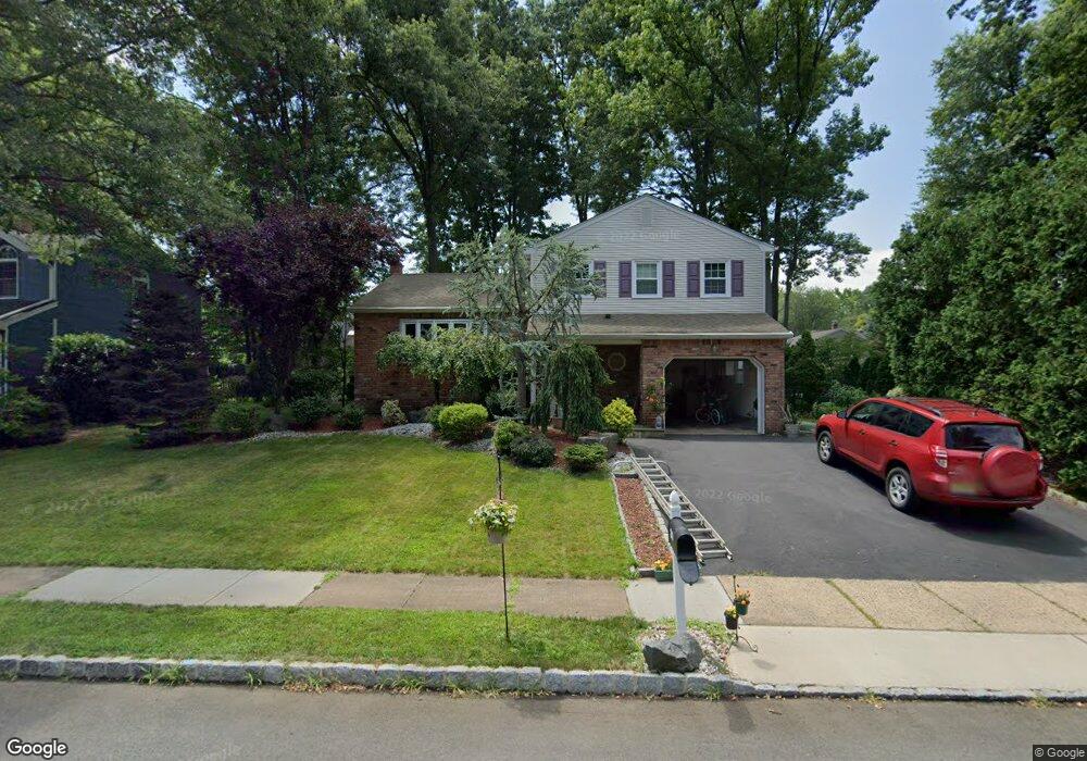
219 W Locust Ave Edison, NJ 08820
Estimated Value: $706,644 - $819,000
3
Beds
2
Baths
1,618
Sq Ft
$468/Sq Ft
Est. Value
About This Home
This home is located at 219 W Locust Ave, Edison, NJ 08820 and is currently estimated at $756,661, approximately $467 per square foot. 219 W Locust Ave is a home located in Middlesex County with nearby schools including James Madison Primary School, James Madison Intermediate School, and John Adams Middle School.
Ownership History
Date
Name
Owned For
Owner Type
Purchase Details
Closed on
Oct 12, 2012
Sold by
Dileo Anthony M and Dileo Frances M
Bought by
Mohanty Paresh and Mohanty Somya Sikata
Current Estimated Value
Home Financials for this Owner
Home Financials are based on the most recent Mortgage that was taken out on this home.
Original Mortgage
$370,405
Outstanding Balance
$255,390
Interest Rate
3.57%
Mortgage Type
New Conventional
Estimated Equity
$501,271
Purchase Details
Closed on
May 29, 1996
Sold by
Lang Thomas
Bought by
Dileo Anthony and Dileo Frances
Home Financials for this Owner
Home Financials are based on the most recent Mortgage that was taken out on this home.
Original Mortgage
$160,000
Interest Rate
7.91%
Create a Home Valuation Report for This Property
The Home Valuation Report is an in-depth analysis detailing your home's value as well as a comparison with similar homes in the area
Home Values in the Area
Average Home Value in this Area
Purchase History
| Date | Buyer | Sale Price | Title Company |
|---|---|---|---|
| Mohanty Paresh | $389,900 | None Available | |
| Dileo Anthony | $220,000 | -- |
Source: Public Records
Mortgage History
| Date | Status | Borrower | Loan Amount |
|---|---|---|---|
| Open | Mohanty Paresh | $370,405 | |
| Previous Owner | Dileo Anthony | $160,000 |
Source: Public Records
Tax History
| Year | Tax Paid | Tax Assessment Tax Assessment Total Assessment is a certain percentage of the fair market value that is determined by local assessors to be the total taxable value of land and additions on the property. | Land | Improvement |
|---|---|---|---|---|
| 2025 | $11,215 | $188,400 | $104,400 | $84,000 |
| 2024 | $11,155 | $188,400 | $104,400 | $84,000 |
| 2023 | $11,155 | $188,400 | $104,400 | $84,000 |
| 2022 | $11,159 | $188,400 | $104,400 | $84,000 |
| 2021 | $11,121 | $188,400 | $104,400 | $84,000 |
| 2020 | $12,488 | $213,500 | $104,400 | $109,100 |
| 2019 | $12,016 | $213,500 | $104,400 | $109,100 |
| 2018 | $11,725 | $213,500 | $104,400 | $109,100 |
| 2017 | $11,478 | $213,500 | $104,400 | $109,100 |
| 2016 | $11,264 | $213,500 | $104,400 | $109,100 |
| 2015 | $10,833 | $213,500 | $104,400 | $109,100 |
| 2014 | $10,517 | $209,900 | $104,400 | $105,500 |
Source: Public Records
Map
Nearby Homes
- 973 Ellis Pkwy
- 868 Inman Ave
- 34 E Prescott Ave
- 8 Periwinkle Place
- 372 Willow Way
- 24 Woodland Rd
- 67 Brookside Terrace
- 786 Wood Ave
- 12 W Clark Place
- 6 Tulip Ct
- 8 Normandy Rd
- 15 New Dover Ave
- 990 Inman Ave
- 53 Jordan Rd
- 131 Morningside Rd
- 172 Briarheath Ln
- 80 Gaywood Ave
- 64 William St
- 46 Taylor Terrace
- 628 New Dover Rd
- 223 W Locust Ave
- 217 W Locust Ave
- 220 W Shirley Ave
- 224 W Shirley Ave
- 218 W Shirley Ave
- 220 W Locust Ave
- 213 W Locust Ave
- 988 Ellis Pkwy
- 224 W Locust Ave
- 218 W Locust Ave
- 214 W Shirley Ave
- 982 Ellis Pkwy
- 992 Ellis Pkwy
- 214 W Locust Ave
- 219 W Shirley Ave
- 219 W Prescott Ave
- 223 W Prescott Ave
- 223 W Shirley Ave
- 209 W Locust Ave
- 217 W Shirley Ave
Your Personal Tour Guide
Ask me questions while you tour the home.