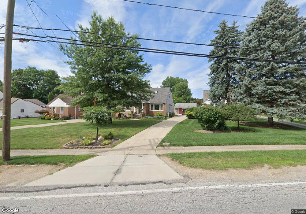
2190 Glenridge Rd Euclid, OH 44117
Estimated Value: $156,000 - $200,000
3
Beds
1
Bath
2,040
Sq Ft
$89/Sq Ft
Est. Value
About This Home
This home is located at 2190 Glenridge Rd, Euclid, OH 44117 and is currently estimated at $181,607, approximately $89 per square foot. 2190 Glenridge Rd is a home located in Cuyahoga County with nearby schools including Bluestone Elementary School, Euclid Middle School, and Euclid High School.
Ownership History
Date
Name
Owned For
Owner Type
Purchase Details
Closed on
Feb 4, 2023
Sold by
Dang Hoang Ngoc and Libby Anne
Bought by
Dang Family Trust
Current Estimated Value
Purchase Details
Closed on
Jul 16, 2002
Sold by
Cooper Edward L and Cooper Yvonne W
Bought by
Quarterman Janet
Purchase Details
Closed on
Jun 12, 1992
Sold by
Champa Marie
Bought by
Cooper Edward L
Purchase Details
Closed on
Dec 2, 1986
Sold by
Marie Champa
Bought by
Champa Marie
Purchase Details
Closed on
Apr 23, 1982
Sold by
Champa Joseph
Bought by
Marie Champa
Purchase Details
Closed on
Jul 29, 1976
Sold by
Champa Joseph and Champa Marie
Bought by
Champa Joseph
Purchase Details
Closed on
Jan 1, 1975
Bought by
Champa Joseph and Champa Marie
Create a Home Valuation Report for This Property
The Home Valuation Report is an in-depth analysis detailing your home's value as well as a comparison with similar homes in the area
Home Values in the Area
Average Home Value in this Area
Purchase History
| Date | Buyer | Sale Price | Title Company |
|---|---|---|---|
| Dang Family Trust | -- | -- | |
| Quarterman Janet | $91,000 | -- | |
| Cooper Edward L | $76,400 | -- | |
| Champa Marie | -- | -- | |
| Marie Champa | -- | -- | |
| Champa Joseph | -- | -- | |
| Champa Joseph | -- | -- |
Source: Public Records
Tax History Compared to Growth
Tax History
| Year | Tax Paid | Tax Assessment Tax Assessment Total Assessment is a certain percentage of the fair market value that is determined by local assessors to be the total taxable value of land and additions on the property. | Land | Improvement |
|---|---|---|---|---|
| 2024 | $4,214 | $61,705 | $11,025 | $50,680 |
| 2023 | $4,322 | $49,810 | $10,190 | $39,620 |
| 2022 | $4,223 | $49,805 | $10,185 | $39,620 |
| 2021 | $4,718 | $49,810 | $10,190 | $39,620 |
| 2020 | $4,473 | $42,950 | $8,790 | $34,160 |
| 2019 | $4,036 | $122,700 | $25,100 | $97,600 |
| 2018 | $4,066 | $42,950 | $8,790 | $34,160 |
| 2017 | $3,574 | $31,260 | $6,370 | $24,890 |
| 2016 | $3,583 | $31,260 | $6,370 | $24,890 |
| 2015 | $3,264 | $31,260 | $6,370 | $24,890 |
| 2014 | $3,264 | $31,260 | $6,370 | $24,890 |
Source: Public Records
Map
Nearby Homes
- 2150 Glenridge Rd
- 24 Washington Square
- 209 Greenbriar Ct
- 237 Greenbriar Ct Unit F237
- 19871 Upper Valley Dr
- 1860 Glenridge Rd
- 2441 Malden Rd
- 19201 Shawnee Rd
- 1721 Grand Blvd
- 19201 Genesee Rd
- 2536 Greenvale Rd
- 2337 Greenvale Rd
- 22601 Harms Rd
- 4002 Lancaster Rd
- 24801 Highland Rd
- 4031 Suffolk Rd
- 220 Greenvale Rd
- 1777 Catalpa Rd
- 3803 Bridgeview Dr
- 2010 E 221st St
- 2188 Glenridge Rd
- 2196 Glenridge Rd
- 2184 Glenridge Rd
- 2200 Glenridge Rd
- 20316 Linda Dr
- 20320 Linda Dr
- 2176 Glenridge Rd
- 20351 Blackfoot Ave
- 20341 Blackfoot Ave
- 20324 Linda Dr
- 2220 Glenridge Rd
- 20331 Blackfoot Ave
- 20314 Linda Dr
- 20321 Blackfoot Ave
- 2230 Glenridge Rd
- 20331 Major Dr
- 20310 Linda Dr
- 20311 Blackfoot Ave
- 20321 Major Dr
- 20311 Linda Dr