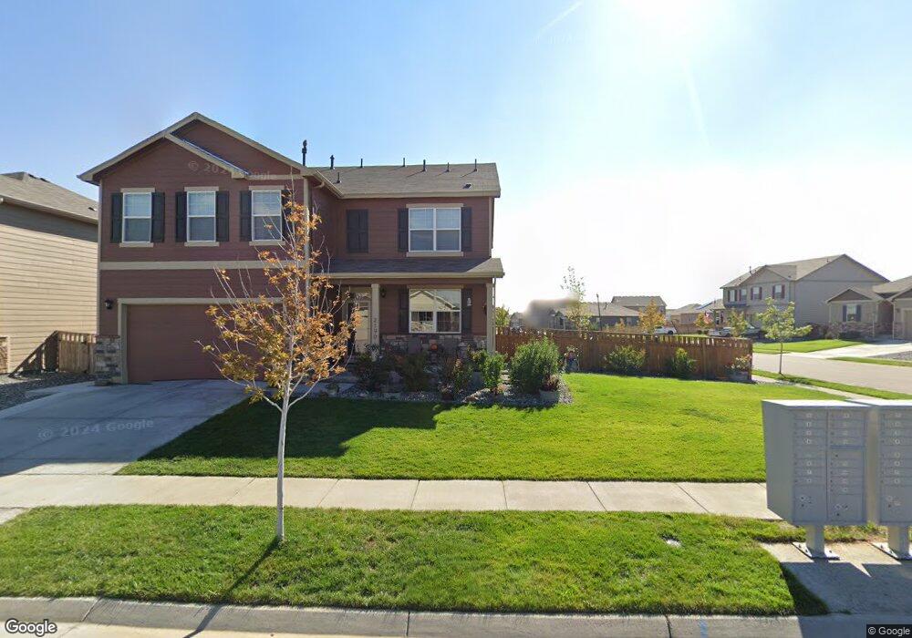
2190 Opal Ave Lochbuie, CO 80603
Estimated Value: $505,000 - $551,000
5
Beds
4
Baths
2,703
Sq Ft
$197/Sq Ft
Est. Value
About This Home
This home is located at 2190 Opal Ave, Lochbuie, CO 80603 and is currently estimated at $533,333, approximately $197 per square foot. 2190 Opal Ave is a home located in Weld County with nearby schools including Weld Central Senior High School, Bromley East Charter School, and Foundations Academy.
Ownership History
Date
Name
Owned For
Owner Type
Purchase Details
Closed on
Nov 2, 2020
Sold by
Reinhart Cody A and Parel Franny D
Bought by
Culver Cody and Culver Jennifer
Current Estimated Value
Home Financials for this Owner
Home Financials are based on the most recent Mortgage that was taken out on this home.
Original Mortgage
$260,000
Outstanding Balance
$231,363
Interest Rate
2.8%
Mortgage Type
New Conventional
Estimated Equity
$301,970
Purchase Details
Closed on
Sep 7, 2018
Sold by
Melody Homes Inc
Bought by
Reinhart Cody A and Parel Franny D
Home Financials for this Owner
Home Financials are based on the most recent Mortgage that was taken out on this home.
Original Mortgage
$365,075
Interest Rate
4.5%
Mortgage Type
FHA
Create a Home Valuation Report for This Property
The Home Valuation Report is an in-depth analysis detailing your home's value as well as a comparison with similar homes in the area
Home Values in the Area
Average Home Value in this Area
Purchase History
| Date | Buyer | Sale Price | Title Company |
|---|---|---|---|
| Culver Cody | $410,000 | Heritage Title Company | |
| Reinhart Cody A | $389,375 | Heritage Title Co |
Source: Public Records
Mortgage History
| Date | Status | Borrower | Loan Amount |
|---|---|---|---|
| Open | Culver Cody | $260,000 | |
| Previous Owner | Reinhart Cody A | $365,075 |
Source: Public Records
Tax History Compared to Growth
Tax History
| Year | Tax Paid | Tax Assessment Tax Assessment Total Assessment is a certain percentage of the fair market value that is determined by local assessors to be the total taxable value of land and additions on the property. | Land | Improvement |
|---|---|---|---|---|
| 2025 | $4,781 | $31,710 | $7,810 | $23,900 |
| 2024 | $4,781 | $31,710 | $7,810 | $23,900 |
| 2023 | $4,653 | $36,820 | $8,120 | $28,700 |
| 2022 | $3,714 | $27,810 | $4,520 | $23,290 |
| 2021 | $3,807 | $28,020 | $4,650 | $23,370 |
| 2020 | $3,331 | $25,330 | $3,220 | $22,110 |
| 2019 | $3,485 | $25,330 | $3,220 | $22,110 |
| 2018 | $6 | $10 | $10 | $0 |
| 2017 | $6 | $10 | $10 | $0 |
| 2016 | $6 | $10 | $10 | $0 |
| 2015 | $6 | $10 | $10 | $0 |
| 2014 | $6 | $10 | $10 | $0 |
Source: Public Records
Map
Nearby Homes
- 1032 Cable St
- 1977 Opal Ave
- 2328 Ruby Ave
- 1790 Jade Ave
- 713 Indigo St
- 603 Jewel St
- 412 Iron St
- 252 Firestone Cir
- 277 Jewel St
- 269 Jewel St
- 4532 Dewey Ln
- 1688 Aquamarine Dr
- LARK Plan at Silver Peaks
- Edmon Plan at Silver Peaks
- Hennessy Plan at Silver Peaks
- Adair Plan at Silver Peaks
- ELDER II Plan at Silver Peaks
- Chatham Plan at Silver Peaks
- HENLEY Plan at Silver Peaks
- BRIDGEPORT Plan at Silver Peaks