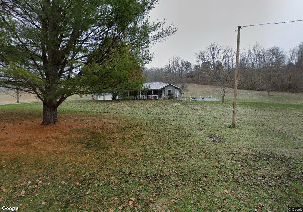
2190 Poplar Fork Rd Franklin Furnace, OH 45629
Estimated Value: $224,000 - $374,000
3
Beds
2
Baths
1,814
Sq Ft
$162/Sq Ft
Est. Value
About This Home
This home is located at 2190 Poplar Fork Rd, Franklin Furnace, OH 45629 and is currently estimated at $293,554, approximately $161 per square foot. 2190 Poplar Fork Rd is a home located in Scioto County with nearby schools including Bloom-Vernon Elementary School and South Webster Junior/Senior High School.
Ownership History
Date
Name
Owned For
Owner Type
Purchase Details
Closed on
May 4, 2020
Sold by
Wilson Cheryl K and Wilson Jim
Bought by
Basham Brett T
Current Estimated Value
Home Financials for this Owner
Home Financials are based on the most recent Mortgage that was taken out on this home.
Original Mortgage
$148,500
Outstanding Balance
$132,082
Interest Rate
3.5%
Mortgage Type
New Conventional
Estimated Equity
$161,472
Purchase Details
Closed on
Oct 28, 2016
Sold by
Bowman Cheryl Terrine and Bowman Ricky Lee
Bought by
Wilson Cheryl K and Wilson Jim
Purchase Details
Closed on
Sep 19, 2016
Sold by
Wells Fargo Bank
Bought by
Bowman Cheryl Terrine and Bowman Ricky Lee
Purchase Details
Closed on
Dec 2, 2015
Sold by
Scioto County Sheriff
Bought by
Wells Fargo Bank
Purchase Details
Closed on
Dec 2, 2004
Bought by
Boza Edward J Jr + Melani
Purchase Details
Closed on
Mar 24, 1998
Sold by
Deems James E + Karen J and Deems S
Bought by
Spreacker Darren L
Create a Home Valuation Report for This Property
The Home Valuation Report is an in-depth analysis detailing your home's value as well as a comparison with similar homes in the area
Home Values in the Area
Average Home Value in this Area
Purchase History
| Date | Buyer | Sale Price | Title Company |
|---|---|---|---|
| Basham Brett T | $165,000 | Bestitle Agency Inc | |
| Wilson Cheryl K | $103,000 | -- | |
| Bowman Cheryl Terrine | $94,000 | -- | |
| Wells Fargo Bank | $83,400 | -- | |
| Boza Edward J Jr + Melani | $139,000 | -- | |
| Spreacker Darren L | $110,000 | -- |
Source: Public Records
Mortgage History
| Date | Status | Borrower | Loan Amount |
|---|---|---|---|
| Open | Basham Brett T | $148,500 |
Source: Public Records
Tax History Compared to Growth
Tax History
| Year | Tax Paid | Tax Assessment Tax Assessment Total Assessment is a certain percentage of the fair market value that is determined by local assessors to be the total taxable value of land and additions on the property. | Land | Improvement |
|---|---|---|---|---|
| 2024 | $2,504 | $58,040 | $7,140 | $50,900 |
| 2023 | $2,504 | $58,040 | $7,140 | $50,900 |
| 2022 | $2,399 | $58,040 | $7,140 | $50,900 |
| 2021 | $2,110 | $50,920 | $6,230 | $44,690 |
| 2020 | $4,141 | $50,920 | $6,230 | $44,690 |
| 2019 | $2,064 | $46,660 | $6,030 | $40,630 |
| 2018 | $1,949 | $46,660 | $6,030 | $40,630 |
| 2017 | $1,901 | $46,660 | $6,030 | $40,630 |
| 2016 | $1,939 | $47,060 | $5,670 | $41,390 |
| 2015 | $1,921 | $47,060 | $5,670 | $41,390 |
| 2013 | $1,752 | $47,060 | $5,670 | $41,390 |
Source: Public Records
Map
Nearby Homes
- 2053 Snook Rd
- 2170 Snook Rd
- 6173 Ohio 522
- 0 Lick Run Lyra Rd Lot Unit Wp003
- 494 Germany Hollow Rd
- 4235 Ohio 522
- 0 Haney Rd Lot Unit Wp002
- 3272 Big Pete Rd
- 3272 Big Pete Rd Unit A
- 1318 Haney Rd
- 0 Haney Rd Unit 225025433
- 3754 Ohio 522
- 638 Sam Jones Rd Unit 2
- 638 Sam Jones Rd
- 1860 Haverhill Ohio Furance
- 863 County Road 9
- 638 Sam Jones Rd
- 0 Lick Run-Lyra Rd
- 0 Patriot Ridge Dr
- 0 Harrison Ave
- 2101 Poplar Fork Rd
- 2347 Poplar Fork Rd
- 0 Poplar Fork Rd Unit 11338074
- 0 Poplar Fork Rd
- 2515 Poplar Fork Rd
- 2551 Poplar Fork Rd
- 59 Cooney Rd
- 265 Cooney Rd
- 2613 Poplar Fork Rd
- 275 Cooney Rd
- 515 Cooney Rd
- 2767 Poplar Fork Rd
- 2786 Poplar Fork Rd
- 2786 Poplar Fork Rd
- 2786 Poplar Fork Rd Unit A
- 1303 Poplar Fork Rd
- 278 Cooney Rd
- 2813 Poplar Fork Rd
- 3349 Poplar Fork Rd
- 2827 Poplar Fork Rd