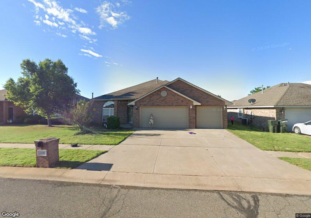
2190 Scissortail Landing Dr Edmond, OK 73012
Deer Creek NeighborhoodEstimated Value: $311,000 - $339,000
4
Beds
3
Baths
2,276
Sq Ft
$141/Sq Ft
Est. Value
About This Home
This home is located at 2190 Scissortail Landing Dr, Edmond, OK 73012 and is currently estimated at $321,206, approximately $141 per square foot. 2190 Scissortail Landing Dr is a home located in Oklahoma County with nearby schools including Frontier Elementary, Heartland Middle School, and Santa Fe High School.
Ownership History
Date
Name
Owned For
Owner Type
Purchase Details
Closed on
Nov 30, 2011
Sold by
Bycko Conan R and Bycko Michelle L
Bought by
Dinkins Elizabeth Ruth and Dinkins Alex
Current Estimated Value
Home Financials for this Owner
Home Financials are based on the most recent Mortgage that was taken out on this home.
Original Mortgage
$175,000
Interest Rate
4.13%
Mortgage Type
Purchase Money Mortgage
Purchase Details
Closed on
Jun 15, 2005
Sold by
Colony Homes Inc
Bought by
Bycko Conan R and Bycko Michelle L
Home Financials for this Owner
Home Financials are based on the most recent Mortgage that was taken out on this home.
Original Mortgage
$166,807
Interest Rate
5.67%
Mortgage Type
Fannie Mae Freddie Mac
Create a Home Valuation Report for This Property
The Home Valuation Report is an in-depth analysis detailing your home's value as well as a comparison with similar homes in the area
Home Values in the Area
Average Home Value in this Area
Purchase History
| Date | Buyer | Sale Price | Title Company |
|---|---|---|---|
| Dinkins Elizabeth Ruth | $175,000 | First American Title | |
| Bycko Conan R | $185,500 | First American Title & Tr Co |
Source: Public Records
Mortgage History
| Date | Status | Borrower | Loan Amount |
|---|---|---|---|
| Closed | Dinkins Elizabeth Ruth | $175,000 | |
| Previous Owner | Bycko Conan R | $166,807 |
Source: Public Records
Tax History Compared to Growth
Tax History
| Year | Tax Paid | Tax Assessment Tax Assessment Total Assessment is a certain percentage of the fair market value that is determined by local assessors to be the total taxable value of land and additions on the property. | Land | Improvement |
|---|---|---|---|---|
| 2024 | $3,034 | $28,557 | $3,144 | $25,413 |
| 2023 | $3,034 | $27,198 | $3,149 | $24,049 |
| 2022 | $2,710 | $25,903 | $3,422 | $22,481 |
| 2021 | $2,569 | $24,669 | $3,700 | $20,969 |
| 2020 | $2,648 | $23,495 | $3,415 | $20,080 |
| 2019 | $163 | $22,376 | $3,322 | $19,054 |
| 2018 | $159 | $21,725 | $0 | $0 |
| 2017 | $154 | $21,117 | $3,292 | $17,825 |
| 2016 | $2,214 | $20,502 | $2,848 | $17,654 |
| 2015 | $1,999 | $19,906 | $2,830 | $17,076 |
| 2014 | $1,935 | $19,326 | $3,415 | $15,911 |
Source: Public Records
Map
Nearby Homes
- 21222 Robin Ridge Ln
- 2322 Melody Dr
- 1988 Tall Grass Cir
- 21755 Long Trail
- 1798 Long Trail
- 1833 Lariat Trail
- 21070 Highlander Ridge Dr
- 1814 Olde School Rd
- 20897 Highlander Ridge Dr
- 21998 Homesteaders Rd
- 2300 NW 220th Terrace
- 22576 Pine Bluff Way
- 22057 Water Oak Cir
- 3316 Holland Cir
- 3324 Holland Cir
- 4317 Ritter Rd
- 1701 Birchfield Rd
- 22301 Pine Bluff Way
- 21687 Coffee Tree Cir
- 3324 Courtney Creek Dr
- 2174 Scissortail Landing Dr
- 2200 Scissortail Landing Dr
- 2199 Peacock Dr
- 2183 Peacock Dr
- 2162 Scissortail Landing Dr
- 2212 Scissortail Landing Dr
- 2215 Peacock Dr
- 2175 Peacock Dr
- 2193 Scissortail Landing Dr
- 2177 Scissortail Landing Dr
- 2150 Scissortail Landing Dr
- 2163 Peacock Dr
- 2201 Scissortail Landing Dr
- 2169 Scissortail Landing Dr
- 2236 Scissortail Landing Dr
- 2211 Scissortail Landing Dr
- 2237 Peacock Dr
- 2159 Peacock Dr
- 2153 Scissortail Landing Dr
- 2140 Scissortail Landing Dr