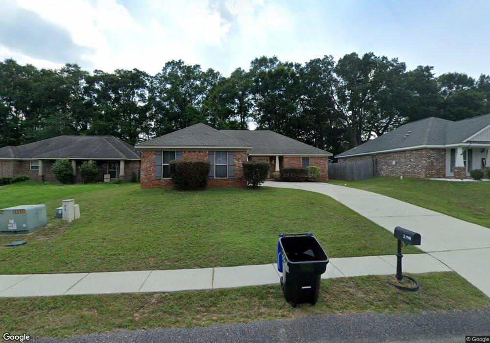
2190 Wolf Branch Dr S Unit 61 Mobile, AL 36608
Outer West Mobile NeighborhoodEstimated Value: $231,000 - $255,000
5
Beds
2
Baths
1,415
Sq Ft
$172/Sq Ft
Est. Value
About This Home
This home is located at 2190 Wolf Branch Dr S Unit 61, Mobile, AL 36608 and is currently estimated at $243,285, approximately $171 per square foot. 2190 Wolf Branch Dr S Unit 61 is a home located in Mobile County with nearby schools including Taylor White Elementary School, Bernice J Causey Middle School, and Baker High School.
Ownership History
Date
Name
Owned For
Owner Type
Purchase Details
Closed on
Jul 8, 2013
Sold by
Mark Swanson Builders Inc
Bought by
Swanner Stratten S and Swanner Diana L
Current Estimated Value
Home Financials for this Owner
Home Financials are based on the most recent Mortgage that was taken out on this home.
Original Mortgage
$138,924
Outstanding Balance
$100,461
Interest Rate
3.79%
Mortgage Type
VA
Estimated Equity
$142,824
Purchase Details
Closed on
Aug 14, 2012
Sold by
M P Properties Llc
Bought by
Mark Swanson Builders Inc
Home Financials for this Owner
Home Financials are based on the most recent Mortgage that was taken out on this home.
Original Mortgage
$112,800
Interest Rate
3.65%
Mortgage Type
Future Advance Clause Open End Mortgage
Create a Home Valuation Report for This Property
The Home Valuation Report is an in-depth analysis detailing your home's value as well as a comparison with similar homes in the area
Home Values in the Area
Average Home Value in this Area
Purchase History
| Date | Buyer | Sale Price | Title Company |
|---|---|---|---|
| Swanner Stratten S | $136,000 | None Available | |
| Mark Swanson Builders Inc | $29,000 | Surety Land Title |
Source: Public Records
Mortgage History
| Date | Status | Borrower | Loan Amount |
|---|---|---|---|
| Open | Swanner Stratten S | $138,924 | |
| Previous Owner | Mark Swanson Builders Inc | $112,800 |
Source: Public Records
Tax History Compared to Growth
Tax History
| Year | Tax Paid | Tax Assessment Tax Assessment Total Assessment is a certain percentage of the fair market value that is determined by local assessors to be the total taxable value of land and additions on the property. | Land | Improvement |
|---|---|---|---|---|
| 2024 | $2,166 | $43,220 | $8,000 | $35,220 |
| 2023 | $2,166 | $38,500 | $7,200 | $31,300 |
| 2022 | $1,680 | $34,640 | $5,980 | $28,660 |
| 2021 | $1,488 | $30,680 | $5,200 | $25,480 |
| 2020 | $1,501 | $30,940 | $5,200 | $25,740 |
| 2019 | $1,485 | $30,620 | $5,200 | $25,420 |
| 2018 | $1,355 | $27,940 | $0 | $0 |
| 2017 | $1,448 | $28,420 | $0 | $0 |
| 2016 | $1,387 | $28,600 | $0 | $0 |
| 2013 | $150 | $6,200 | $0 | $0 |
Source: Public Records
Map
Nearby Homes
- 11920 Ives Ln
- 12171 Yancey Glen Dr
- 2760 Wildflower Dr W
- 0 Busby Rd
- 0 Newman Rd Unit 7652668
- 0 Newman Rd Unit 7559711
- 0 Newman Rd Unit 7559708
- 0 Newman Rd Unit 7559706
- 0 Newman Rd Unit 7559705
- 0 Newman Rd Unit 7559703
- 0 Newman Rd Unit 22348697
- 0 Newman Rd Unit 22348691
- 0 Newman Rd Unit 21040182
- 0 Newman Rd Unit 21040073
- 0 Newman Rd Unit 13 20683522
- 0 Newman Rd Unit 7499863
- 0 Newman Rd Unit 7493775
- 0 Newman Rd Unit 7427944
- 0 Newman Rd Unit 3 365680
- The Kingston Plan at Coxwell Crossing
- 2190 Wolf Branch Dr S
- 2184 Wolf Branch Dr S
- 2196 Wolf Branch Dr N
- 2196 Wolf Branch Dr S Unit 60
- 2196 Wolf Branch Dr S
- 2202 Wolf Branch Dr S Unit 59
- 2176 Wolf Branch Dr N
- 2168 Wolf Branch Dr N
- 2208 Wolf Branch Dr N
- 2208 Wolf Branch Dr S
- 2185 Wolf Branch Dr S
- 2193 Wolf Branch Dr S Unit 55
- 2193 Wolf Branch Dr S
- 2193 Wolf Branch Dr N
- 2181 Wolf Branch Dr N
- 2160 Wolf Branch Dr N Unit 65
- 2209 Wolf Branch Dr S Unit 57
- 2209 Wolf Branch Dr S
- 2201 Wolf Branch Dr S Unit 56
- 2201 Wolf Branch Dr S