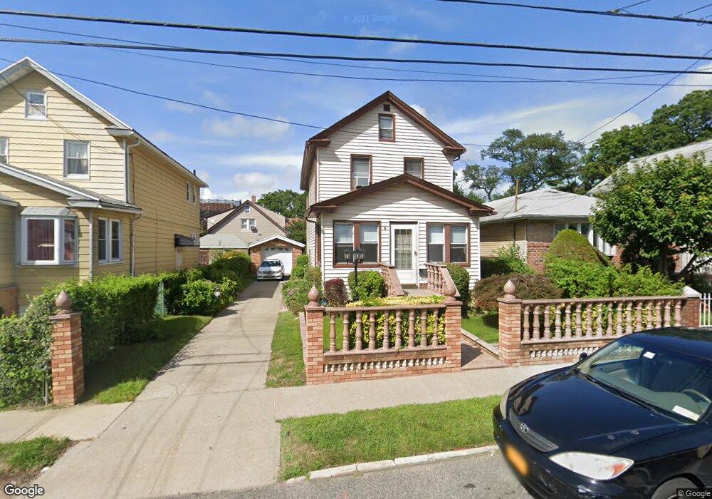
21907 133rd Ave Springfield Gardens, NY 11413
Laurelton NeighborhoodEstimated Value: $651,554 - $757,000
--
Bed
--
Bath
1,584
Sq Ft
$436/Sq Ft
Est. Value
About This Home
This home is located at 21907 133rd Ave, Springfield Gardens, NY 11413 and is currently estimated at $689,889, approximately $435 per square foot. 21907 133rd Ave is a home located in Queens County with nearby schools including P.S. 132 - Ralph Bunche, Is 59 Springfield Gardens, and Success Academy Springfield Gardens.
Ownership History
Date
Name
Owned For
Owner Type
Purchase Details
Closed on
Mar 28, 2014
Sold by
Bernard Marie Julie N and Bernard Stanley M
Bought by
Levy Phillip
Current Estimated Value
Home Financials for this Owner
Home Financials are based on the most recent Mortgage that was taken out on this home.
Original Mortgage
$277,700
Outstanding Balance
$211,659
Interest Rate
4.41%
Mortgage Type
New Conventional
Estimated Equity
$478,230
Create a Home Valuation Report for This Property
The Home Valuation Report is an in-depth analysis detailing your home's value as well as a comparison with similar homes in the area
Home Values in the Area
Average Home Value in this Area
Purchase History
| Date | Buyer | Sale Price | Title Company |
|---|---|---|---|
| Levy Phillip | $370,000 | -- |
Source: Public Records
Mortgage History
| Date | Status | Borrower | Loan Amount |
|---|---|---|---|
| Open | Levy Phillip | $277,700 |
Source: Public Records
Tax History Compared to Growth
Tax History
| Year | Tax Paid | Tax Assessment Tax Assessment Total Assessment is a certain percentage of the fair market value that is determined by local assessors to be the total taxable value of land and additions on the property. | Land | Improvement |
|---|---|---|---|---|
| 2025 | $5,558 | $30,815 | $8,546 | $22,269 |
| 2024 | $5,570 | $29,071 | $8,219 | $20,852 |
| 2023 | $5,228 | $27,427 | $6,891 | $20,536 |
| 2022 | $4,879 | $40,380 | $12,180 | $28,200 |
| 2021 | $5,150 | $38,880 | $12,180 | $26,700 |
| 2020 | $5,140 | $33,480 | $12,180 | $21,300 |
| 2019 | $4,775 | $34,200 | $12,180 | $22,020 |
| 2018 | $4,362 | $22,856 | $9,956 | $12,900 |
| 2017 | $4,096 | $21,565 | $9,063 | $12,502 |
| 2016 | $4,001 | $21,565 | $9,063 | $12,502 |
| 2015 | $2,234 | $21,400 | $11,276 | $10,124 |
| 2014 | $2,234 | $20,189 | $10,467 | $9,722 |
Source: Public Records
Map
Nearby Homes
- 218-36 133rd Rd
- 21931 133rd Ave
- 133-15 220th St
- 21608 Merrick Blvd
- 134-16 221st St
- 134-15 221st St
- 220-27 134th Rd
- 187-01 Ridgedale St
- 220-24 134th Rd
- 12512 Nepton St
- 21611 135th Ave
- 21924 130th Dr
- 131-35 222nd St
- 13049 217th St
- 22126 134th Rd
- 130-45 220th St
- 130-25 217th St
- 136-3 220th St
- 187-16 Williamson Ave
- 187-04 Williamson Ave
- 21901 133rd Ave
- 21911 133rd Ave
- 13241 219th St
- 21915 133rd Ave
- 13235 219th St
- 21817 133rd Ave
- 219-17 133rd Ave
- 21917 133rd Ave
- 21906 133rd Ave
- 21910 133rd Ave
- 13231 219th St
- 219-25 219 St
- 219-14 133rd Ave
- 13240 219th St
- 13231 219th St
- 21814 133rd Ave
- 21914 133rd Ave
- 21925 133rd Ave
- 13236 219th St
- 21810 133rd Ave