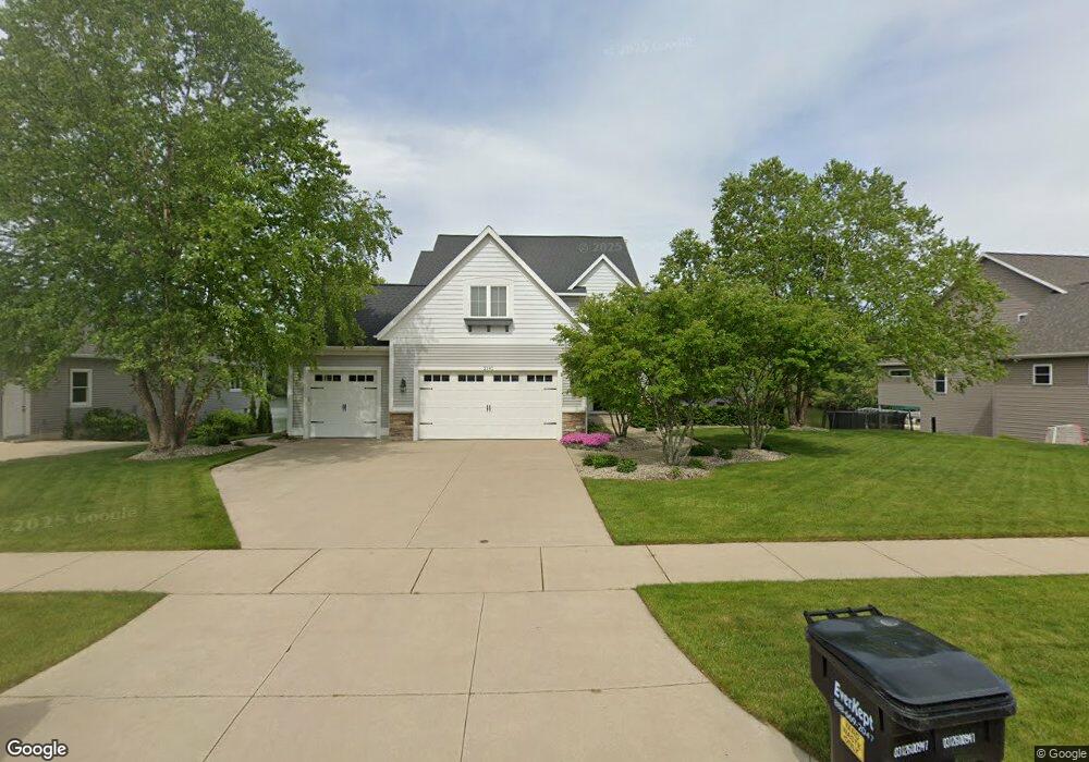
2191 Byron Shores Dr SW Byron Center, MI 49315
Estimated Value: $856,359 - $1,081,000
5
Beds
4
Baths
4,287
Sq Ft
$217/Sq Ft
Est. Value
About This Home
This home is located at 2191 Byron Shores Dr SW, Byron Center, MI 49315 and is currently estimated at $929,340, approximately $216 per square foot. 2191 Byron Shores Dr SW is a home located in Kent County with nearby schools including Marshall Elementary School, Robert L. Nickels Intermediate School, and Byron Center West Middle School.
Ownership History
Date
Name
Owned For
Owner Type
Purchase Details
Closed on
Sep 26, 2018
Sold by
Boyle Thomas P and Boyle Karen C
Bought by
Boyle Thomas P and Boyle Karen C
Current Estimated Value
Purchase Details
Closed on
Aug 10, 2011
Sold by
Paul Michael F and Paul Cara
Bought by
Boyle Thomas P and Boyle Karen C
Purchase Details
Closed on
Mar 4, 2011
Sold by
Prdl Llc
Bought by
Paul Michael F and Paul Cara
Home Financials for this Owner
Home Financials are based on the most recent Mortgage that was taken out on this home.
Original Mortgage
$364,800
Interest Rate
4.88%
Mortgage Type
New Conventional
Create a Home Valuation Report for This Property
The Home Valuation Report is an in-depth analysis detailing your home's value as well as a comparison with similar homes in the area
Home Values in the Area
Average Home Value in this Area
Purchase History
| Date | Buyer | Sale Price | Title Company |
|---|---|---|---|
| Boyle Thomas P | -- | None Available | |
| Boyle Thomas P | $435,500 | Multiple | |
| Paul Michael F | $90,000 | None Available |
Source: Public Records
Mortgage History
| Date | Status | Borrower | Loan Amount |
|---|---|---|---|
| Previous Owner | Paul Michael F | $364,800 |
Source: Public Records
Tax History Compared to Growth
Tax History
| Year | Tax Paid | Tax Assessment Tax Assessment Total Assessment is a certain percentage of the fair market value that is determined by local assessors to be the total taxable value of land and additions on the property. | Land | Improvement |
|---|---|---|---|---|
| 2025 | $5,600 | $430,300 | $0 | $0 |
| 2024 | $5,600 | $397,000 | $0 | $0 |
| 2023 | $5,356 | $357,300 | $0 | $0 |
| 2022 | $7,464 | $328,300 | $0 | $0 |
| 2021 | $7,265 | $292,600 | $0 | $0 |
| 2020 | $4,930 | $290,200 | $0 | $0 |
| 2019 | $7,089 | $283,700 | $0 | $0 |
| 2018 | $6,943 | $271,100 | $47,500 | $223,600 |
| 2017 | $6,758 | $242,000 | $0 | $0 |
| 2016 | $6,513 | $229,300 | $0 | $0 |
| 2015 | $6,402 | $229,300 | $0 | $0 |
| 2013 | -- | $206,100 | $0 | $0 |
Source: Public Records
Map
Nearby Homes
- 1969 Northfield Ct SW
- 2245 Pleasant Pond Dr SW
- 6617 Northfield St SW
- 1901 Northfield Ct SW
- 1818 Northfield Ct SW
- 1839 Northfield Ct SW
- Whitby Plan at Kuiper's Meadow - Cottage Series
- Pentwater Plan at Kuiper's Meadow - Landmark Series
- Harbor Springs Plan at Kuiper's Meadow - Landmark Series
- Sequoia Plan at Kuiper's Meadow - Woodland Series
- Bay Harbor Plan at Kuiper's Meadow - Landmark Series
- Elmwood Plan at Kuiper's Meadow - Woodland Series
- Maplewood Plan at Kuiper's Meadow - Woodland Series
- Camden Plan at Kuiper's Meadow - Cottage Series
- Cedarwood Plan at Kuiper's Meadow - Woodland Series
- Sycamore Plan at Kuiper's Meadow - Woodland Series
- Redwood Plan at Kuiper's Meadow - Woodland Series
- Oakwood Plan at Kuiper's Meadow - Woodland Series
- Northport Plan at Kuiper's Meadow - Landmark Series
- Chestnut Plan at Kuiper's Meadow - Woodland Series
- 2197 Byron Shores Dr SW
- 2187 Byron Shores Dr SW
- 2201 Byron Shores Dr SW
- 2183 Byron Shores Dr SW
- 2194 Byron Shores Dr SW
- 2190 Byron Shores Dr SW
- 2200 Byron Shores Dr SW
- 2186 Byron Shores Dr SW
- 2207 Byron Shores Dr SW
- 2182 Byron Shores Dr SW
- 2177 Byron Shores Dr SW
- 2211 Byron Shores Dr SW
- 2210 Byron Shores Dr SW
- 2178 Byron Shores Dr SW
- 2214 Byron Shores Dr SW
- 1860 68th St SW
- 2215 Byron Shores Dr SW
- 1848 68th St SW
- 2218 Byron Shores Dr SW
- 2221 Byron Shores Dr SW