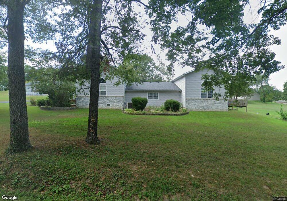
21919 Shady Ln Shell Knob, MO 65747
Estimated Value: $299,000 - $692,000
4
Beds
3
Baths
2,822
Sq Ft
$175/Sq Ft
Est. Value
About This Home
This home is located at 21919 Shady Ln, Shell Knob, MO 65747 and is currently estimated at $494,000, approximately $175 per square foot. 21919 Shady Ln is a home located in Barry County with nearby schools including Shell Knob Elementary School.
Ownership History
Date
Name
Owned For
Owner Type
Purchase Details
Closed on
Nov 6, 2023
Sold by
Mccuen Lloyd L
Bought by
Bishop Stephen and Bishop Stacy
Current Estimated Value
Home Financials for this Owner
Home Financials are based on the most recent Mortgage that was taken out on this home.
Original Mortgage
$364,500
Outstanding Balance
$357,096
Interest Rate
7.19%
Mortgage Type
New Conventional
Estimated Equity
$136,904
Purchase Details
Closed on
Nov 12, 2013
Sold by
Sherman Gary and Sherman Linda
Bought by
Mccuen Lloyd Lee and Mccuen Carol Gay
Home Financials for this Owner
Home Financials are based on the most recent Mortgage that was taken out on this home.
Original Mortgage
$175,000
Interest Rate
4.34%
Mortgage Type
New Conventional
Create a Home Valuation Report for This Property
The Home Valuation Report is an in-depth analysis detailing your home's value as well as a comparison with similar homes in the area
Purchase History
| Date | Buyer | Sale Price | Title Company |
|---|---|---|---|
| Bishop Stephen | -- | Barry County Abstract & Title | |
| Mccuen Lloyd Lee | -- | None Available |
Source: Public Records
Mortgage History
| Date | Status | Borrower | Loan Amount |
|---|---|---|---|
| Open | Bishop Stephen | $364,500 | |
| Previous Owner | Mccuen Lloyd Lee | $175,000 |
Source: Public Records
Tax History
| Year | Tax Paid | Tax Assessment Tax Assessment Total Assessment is a certain percentage of the fair market value that is determined by local assessors to be the total taxable value of land and additions on the property. | Land | Improvement |
|---|---|---|---|---|
| 2025 | $7,160 | $32,205 | $3,610 | $28,595 |
| 2024 | $14 | $29,602 | $3,610 | $25,992 |
| 2023 | $1,437 | $29,602 | $3,610 | $25,992 |
| 2022 | $1,437 | $29,602 | $3,610 | $25,992 |
| 2020 | $1,423 | $29,602 | $3,610 | $25,992 |
| 2018 | $1,402 | $28,253 | $3,610 | $24,643 |
| 2017 | $1,228 | $28,253 | $3,610 | $24,643 |
| 2016 | $1,145 | $25,612 | $3,610 | $22,002 |
| 2015 | -- | $25,612 | $3,610 | $22,002 |
| 2014 | -- | $25,612 | $3,610 | $22,002 |
| 2012 | -- | $0 | $0 | $0 |
Source: Public Records
Map
Nearby Homes
- 22008 Ice House Ln
- 26094 State Highway 39
- 26032 State Highway 39
- 25620 Hillcrest Dr
- 21992 Knob Hill Ln
- 6 Lots Needles Eye Rd
- Lot142 143 Needles Eye Rd
- 000 Shoreline Dr
- 21791 Mill Creek Dr
- 21942 Mill Creek Cir
- 22009 Mill Creek Way
- 22821 Needles Eye Rd
- 21461 Needles Eye Rd
- 21513 Needles Eye Rd
- 25275 Riverside Ln
- 21380 Access Rd
- 20615 Table Rock Ridge Rd
- 26359 State Highway Yy
- .25M/L Farm Road 2210
- 26385 Rustic Rd
- 2199 Grant Dr
- 25354 Central Dr
- 21904 Grant Dr
- Tbd Central Dr
- 21945 Lindsey Ln
- 21963 Grant Dr
- 21941 Grant Dr
- 8899 County Road 241
- 21917 Grant Dr
- 00000 Grant Dr
- 0 Grant Dr
- Lots 33-36 Windsor Lane & Fr 1260
- 22002 Lakeside Dr
- 21839 Lindsey Ln
- 21862 Shady Ln
- 21946 Lindsey Ln
- Tbd Lots 30 & 31 Lakeside
- 21089 Lawrence 1215
- 25272 Ashley Ave
- 21867 Lindsey Ln
Your Personal Tour Guide
Ask me questions while you tour the home.