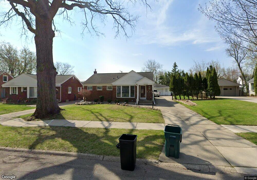
2194 Pembroke Rd Unit Bldg-Unit Birmingham, MI 48009
Estimated Value: $473,065 - $575,000
3
Beds
2
Baths
1,403
Sq Ft
$372/Sq Ft
Est. Value
About This Home
This home is located at 2194 Pembroke Rd Unit Bldg-Unit, Birmingham, MI 48009 and is currently estimated at $521,266, approximately $371 per square foot. 2194 Pembroke Rd Unit Bldg-Unit is a home located in Oakland County with nearby schools including Pembroke Elementary School, Derby Middle School, and Ernest W. Seaholm High School.
Ownership History
Date
Name
Owned For
Owner Type
Purchase Details
Closed on
Aug 3, 2018
Sold by
Kennedy Joseph J and Kennedy Shirley J
Bought by
Sperhac Andrew J and Sperhac Linda M
Current Estimated Value
Home Financials for this Owner
Home Financials are based on the most recent Mortgage that was taken out on this home.
Original Mortgage
$276,000
Outstanding Balance
$239,695
Interest Rate
4.5%
Mortgage Type
Purchase Money Mortgage
Estimated Equity
$281,571
Create a Home Valuation Report for This Property
The Home Valuation Report is an in-depth analysis detailing your home's value as well as a comparison with similar homes in the area
Home Values in the Area
Average Home Value in this Area
Purchase History
| Date | Buyer | Sale Price | Title Company |
|---|---|---|---|
| Sperhac Andrew J | $345,000 | Equity Title Agency Llc |
Source: Public Records
Mortgage History
| Date | Status | Borrower | Loan Amount |
|---|---|---|---|
| Open | Sperhac Andrew J | $276,000 |
Source: Public Records
Tax History Compared to Growth
Tax History
| Year | Tax Paid | Tax Assessment Tax Assessment Total Assessment is a certain percentage of the fair market value that is determined by local assessors to be the total taxable value of land and additions on the property. | Land | Improvement |
|---|---|---|---|---|
| 2024 | $6,325 | $206,280 | $0 | $0 |
| 2023 | $6,061 | $187,360 | $0 | $0 |
| 2022 | $6,561 | $175,830 | $0 | $0 |
| 2021 | $6,619 | $172,950 | $0 | $0 |
| 2020 | $5,897 | $166,160 | $0 | $0 |
| 2019 | $6,674 | $159,340 | $0 | $0 |
| 2018 | $4,008 | $151,960 | $0 | $0 |
| 2017 | $4,002 | $148,110 | $0 | $0 |
| 2016 | $4,009 | $138,170 | $0 | $0 |
| 2015 | -- | $121,830 | $0 | $0 |
| 2014 | -- | $101,810 | $0 | $0 |
| 2011 | -- | $89,470 | $0 | $0 |
Source: Public Records
Map
Nearby Homes
- 2106 Pembroke Rd
- 2263 Manchester Rd
- 3401 Witherbee Dr
- 2182 Buckingham Ave
- 714 Graefield Ct
- 1801 Graefield Rd
- 1814 Graefield Rd
- 2498 Buckingham Ave
- 361 N Eton St Unit 7
- 2873 Summers Place
- 671 Coolidge Rd
- 3274 Camden Dr Unit 135
- 3246 Camden Dr Unit 141
- 3067 Camden Dr Unit 35
- 3286 Camden Dr Unit 132
- 1546 Devon Ln
- 1570 Devon Ln Unit 4
- 2859 E Maple Rd Unit 3
- 2051 Villa Rd Unit 304
- 2051 Villa Rd Unit 302
- 2194 Pembroke Rd
- 2152 Pembroke Rd
- 2204 Pembroke Rd
- 2148 Pembroke Rd
- 2236 Pembroke Rd
- 2191 Manchester Rd
- 2183 Manchester Rd
- 2217 Manchester Rd
- 2167 Manchester Rd
- 2229 Manchester Rd
- 2124 Pembroke Rd
- 2151 Manchester Rd
- 2252 Pembroke Rd
- 2171 Pembroke Rd
- 2195 Pembroke Rd Unit Bldg-Unit
- 2195 Pembroke Rd
- 2153 Pembroke Rd
- 2205 Pembroke Rd
- 2237 Pembroke Rd
- 2135 Manchester Rd