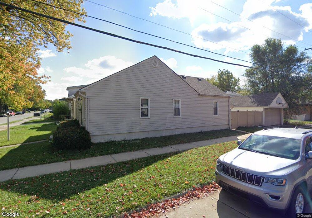
2195 Charter St Lincoln Park, MI 48146
Estimated Value: $144,000 - $157,000
3
Beds
1
Bath
1,000
Sq Ft
$149/Sq Ft
Est. Value
About This Home
This home is located at 2195 Charter St, Lincoln Park, MI 48146 and is currently estimated at $148,976, approximately $148 per square foot. 2195 Charter St is a home located in Wayne County with nearby schools including Lafayette School, Lincoln Park Middle School, and Lincoln Park High School.
Ownership History
Date
Name
Owned For
Owner Type
Purchase Details
Closed on
May 12, 2017
Sold by
Paisely Sarah L and Al Alwan Sarah L
Bought by
Al Alwan Sarah L
Current Estimated Value
Purchase Details
Closed on
Nov 12, 2010
Sold by
The Equiti Group Inc
Bought by
Paisley Sarah L
Purchase Details
Closed on
Mar 2, 2009
Sold by
Collins Bobby and Thornton Samika
Bought by
Deutsche Bank National Trust Company
Purchase Details
Closed on
Jul 25, 2003
Sold by
Collins Bobby
Bought by
Collins Bobby
Purchase Details
Closed on
Oct 30, 2001
Sold by
Hancock Mark G
Bought by
Collins Bobby
Create a Home Valuation Report for This Property
The Home Valuation Report is an in-depth analysis detailing your home's value as well as a comparison with similar homes in the area
Home Values in the Area
Average Home Value in this Area
Purchase History
| Date | Buyer | Sale Price | Title Company |
|---|---|---|---|
| Al Alwan Sarah L | -- | None Available | |
| Paisley Sarah L | $29,999 | None Available | |
| Deutsche Bank National Trust Company | $14,950 | None Available | |
| Collins Bobby | -- | Progressive Land Title | |
| Collins Bobby | $95,000 | -- |
Source: Public Records
Tax History Compared to Growth
Tax History
| Year | Tax Paid | Tax Assessment Tax Assessment Total Assessment is a certain percentage of the fair market value that is determined by local assessors to be the total taxable value of land and additions on the property. | Land | Improvement |
|---|---|---|---|---|
| 2025 | $1,168 | $72,700 | $0 | $0 |
| 2024 | $1,168 | $61,900 | $0 | $0 |
| 2023 | $1,107 | $52,000 | $0 | $0 |
| 2022 | $1,310 | $41,600 | $0 | $0 |
| 2021 | $1,281 | $36,900 | $0 | $0 |
| 2020 | $1,270 | $32,800 | $0 | $0 |
| 2019 | $1,004 | $27,700 | $0 | $0 |
| 2018 | $904 | $22,300 | $0 | $0 |
| 2017 | $748 | $24,000 | $0 | $0 |
| 2016 | $1,310 | $24,700 | $0 | $0 |
| 2015 | $2,410 | $24,100 | $0 | $0 |
| 2013 | $2,580 | $26,900 | $0 | $0 |
| 2012 | $1,578 | $27,900 | $5,300 | $22,600 |
Source: Public Records
Map
Nearby Homes
- 3603 Harlow Ave
- 819 Frank Ave
- 4020 Wall Ave
- 2190 Morris Ave
- 000 Harlow St
- 2064 Morris Ave
- 24558 Outer Dr
- 14713 Morris Ave
- 1862 Montie Rd
- 14545 College Ave
- 19211 Wall St
- 14633 College Ave
- 2105 Paris Ave
- 1840 Morris Ave
- 19120 Dix Rd
- 2790 Blanche St
- 1826 Morris Ave
- 14823 Paris Ct Unit 19
- 1807 Morris Ave
- 18949 Wall St
- 2191 Charter St
- 2181 Charter St
- 2205 Charter St
- 2196 Council Ave
- 2196 Council Ave
- 2196 Council Ave
- 2196 Council Ave
- 2161 Charter St
- 2211 Charter St
- 2194 Charter St
- 2180 Council Ave
- 2204 Council Ave
- 2190 Charter St
- 2141 Charter St
- 2170 Charter St
- 2210 Council Ave
- 2160 Charter St
- 2158 Council Ave
- 2216 Council Ave
- 2210 Charter St