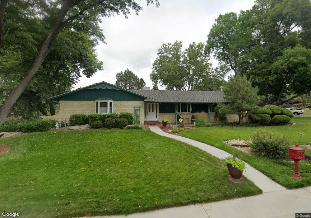
2195 Union Dr Lakewood, CO 80215
Applewood Valley NeighborhoodEstimated Value: $990,519 - $1,166,000
4
Beds
3
Baths
2,708
Sq Ft
$399/Sq Ft
Est. Value
About This Home
This home is located at 2195 Union Dr, Lakewood, CO 80215 and is currently estimated at $1,081,380, approximately $399 per square foot. 2195 Union Dr is a home located in Jefferson County with nearby schools including Stober Elementary School, Everitt Middle School, and Wheat Ridge High School.
Ownership History
Date
Name
Owned For
Owner Type
Purchase Details
Closed on
Mar 7, 2011
Sold by
Stumm Christopher T and Stumm Roberta M
Bought by
Brisnehan David P and Brisnehan Susan S
Current Estimated Value
Home Financials for this Owner
Home Financials are based on the most recent Mortgage that was taken out on this home.
Original Mortgage
$262,500
Outstanding Balance
$171,282
Interest Rate
3.75%
Mortgage Type
New Conventional
Estimated Equity
$910,098
Purchase Details
Closed on
Dec 27, 2007
Sold by
The Charles W & Polly O Miller Trust
Bought by
Stumm Christopher T and Stumm Roberta M
Home Financials for this Owner
Home Financials are based on the most recent Mortgage that was taken out on this home.
Original Mortgage
$275,800
Interest Rate
6.23%
Mortgage Type
Purchase Money Mortgage
Purchase Details
Closed on
Nov 15, 1993
Sold by
Miller Charles William and Miller Polly O
Bought by
Charles W Miller & Polly O Miller Trust
Create a Home Valuation Report for This Property
The Home Valuation Report is an in-depth analysis detailing your home's value as well as a comparison with similar homes in the area
Home Values in the Area
Average Home Value in this Area
Purchase History
| Date | Buyer | Sale Price | Title Company |
|---|---|---|---|
| Brisnehan David P | $375,000 | None Available | |
| Stumm Christopher T | $369,900 | None Available | |
| Charles W Miller & Polly O Miller Trust | -- | -- |
Source: Public Records
Mortgage History
| Date | Status | Borrower | Loan Amount |
|---|---|---|---|
| Open | Brisnehan David P | $262,500 | |
| Previous Owner | Stumm Christopher T | $275,800 |
Source: Public Records
Tax History Compared to Growth
Tax History
| Year | Tax Paid | Tax Assessment Tax Assessment Total Assessment is a certain percentage of the fair market value that is determined by local assessors to be the total taxable value of land and additions on the property. | Land | Improvement |
|---|---|---|---|---|
| 2024 | $4,513 | $53,778 | $26,074 | $27,704 |
| 2023 | $4,513 | $53,778 | $26,074 | $27,704 |
| 2022 | $3,639 | $43,871 | $15,761 | $28,110 |
| 2021 | $4,361 | $45,133 | $16,214 | $28,919 |
| 2020 | $4,009 | $41,504 | $13,748 | $27,756 |
| 2019 | $3,958 | $41,504 | $13,748 | $27,756 |
| 2018 | $3,914 | $39,997 | $11,085 | $28,912 |
| 2017 | $3,522 | $39,997 | $11,085 | $28,912 |
| 2016 | $3,328 | $35,562 | $11,181 | $24,381 |
| 2015 | $3,038 | $35,562 | $11,181 | $24,381 |
| 2014 | $3,038 | $29,579 | $10,316 | $19,263 |
Source: Public Records
Map
Nearby Homes
- 2140 Tabor Dr
- 2110 Tabor Dr
- 2368 Ward Dr
- 2055 Quail Dr
- 11715 W 18th Ave
- 1825 Simms St
- 11340 Benthaven Dr
- 1832 Simms St Unit 1832A
- 1830 Simms St
- 11423 W 17th Place Unit I11423
- 11734 W Applewood Knolls Dr
- 1802 Simms St
- 11422 W 17th Place
- 11813 W 17th Ave
- 11217 W 18th Ave Unit A
- 12075 W 18th Dr
- 11569 W 27th Ave
- 1723 Robb St Unit 45
- 1723 Robb St Unit 26
- 11954 W Applewood Knolls Dr
- 11850 W 22nd Place
- 2175 Union Dr
- 2180 Union Dr
- 2190 Union Dr
- 11835 W 22nd Place
- 11795 W 22nd Place
- 11880 W 22nd Place
- 2170 Union Dr
- 11865 W 22nd Place
- 2155 Union Dr
- 11765 W 22nd Place
- 2135 Tabor Dr
- 2145 Tabor Dr
- 11720 W 22nd Place
- 11780 Carmel Dr
- 11875 W 21st Way
- 2160 Union Dr
- 11800 Carmel Dr
- 11900 W 22nd Place
- 11750 Carmel Dr