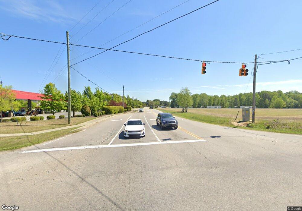
2196 Nc Highway 42 W Clayton, NC 27520
Estimated Value: $4,268,641
--
Bed
--
Bath
11,000
Sq Ft
$388/Sq Ft
Est. Value
About This Home
This home is located at 2196 Nc Highway 42 W, Clayton, NC 27520 and is currently estimated at $4,268,641, approximately $388 per square foot. 2196 Nc Highway 42 W is a home located in Johnston County with nearby schools including West Clayton Elementary School, Clayton Middle School, and Clayton High.
Ownership History
Date
Name
Owned For
Owner Type
Purchase Details
Closed on
Jun 27, 2024
Sold by
Triangle Orthopaedics Real Estate Group
Bought by
Toreg Clayton Llc
Current Estimated Value
Home Financials for this Owner
Home Financials are based on the most recent Mortgage that was taken out on this home.
Original Mortgage
$3,425,000
Outstanding Balance
$3,384,405
Interest Rate
7.03%
Mortgage Type
New Conventional
Estimated Equity
$884,236
Purchase Details
Closed on
Mar 1, 2021
Sold by
Uacfe Llc
Bought by
Hwy 42 Mob Llc
Home Financials for this Owner
Home Financials are based on the most recent Mortgage that was taken out on this home.
Original Mortgage
$3,200,000
Interest Rate
2.7%
Mortgage Type
Future Advance Clause Open End Mortgage
Create a Home Valuation Report for This Property
The Home Valuation Report is an in-depth analysis detailing your home's value as well as a comparison with similar homes in the area
Home Values in the Area
Average Home Value in this Area
Purchase History
| Date | Buyer | Sale Price | Title Company |
|---|---|---|---|
| Toreg Clayton Llc | -- | None Listed On Document | |
| Hwy 42 Mob Llc | $800,000 | None Available |
Source: Public Records
Mortgage History
| Date | Status | Borrower | Loan Amount |
|---|---|---|---|
| Open | Toreg Clayton Llc | $3,425,000 | |
| Previous Owner | Hwy 42 Mob Llc | $3,200,000 |
Source: Public Records
Tax History Compared to Growth
Tax History
| Year | Tax Paid | Tax Assessment Tax Assessment Total Assessment is a certain percentage of the fair market value that is determined by local assessors to be the total taxable value of land and additions on the property. | Land | Improvement |
|---|---|---|---|---|
| 2025 | $35,325 | $3,497,540 | $1,221,860 | $2,275,680 |
| 2024 | $35,102 | $2,659,260 | $702,930 | $1,956,330 |
| 2023 | $34,304 | $2,659,260 | $702,930 | $1,956,330 |
| 2022 | $20,737 | $1,559,140 | $702,930 | $856,210 |
| 2021 | $9,208 | $702,930 | $702,930 | $0 |
| 2020 | $9,419 | $702,930 | $702,930 | $0 |
| 2019 | $8,791 | $656,060 | $656,060 | $0 |
| 2018 | $2,281 | $167,710 | $167,710 | $0 |
| 2017 | $2,231 | $167,710 | $167,710 | $0 |
| 2016 | $2,231 | $167,710 | $167,710 | $0 |
| 2015 | $2,189 | $167,710 | $167,710 | $0 |
| 2014 | $2,189 | $167,710 | $167,710 | $0 |
Source: Public Records
Map
Nearby Homes
- 180 Johnson Estate Rd
- 2172 Amelia Church Rd
- 2021 Fort Dr
- 2995 Government 42 Rd
- 217 Shooting Star Ln
- 85 W Tecoma Ln
- 176 Red Jasper Way
- 154 Red Jasper Way
- 142 Red Jasper Way
- 166 Red Jasper Way
- 160 Corvina Dr
- 764 Corbett Rd
- 5721 Satinwood Dr
- 2005 Canterbury Rd
- 104 Wood Bend Ct
- 2124 Lee St
- 240 David Ln
- 214 Thumper Way
- 54 E Fire Opal Ct
- 49 W Fire Opal Ct
- 2196 Nc Highway 42 W Unit 2
- 2196 Nc Highway 42 W Unit 2
- 2162 Nc Highway 42 W
- 2242 N Carolina 42
- 2242 N Carolina 42 Unit 1
- 2201 Nc Highway 42 W
- 244 Springbrook Ave
- 155 Springbrook Ave
- 175 Springbrook Ave
- 90 Springbrook Ave
- 244 Springbrook Ave Unit 6
- 90 Springbrook Ave Unit 5
- 175 Springbrook Ave Unit 10
- 155 Springbrook Ave Unit 9
- 2242 Nc 42 Hwy Unit 1
- 2302 Nc 42 Hwy Unit 3
- 2302 N Carolina 42
- 2302 N Carolina 42 Unit 3
- 2149 Nc Highway 42 W
- 2117 Nc Highway 42 W
