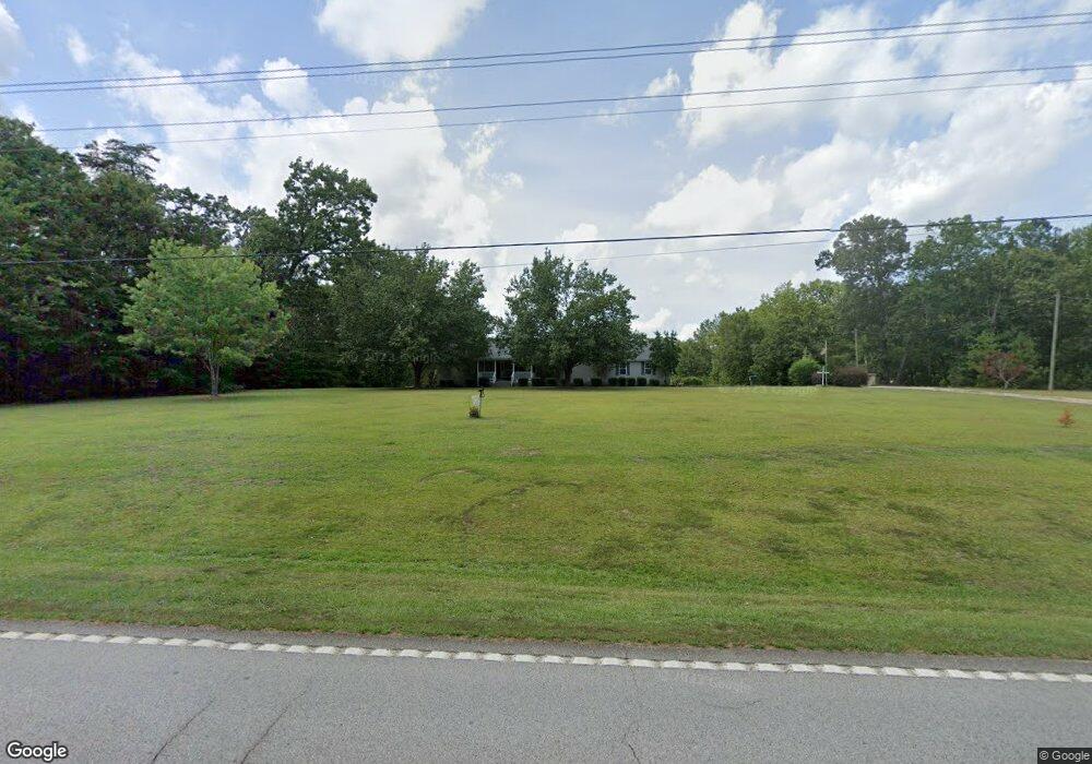
2197 Anderson Hwy Elberton, GA 30635
Estimated Value: $349,000 - $468,000
3
Beds
2
Baths
2,074
Sq Ft
$188/Sq Ft
Est. Value
About This Home
This home is located at 2197 Anderson Hwy, Elberton, GA 30635 and is currently estimated at $389,835, approximately $187 per square foot. 2197 Anderson Hwy is a home located in Elbert County with nearby schools including Elbert County Primary School, Elbert County Elementary School, and Elbert County Middle School.
Ownership History
Date
Name
Owned For
Owner Type
Purchase Details
Closed on
May 31, 2017
Sold by
Cornell Christopher M
Bought by
Bennett Barbara
Current Estimated Value
Purchase Details
Closed on
Oct 11, 2016
Bought by
Bennett Barbara
Purchase Details
Closed on
May 3, 2016
Sold by
Cornell Christopher M
Bought by
Us Bank Na Trustee
Purchase Details
Closed on
Oct 19, 1999
Sold by
Guest Charles Roger Carolyn L
Bought by
Cornell Christopher Letha G
Purchase Details
Closed on
Feb 17, 1998
Sold by
Guest Charles Roger and Guest Carolyn L
Bought by
Cornell Chris M and Cornell Letha A
Create a Home Valuation Report for This Property
The Home Valuation Report is an in-depth analysis detailing your home's value as well as a comparison with similar homes in the area
Home Values in the Area
Average Home Value in this Area
Purchase History
| Date | Buyer | Sale Price | Title Company |
|---|---|---|---|
| Bennett Barbara | $16,000 | -- | |
| Bennett Barbara | $62,000 | -- | |
| Us Bank Na Trustee | -- | -- | |
| Cornell Christopher Letha G | -- | -- | |
| Cornell Chris M | -- | -- |
Source: Public Records
Tax History Compared to Growth
Tax History
| Year | Tax Paid | Tax Assessment Tax Assessment Total Assessment is a certain percentage of the fair market value that is determined by local assessors to be the total taxable value of land and additions on the property. | Land | Improvement |
|---|---|---|---|---|
| 2024 | $2,765 | $117,308 | $14,423 | $102,885 |
| 2023 | $2,333 | $117,308 | $14,423 | $102,885 |
| 2022 | $2,076 | $88,568 | $8,585 | $79,983 |
| 2021 | $2,079 | $88,568 | $8,585 | $79,983 |
| 2020 | $1,823 | $69,064 | $6,868 | $62,196 |
| 2019 | $1,894 | $69,064 | $6,868 | $62,196 |
| 2018 | $1,951 | $69,064 | $6,868 | $62,196 |
| 2017 | $716 | $55,524 | $2,444 | $53,080 |
| 2016 | $1,760 | $59,948 | $6,868 | $53,080 |
| 2015 | -- | $59,948 | $6,868 | $53,080 |
| 2014 | -- | $59,948 | $6,868 | $53,080 |
| 2013 | -- | $59,948 | $6,868 | $53,080 |
Source: Public Records
Map
Nearby Homes
- 2166 Far A Way Rd
- 2154 Far-A-way Rd
- 0 Far-A-way Rd
- 0 Far-A-way Rd Unit 1026251
- 0 Harmony Rd Unit 18771344
- 0 Paul Motes Rd Unit 10631596
- 2023 Stephens Rd
- 1136 Flagstone Rd
- 0 Allen Logan Rd Unit 22671131
- 1912 Ruckersville
- 2126 Amberly Rd
- 1859 William Smith Rd
- 2109 Brewers Mill Rd
- 2920 Ruckersville Rd
- 1160 Plantation Rd
- 0 Anderson Hwy Unit 24629664
- 0 Anderson Hwy Unit 10536298
- 2193 Ruckersville Rd
- 1661 G R Hayes Dr
- 1 Powerhouse Dr
- 2183 Anderson Hwy
- 2205 Anderson Hwy
- 2224 Anderson Hwy
- 2184 Anderson Hwy
- 2164 Anderson Hwy
- 2255 Anderson Hwy
- 2078 Double Branches Rd
- 2244 Anderson Hwy
- 2096 Double Branches Rd
- 2144 Anderson Hwy
- 2091 Double Branches Rd
- 2140 Double Branches Rd
- 2166 Pauline Daniels Rd
- 2294 Anderson Hwy
- 2309 Anderson Hwy
- 2317 Anderson Hwy
- 2100 Anderson Hwy
- 2101 Anderson Hwy
- 2162 Pauline Daniels Rd
- 2097 Anderson Hwy