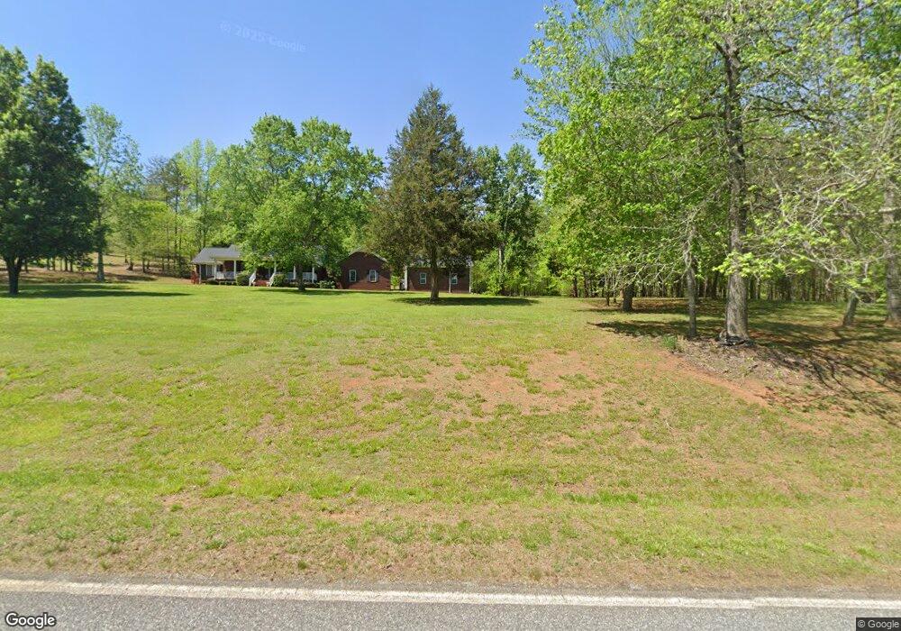
2199 Abrams and Moore Rd Rutherfordton, NC 28139
Estimated Value: $442,000 - $573,000
3
Beds
2
Baths
1,700
Sq Ft
$293/Sq Ft
Est. Value
About This Home
This home is located at 2199 Abrams and Moore Rd, Rutherfordton, NC 28139 and is currently estimated at $498,273, approximately $293 per square foot. 2199 Abrams and Moore Rd is a home located in Polk County.
Ownership History
Date
Name
Owned For
Owner Type
Purchase Details
Closed on
Jul 10, 2009
Sold by
Carswell Michael L and Carswell Peggy H
Bought by
Murphy Daniel and Murphy Lena C
Current Estimated Value
Home Financials for this Owner
Home Financials are based on the most recent Mortgage that was taken out on this home.
Original Mortgage
$200,000
Outstanding Balance
$131,984
Interest Rate
5.53%
Mortgage Type
New Conventional
Estimated Equity
$366,289
Purchase Details
Closed on
Aug 19, 2002
Bought by
Murphy Daniel
Purchase Details
Closed on
Sep 27, 1999
Bought by
Murphy Daniel
Create a Home Valuation Report for This Property
The Home Valuation Report is an in-depth analysis detailing your home's value as well as a comparison with similar homes in the area
Home Values in the Area
Average Home Value in this Area
Purchase History
| Date | Buyer | Sale Price | Title Company |
|---|---|---|---|
| Murphy Daniel | $250,000 | None Available | |
| Murphy Daniel | $25,000 | -- | |
| Murphy Daniel | -- | -- |
Source: Public Records
Mortgage History
| Date | Status | Borrower | Loan Amount |
|---|---|---|---|
| Open | Murphy Daniel | $200,000 |
Source: Public Records
Tax History
| Year | Tax Paid | Tax Assessment Tax Assessment Total Assessment is a certain percentage of the fair market value that is determined by local assessors to be the total taxable value of land and additions on the property. | Land | Improvement |
|---|---|---|---|---|
| 2025 | $2,250 | $440,859 | $72,180 | $368,679 |
| 2024 | $2,145 | $335,369 | $47,800 | $287,569 |
| 2023 | $2,145 | $335,369 | $47,800 | $287,569 |
| 2022 | $1,820 | $302,754 | $47,800 | $254,954 |
| 2021 | $1,820 | $302,754 | $47,800 | $254,954 |
| 2020 | $1,583 | $245,427 | $38,240 | $207,187 |
| 2019 | $1,583 | $245,427 | $38,240 | $207,187 |
| 2018 | $1,534 | $245,427 | $38,240 | $207,187 |
| 2017 | $1,447 | $229,931 | $33,960 | $195,971 |
| 2016 | $1,403 | $229,931 | $33,960 | $195,971 |
| 2015 | $1,347 | $0 | $0 | $0 |
| 2014 | $1,347 | $0 | $0 | $0 |
| 2013 | -- | $0 | $0 | $0 |
Source: Public Records
Map
Nearby Homes
- 99999 Abrams & Moore Rd
- Tbd Pea Ridge Rd
- 1972 River Crest Pkwy
- 00 Valley Dr
- 0 Valley Dr Unit 142
- 270 Cross Ridge Dr
- 1050 Cross Ridge Dr
- 0 Pea Ridge Rd
- 99999 Pea Ridge Rd
- 0000 Zachary Ln Unit 37
- 0000 Elliott Ln Unit 45 & 48
- 00 County Line Rd S
- 190 Elliott Ln
- 00 County Line Rd
- Tract 3 County Line Rd
- 1178 Pea Ridge Rd
- 480 River Crest Pkwy Unit 1
- 99999 River Crest Pkwy
- 1888 Pea Ridge Rd
- 260 Buck Branch Rd
- 2225 Abrams and Moore Rd
- 2225 Abrams and Moore Rd
- 2225 Abrams & Moore Rd
- 131 Prices Dr
- 77 Living Water Ln
- 196 the Gathering Place
- 130 Living Water Ln
- 2346 Manus Chapel Rd
- 2178 Manus Chapel Rd
- 2156 Manus Chapel Rd
- 127 Raceway Dr
- 000 Ponder Rd
- TBD Abrams & Moore Rd
- 224 Raceway Dr
- 2015 Manus Chapel Rd
- 000 Abrams & Moore Rd
- 2771 Abrams Moore Rd
- 1585 Abrams and Moore Rd
- 400 Manus Chapel Rd
- 1050 Ponder Rd
Your Personal Tour Guide
Ask me questions while you tour the home.