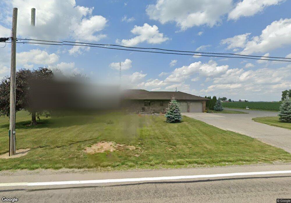
21997 State Route 697 Delphos, OH 45833
Estimated Value: $263,000
--
Bed
2
Baths
1,264
Sq Ft
$208/Sq Ft
Est. Value
About This Home
This home is located at 21997 State Route 697, Delphos, OH 45833 and is currently estimated at $263,000, approximately $208 per square foot. 21997 State Route 697 is a home located in Van Wert County with nearby schools including Delphos St. John's High School and Delphos St. John's Elementary School.
Ownership History
Date
Name
Owned For
Owner Type
Purchase Details
Closed on
Sep 12, 2019
Sold by
Reindel Larry J and Reindel Amy J
Bought by
R3 Farms Llc
Current Estimated Value
Create a Home Valuation Report for This Property
The Home Valuation Report is an in-depth analysis detailing your home's value as well as a comparison with similar homes in the area
Home Values in the Area
Average Home Value in this Area
Purchase History
| Date | Buyer | Sale Price | Title Company |
|---|---|---|---|
| R3 Farms Llc | -- | None Available |
Source: Public Records
Tax History Compared to Growth
Tax History
| Year | Tax Paid | Tax Assessment Tax Assessment Total Assessment is a certain percentage of the fair market value that is determined by local assessors to be the total taxable value of land and additions on the property. | Land | Improvement |
|---|---|---|---|---|
| 2024 | $742 | $23,470 | $23,470 | $0 |
| 2023 | $742 | $23,470 | $23,470 | $0 |
| 2022 | $467 | $12,870 | $12,870 | $0 |
| 2021 | $468 | $12,870 | $12,870 | $0 |
| 2020 | $487 | $12,870 | $12,870 | $0 |
| 2019 | $2,467 | $82,100 | $33,460 | $48,640 |
| 2018 | $2,461 | $82,100 | $33,460 | $48,640 |
| 2017 | $2,584 | $82,100 | $33,460 | $48,640 |
| 2016 | $2,607 | $92,000 | $41,340 | $50,660 |
| 2015 | $2,607 | $92,000 | $41,340 | $50,660 |
| 2014 | $2,745 | $92,320 | $41,340 | $50,980 |
| 2013 | $2,333 | $72,470 | $21,490 | $50,980 |
Source: Public Records
Map
Nearby Homes
- 11630 Clearview Dr
- 104 W Railroad St
- 709 W 4th St
- 4455 N Kill Rd
- 8951 Brickner Rd
- 104 W South St
- 112 W Railroad St
- 409 N Bredeick St
- 604 W 6th St
- 634 S Clay St
- 332 W 6th St
- 1400 S Clay St Unit 17
- 424 S Canal St
- 221 S Main St
- 827 S Washington St
- 483 S Franklin St
- 210 E 3rd St
- 610 N Washington St
- 405 N Franklin St
- TBD Dog Creek Rd
- 21297 State Route 697
- 11310 Bockey Rd
- 22140 State Route 697
- 11756 Bockey Rd
- 21842 Gerdeman Rd
- 22284 Gerdeman Rd
- 22420 State Route 697
- 21630 State Route 697
- 000 Gerdeman Rd
- 22252 State Route 697
- 10984 Bockey Rd
- 11923 Bockey Rd
- 21664 Gerdeman Rd
- 11946 Bockey Rd
- 11953 Bockey Rd
- 21773 Gerdeman Rd
- 11982 Bockey Rd
- 11995 Bockey Rd
- 21441 State Route 697