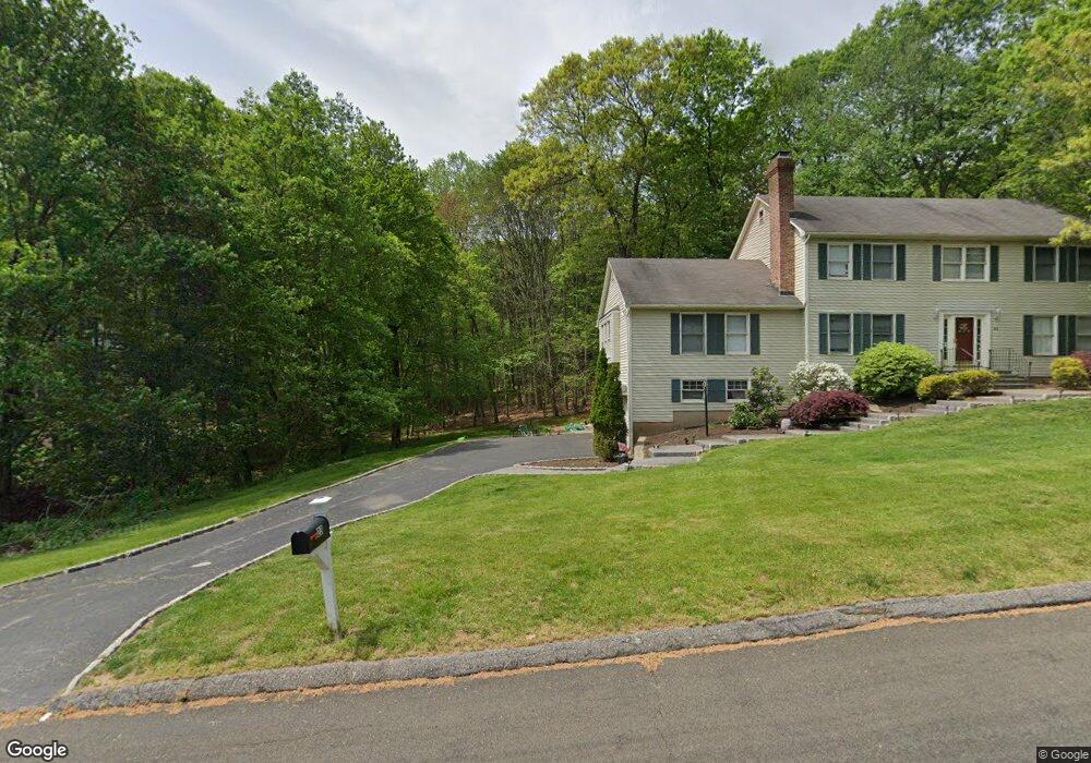
21A Rolling Brook Ln Shelton, CT 06484
Estimated Value: $857,130 - $892,000
4
Beds
3
Baths
3,167
Sq Ft
$277/Sq Ft
Est. Value
About This Home
This home is located at 21A Rolling Brook Ln, Shelton, CT 06484 and is currently estimated at $877,533, approximately $277 per square foot. 21A Rolling Brook Ln is a home located in Fairfield County with nearby schools including Perry Hill School, Shelton Intermediate School, and Shelton High School.
Ownership History
Date
Name
Owned For
Owner Type
Purchase Details
Closed on
Apr 19, 2016
Sold by
Silver Charles and Silver Tobi
Bought by
Lanzaro Stephanie and Lanzaro Marcel Christopher
Current Estimated Value
Home Financials for this Owner
Home Financials are based on the most recent Mortgage that was taken out on this home.
Original Mortgage
$396,000
Outstanding Balance
$313,328
Interest Rate
3.64%
Mortgage Type
Purchase Money Mortgage
Estimated Equity
$564,205
Purchase Details
Closed on
Mar 28, 2005
Sold by
Brennan Eric and Brennan Cheryl
Bought by
Silver Charles and Silver Tobi
Purchase Details
Closed on
Apr 14, 1994
Sold by
Bldg Coordinators Inc
Bought by
Brennan Eric and Brennan Cheryl
Create a Home Valuation Report for This Property
The Home Valuation Report is an in-depth analysis detailing your home's value as well as a comparison with similar homes in the area
Home Values in the Area
Average Home Value in this Area
Purchase History
| Date | Buyer | Sale Price | Title Company |
|---|---|---|---|
| Lanzaro Stephanie | $495,000 | -- | |
| Lanzaro Stephanie | $495,000 | -- | |
| Silver Charles | $590,000 | -- | |
| Silver Charles | $590,000 | -- | |
| Brennan Eric | $100,000 | -- |
Source: Public Records
Mortgage History
| Date | Status | Borrower | Loan Amount |
|---|---|---|---|
| Open | Brennan Eric | $396,000 | |
| Closed | Brennan Eric | $396,000 | |
| Previous Owner | Brennan Eric | $64,000 |
Source: Public Records
Tax History
| Year | Tax Paid | Tax Assessment Tax Assessment Total Assessment is a certain percentage of the fair market value that is determined by local assessors to be the total taxable value of land and additions on the property. | Land | Improvement |
|---|---|---|---|---|
| 2025 | $8,259 | $438,830 | $126,700 | $312,130 |
| 2024 | $8,417 | $438,830 | $126,700 | $312,130 |
| 2023 | $7,666 | $438,830 | $126,700 | $312,130 |
| 2022 | $7,666 | $438,830 | $126,700 | $312,130 |
| 2021 | $7,037 | $319,410 | $109,200 | $210,210 |
| 2020 | $7,161 | $319,410 | $109,200 | $210,210 |
| 2019 | $7,161 | $319,410 | $109,200 | $210,210 |
| 2017 | $7,094 | $319,410 | $109,200 | $210,210 |
| 2015 | $7,573 | $339,430 | $129,990 | $209,440 |
| 2014 | $7,573 | $339,430 | $129,990 | $209,440 |
Source: Public Records
Map
Nearby Homes
- 35 Greenfield Dr
- 256 Nichols Ave
- 311 Isinglass Rd
- 2449 Huntington Turnpike
- 10 Foxwood Rd
- 244 Strobel Rd
- 38 Macdonald Rd
- 176 Strobel Rd
- 424 Waverly Rd
- 2 Doe Hollow Dr
- 10 Doe Hollow Dr
- 0 Pinewood Trail
- 23 Federal Rd
- 97 Greenbrier Rd
- 101 Golden Hill St
- 68 Old Dike Rd
- 0 Lot #4 & Lot #5 W Mischa Rd Unit 24138429
- 1 Steeple View Ln
- 2 Steeple View Ln
- 85 Teeter Rock Rd
- 31 Rolling Brook Ln
- 27 Rolling Brook Ln
- 33 Canfield Dr
- 35 Rolling Brook Ln
- 39 Rolling Brook Ln
- 21B Rolling Brook Ln
- 71 Lady Slipper Dr
- 37 Canfield Dr
- 46 Rolling Brook Ln
- 34 Rolling Brook Ln
- 42 Rolling Brook Ln
- 38 Rolling Brook Ln
- 50 Rolling Brook Ln
- 76 Lady Slipper Dr
- 28 Canfield Dr
- 34 Canfield Dr
- 30 Rolling Brook Ln
- 26 Rolling Brook Ln
- 67 Lady Slipper Dr
- 38 Canfield Dr
Your Personal Tour Guide
Ask me questions while you tour the home.