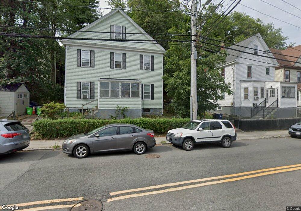
21R Bennett St Brighton, MA 02135
Brighton NeighborhoodEstimated Value: $1,123,000 - $1,545,000
6
Beds
3
Baths
3,343
Sq Ft
$396/Sq Ft
Est. Value
About This Home
This home is located at 21R Bennett St, Brighton, MA 02135 and is currently estimated at $1,322,692, approximately $395 per square foot. 21R Bennett St is a home located in Suffolk County with nearby schools including Boston Green Academy Horace Mann Charter School, St Columbkille Partnership School, and Shaloh House Jewish Day School.
Ownership History
Date
Name
Owned For
Owner Type
Purchase Details
Closed on
Jun 20, 2008
Sold by
Bernard Ft
Bought by
21A Bennett Llc
Current Estimated Value
Home Financials for this Owner
Home Financials are based on the most recent Mortgage that was taken out on this home.
Original Mortgage
$420,000
Outstanding Balance
$270,200
Interest Rate
6.1%
Mortgage Type
Purchase Money Mortgage
Estimated Equity
$1,052,492
Create a Home Valuation Report for This Property
The Home Valuation Report is an in-depth analysis detailing your home's value as well as a comparison with similar homes in the area
Home Values in the Area
Average Home Value in this Area
Purchase History
| Date | Buyer | Sale Price | Title Company |
|---|---|---|---|
| 21A Bennett Llc | $440,000 | -- |
Source: Public Records
Mortgage History
| Date | Status | Borrower | Loan Amount |
|---|---|---|---|
| Open | 21A Bennett Llc | $420,000 |
Source: Public Records
Tax History Compared to Growth
Tax History
| Year | Tax Paid | Tax Assessment Tax Assessment Total Assessment is a certain percentage of the fair market value that is determined by local assessors to be the total taxable value of land and additions on the property. | Land | Improvement |
|---|---|---|---|---|
| 2025 | $13,378 | $1,155,300 | $345,800 | $809,500 |
| 2024 | $12,769 | $1,171,500 | $345,200 | $826,300 |
| 2023 | $11,645 | $1,084,300 | $319,500 | $764,800 |
| 2022 | $11,026 | $1,013,400 | $298,600 | $714,800 |
| 2021 | $10,813 | $1,013,400 | $298,600 | $714,800 |
| 2020 | $10,259 | $971,500 | $234,900 | $736,600 |
| 2019 | $9,748 | $924,900 | $184,700 | $740,200 |
| 2018 | $9,141 | $872,200 | $184,700 | $687,500 |
| 2017 | $9,059 | $855,400 | $184,700 | $670,700 |
| 2016 | $8,402 | $763,800 | $184,700 | $579,100 |
| 2015 | $8,272 | $683,100 | $165,100 | $518,000 |
| 2014 | $7,343 | $583,700 | $165,100 | $418,600 |
Source: Public Records
Map
Nearby Homes
- 6 Harriet St
- 10 Waldo Terrace
- 83-85 Surrey St
- 77 Bennett St Unit 2
- 87 Etna St
- 30 Dighton St Unit 3
- 30 Dighton St
- 11 Faneuil St
- 84-86 Etna St
- 212 Market St Unit 201
- 461 Washington St Unit 301
- 200-202 Market St
- 18 Glencoe St Unit 42
- 2 Westminster Terrace
- 230 Washington St Unit 6
- 230 Washington St Unit 1
- 230 Washington St Unit 11
- 230 Washington St Unit 3
- 230 Washington St Unit 9
- 230 Washington St Unit 10
- 19 Bennett St
- 19 Bennett St
- 19 Bennett St Unit 1
- 17 Bennett St
- 17 Bennett St
- 17 Bennett St Unit 1
- 21 Bennett St
- 21 Bennett St Unit 2
- 21 Bennett St
- 21 Bennett St Unit 1
- 73 Leicester St
- 73 Leicester St Unit B
- 73 Leicester St Unit 3
- 73 Leicester St Unit 1
- 73 Leicester St
- 73 Leicester St Unit 2
- 75 Leicester St
- 75 Leicester St Unit 1
- 75 Leicester St
- 75 Leicester St Unit 2