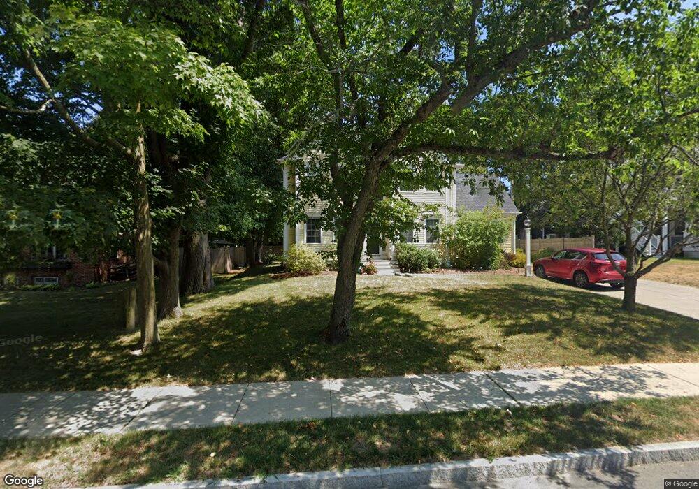
22 1/2 Hillside Ave Amesbury, MA 01913
Estimated Value: $768,756 - $853,000
3
Beds
3
Baths
2,134
Sq Ft
$380/Sq Ft
Est. Value
About This Home
This home is located at 22 1/2 Hillside Ave, Amesbury, MA 01913 and is currently estimated at $811,939, approximately $380 per square foot. 22 1/2 Hillside Ave is a home located in Essex County with nearby schools including Amesbury High School and Amesbury Seventh-Day Adventist School.
Ownership History
Date
Name
Owned For
Owner Type
Purchase Details
Closed on
Oct 9, 2002
Sold by
Bryant Edward and Bryant Florence M
Bought by
Patulak Jeffrey M and Moore Mindy
Current Estimated Value
Home Financials for this Owner
Home Financials are based on the most recent Mortgage that was taken out on this home.
Original Mortgage
$337,500
Interest Rate
6.24%
Mortgage Type
Purchase Money Mortgage
Create a Home Valuation Report for This Property
The Home Valuation Report is an in-depth analysis detailing your home's value as well as a comparison with similar homes in the area
Home Values in the Area
Average Home Value in this Area
Purchase History
| Date | Buyer | Sale Price | Title Company |
|---|---|---|---|
| Patulak Jeffrey M | $427,500 | -- |
Source: Public Records
Mortgage History
| Date | Status | Borrower | Loan Amount |
|---|---|---|---|
| Open | Patulak Jeffrey M | $235,000 | |
| Closed | Patulak Jeffrey M | $250,000 | |
| Closed | Patulak Jeffrey M | $322,700 | |
| Closed | Patulak Jeffrey M | $337,500 |
Source: Public Records
Tax History Compared to Growth
Tax History
| Year | Tax Paid | Tax Assessment Tax Assessment Total Assessment is a certain percentage of the fair market value that is determined by local assessors to be the total taxable value of land and additions on the property. | Land | Improvement |
|---|---|---|---|---|
| 2025 | $10,239 | $669,200 | $237,900 | $431,300 |
| 2024 | $9,761 | $624,100 | $224,400 | $399,700 |
| 2023 | $8,927 | $546,300 | $195,100 | $351,200 |
| 2022 | $8,749 | $494,600 | $169,700 | $324,900 |
| 2021 | $8,313 | $455,500 | $136,700 | $318,800 |
| 2020 | $7,411 | $431,400 | $131,500 | $299,900 |
| 2019 | $7,510 | $408,800 | $131,500 | $277,300 |
| 2018 | $7,385 | $388,900 | $125,300 | $263,600 |
| 2017 | $7,573 | $379,600 | $125,300 | $254,300 |
| 2016 | $7,364 | $363,100 | $125,300 | $237,800 |
| 2015 | $7,218 | $351,400 | $125,300 | $226,100 |
| 2014 | $7,027 | $335,100 | $125,300 | $209,800 |
Source: Public Records
Map
Nearby Homes
- 49 W Greenwood St
- 4 Greenwood St
- 4 Larnard Ct
- 31 Whitter Meadows Dr Unit 31
- 93 Friend St
- 43 Aubin St Unit 43
- 45 Macy St Unit b101
- 45 Macy St Unit 301C
- 45 Macy St Unit 302C
- 47 Macy St
- 37 Millyard Unit 204
- 5 Moncrief St Unit 5
- 35 Merrimac St
- 47 Cutter Ln Unit 47
- 356 Main St
- 4 Winter St
- 13 Bailey Pond Ln Unit 13
- 188 Lions Mouth Rd
- 3 Laurel Place
- 19 Cutter Ln Unit 19
- 22 Hillside Ave
- 7 Winkley St
- 20 Hillside Ave
- 25 Hillside Ave
- 23 Hillside Ave
- 23A Hillside Ave
- 27 Hillside Ave
- 26 Hillside Ave
- 5 Winkley St
- 10 Winkley St
- 21 Hillside Ave
- 21 Hillside Ave Unit 1
- 4 Hitching Post Ln
- 8 Winkley St
- 8 Winkley St
- 30 Hillside Ave
- 18 Hillside Ave
- 18 Hillside Ave
- 18 1/2 Hillside Ave
- 18 Hillside Ave Unit 1