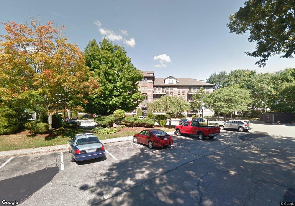
22 Abigail Ave Unit 401 Quincy, MA 02169
South Quincy NeighborhoodEstimated Value: $571,000 - $713,000
2
Beds
2
Baths
1,708
Sq Ft
$378/Sq Ft
Est. Value
About This Home
This home is located at 22 Abigail Ave Unit 401, Quincy, MA 02169 and is currently estimated at $645,602, approximately $377 per square foot. 22 Abigail Ave Unit 401 is a home located in Norfolk County with nearby schools including Lincoln-Hancock Community School, South West Middle School, and Quincy High School.
Ownership History
Date
Name
Owned For
Owner Type
Purchase Details
Closed on
Feb 14, 1997
Sold by
Logan Francis H and Logan Rosemary
Bought by
Schneider Nora J
Current Estimated Value
Home Financials for this Owner
Home Financials are based on the most recent Mortgage that was taken out on this home.
Original Mortgage
$105,000
Outstanding Balance
$11,913
Interest Rate
7.6%
Mortgage Type
Purchase Money Mortgage
Estimated Equity
$633,689
Create a Home Valuation Report for This Property
The Home Valuation Report is an in-depth analysis detailing your home's value as well as a comparison with similar homes in the area
Home Values in the Area
Average Home Value in this Area
Purchase History
| Date | Buyer | Sale Price | Title Company |
|---|---|---|---|
| Schneider Nora J | $185,000 | -- |
Source: Public Records
Mortgage History
| Date | Status | Borrower | Loan Amount |
|---|---|---|---|
| Open | Schneider Nora J | $105,000 |
Source: Public Records
Tax History Compared to Growth
Tax History
| Year | Tax Paid | Tax Assessment Tax Assessment Total Assessment is a certain percentage of the fair market value that is determined by local assessors to be the total taxable value of land and additions on the property. | Land | Improvement |
|---|---|---|---|---|
| 2025 | $6,773 | $587,400 | $0 | $587,400 |
| 2024 | $6,346 | $563,100 | $0 | $563,100 |
| 2023 | $5,656 | $508,200 | $0 | $508,200 |
| 2022 | $5,244 | $437,700 | $0 | $437,700 |
| 2021 | $5,144 | $423,700 | $0 | $423,700 |
| 2020 | $4,997 | $402,000 | $0 | $402,000 |
| 2019 | $5,125 | $408,400 | $0 | $408,400 |
| 2018 | $4,601 | $344,900 | $0 | $344,900 |
| 2017 | $4,592 | $324,100 | $0 | $324,100 |
| 2016 | $4,680 | $325,900 | $0 | $325,900 |
| 2015 | $4,497 | $308,000 | $0 | $308,000 |
| 2014 | $4,060 | $273,200 | $0 | $273,200 |
Source: Public Records
Map
Nearby Homes
- 166 Phipps St
- 155 Kendrick Ave Unit T7
- 83 Madison Ave
- 5 Pearl St
- 57 Summer St
- 72 Federal Ave
- 8 Jackson St Unit B2
- 10 Hughes St
- 34 South St Unit 202
- 94 Brook Rd Unit 3
- 18 Cliveden St Unit 201W
- 32 Sumner St
- 2 Cliveden St Unit 601E
- 2 Cliveden St Unit 305E
- 35 Sumner St
- 165 Granite St
- 195 Independence Ave Unit 137
- 218 Independence Ave Unit B
- 216 South St
- 145 S Walnut St
- 22 Abigail Ave Unit T7
- 22 Abigail Ave Unit T6
- 22 Abigail Ave Unit T5
- 22 Abigail Ave Unit T4
- 22 Abigail Ave Unit T3
- 22 Abigail Ave Unit T2
- 22 Abigail Ave Unit T1
- 22 Abigail Ave Unit 504
- 22 Abigail Ave Unit 503
- 22 Abigail Ave Unit 502
- 22 Abigail Ave Unit 501
- 22 Abigail Ave Unit 410
- 22 Abigail Ave Unit 409
- 22 Abigail Ave Unit 408
- 22 Abigail Ave Unit 407
- 22 Abigail Ave Unit 406
- 22 Abigail Ave Unit 405
- 22 Abigail Ave Unit 404
- 22 Abigail Ave Unit 403
- 22 Abigail Ave Unit 402