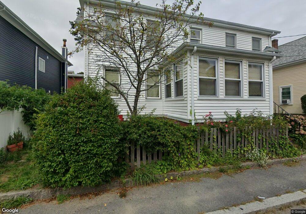
22 Addison St Gloucester, MA 01930
Central Gloucester NeighborhoodEstimated Value: $519,000 - $675,000
3
Beds
2
Baths
1,690
Sq Ft
$362/Sq Ft
Est. Value
About This Home
This home is located at 22 Addison St, Gloucester, MA 01930 and is currently estimated at $612,348, approximately $362 per square foot. 22 Addison St is a home located in Essex County with nearby schools including Beeman Memorial, Ralph B O'maley Middle School, and Gloucester High School.
Ownership History
Date
Name
Owned For
Owner Type
Purchase Details
Closed on
May 2, 2005
Sold by
Pinkham Kenneth S and Hagstrom Wanda P
Bought by
Telep Richard D and Telep Deborah W
Current Estimated Value
Home Financials for this Owner
Home Financials are based on the most recent Mortgage that was taken out on this home.
Original Mortgage
$204,000
Interest Rate
5.95%
Mortgage Type
Purchase Money Mortgage
Create a Home Valuation Report for This Property
The Home Valuation Report is an in-depth analysis detailing your home's value as well as a comparison with similar homes in the area
Home Values in the Area
Average Home Value in this Area
Purchase History
| Date | Buyer | Sale Price | Title Company |
|---|---|---|---|
| Telep Richard D | $255,000 | -- |
Source: Public Records
Mortgage History
| Date | Status | Borrower | Loan Amount |
|---|---|---|---|
| Open | Telep Richard D | $288,000 | |
| Closed | Telep Richard D | $40,000 | |
| Closed | Telep Richard D | $204,000 | |
| Closed | Telep Richard D | $38,200 |
Source: Public Records
Tax History
| Year | Tax Paid | Tax Assessment Tax Assessment Total Assessment is a certain percentage of the fair market value that is determined by local assessors to be the total taxable value of land and additions on the property. | Land | Improvement |
|---|---|---|---|---|
| 2025 | $4,748 | $488,500 | $126,600 | $361,900 |
| 2024 | $4,662 | $479,100 | $120,600 | $358,500 |
| 2023 | $4,811 | $454,300 | $107,700 | $346,600 |
| 2022 | $4,509 | $384,400 | $93,600 | $290,800 |
| 2021 | $4,360 | $350,500 | $85,100 | $265,400 |
| 2020 | $4,133 | $335,200 | $85,100 | $250,100 |
| 2019 | $3,846 | $303,100 | $85,100 | $218,000 |
| 2018 | $3,591 | $277,700 | $85,100 | $192,600 |
| 2017 | $3,373 | $255,700 | $76,700 | $179,000 |
| 2016 | $3,408 | $250,400 | $76,600 | $173,800 |
| 2015 | $3,344 | $245,000 | $76,600 | $168,400 |
Source: Public Records
Map
Nearby Homes
- 33 Maplewood Ave Unit 310
- 120 Washington St
- 113 Pleasant St
- 20 Beacon St
- 20 Beacon St Unit 2
- 20 Beacon St Unit 1
- 35 Middle St Unit 4
- 33 Middle St
- 9 Cleveland Place
- 12 Arthur St
- 50 Warner St
- 191 Main St Unit 3
- 191 Main St Unit 2A
- 40 Sargent St
- 98 Maplewood Ave
- 15 Harvard St
- 6 Monroe Ct
- 19 Trask St Unit 2
- 13 Leslie o Johnson Rd
- 8 Mystic Ave
Your Personal Tour Guide
Ask me questions while you tour the home.