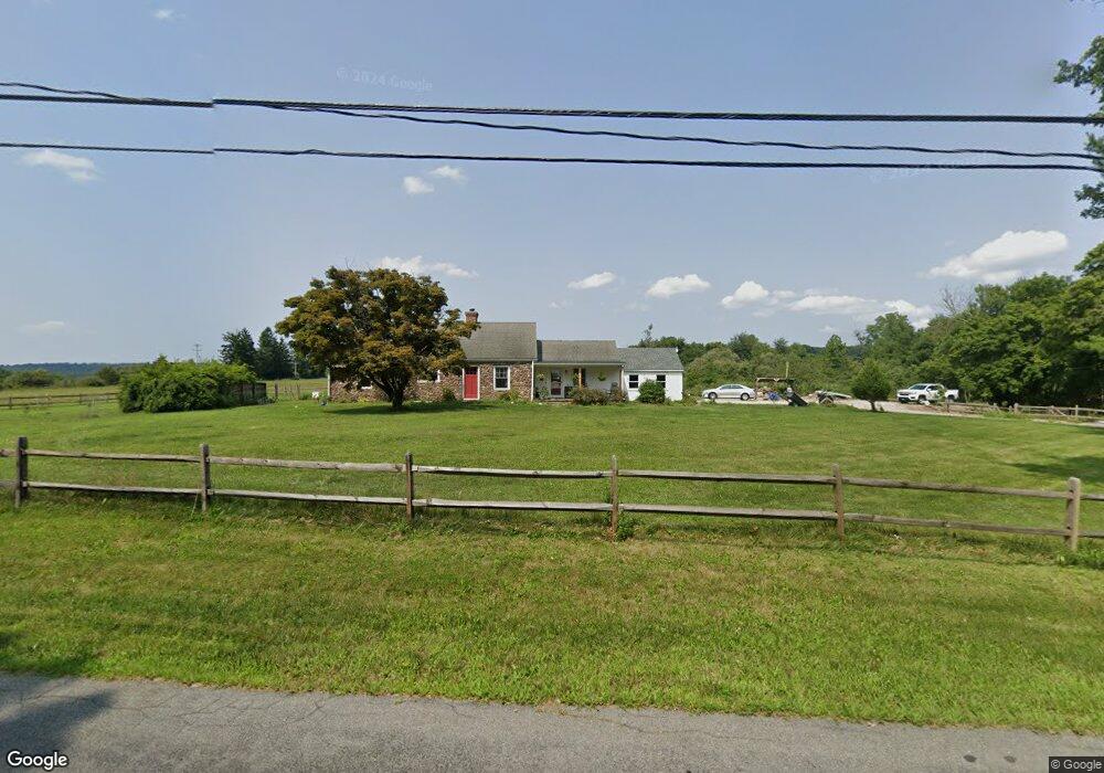
22 Airport Rd Pittstown, NJ 08867
Estimated Value: $418,140 - $640,000
--
Bed
--
Bath
1,535
Sq Ft
$345/Sq Ft
Est. Value
About This Home
This home is located at 22 Airport Rd, Pittstown, NJ 08867 and is currently estimated at $530,035, approximately $345 per square foot. 22 Airport Rd is a home located in Hunterdon County with nearby schools including Alexandria Middle School and Delaware Valley Regional High School.
Ownership History
Date
Name
Owned For
Owner Type
Purchase Details
Closed on
Nov 24, 2021
Sold by
Fritsche William L and Fritsche Beatrice M
Bought by
Fritsche Macklin E
Current Estimated Value
Purchase Details
Closed on
Jan 2, 2013
Sold by
Fritsche Leah E
Bought by
Fritsche William L and Fritsche Beatrice M
Create a Home Valuation Report for This Property
The Home Valuation Report is an in-depth analysis detailing your home's value as well as a comparison with similar homes in the area
Home Values in the Area
Average Home Value in this Area
Purchase History
| Date | Buyer | Sale Price | Title Company |
|---|---|---|---|
| Fritsche Macklin E | -- | Dibianca Thomas F | |
| Fritsche William L | -- | None Available |
Source: Public Records
Tax History Compared to Growth
Tax History
| Year | Tax Paid | Tax Assessment Tax Assessment Total Assessment is a certain percentage of the fair market value that is determined by local assessors to be the total taxable value of land and additions on the property. | Land | Improvement |
|---|---|---|---|---|
| 2025 | $8,106 | $270,100 | $138,800 | $131,300 |
| 2024 | $7,555 | $270,100 | $138,800 | $131,300 |
| 2023 | $7,555 | $270,100 | $138,800 | $131,300 |
| 2022 | $7,487 | $270,100 | $138,800 | $131,300 |
| 2021 | $7,241 | $270,100 | $138,800 | $131,300 |
| 2020 | $7,204 | $270,100 | $138,800 | $131,300 |
| 2019 | $7,101 | $270,100 | $138,800 | $131,300 |
| 2018 | $6,952 | $270,100 | $138,800 | $131,300 |
| 2017 | $6,931 | $270,100 | $138,800 | $131,300 |
| 2016 | $6,909 | $270,100 | $138,800 | $131,300 |
| 2015 | $6,901 | $266,100 | $138,800 | $127,300 |
| 2014 | $6,586 | $266,100 | $138,800 | $127,300 |
Source: Public Records
Map
Nearby Homes
- 2 Smoke Run
- 271 County Road 513
- 97 Hartpence Rd
- 8 Hemingway Dr
- 31 Farmhouse Rd
- 214 Woolf Rd
- 1663 County Road 519
- 634 County Road 579
- 710 County Road 513
- 7 Maple Springs Rd
- 1491&1493 Cty Rd 519
- 1 Shy Creek Rd
- 6 Wyckoff Dr
- 152 Hickory Corner Rd
- 82 Hickory Corner Rd
- 92 Country Acres Dr
- 9 Stires Way
- 39 Sky Manor Rd
- N/A Gravel Hill Rd
- 0 Baptist Church Rd
- 9 Airport Rd
- 11 Airport Rd
- 3 Airport Rd
- 15 Airport Rd
- 395 Mechlin Corner Rd
- 4 Airport Rd
- 63 Airport Rd
- 2 Airport Rd
- 65 Airport Rd
- 397 Mechlin Corner Rd
- 5 Airport Rd
- 9999 Airport Rd
- 1 Airport Rd
- 393 Mechlin Corner Rd
- 391 Mechlin Corner Rd
- 58 Airport Rd
- 62 Airport Rd
- 400 Mechlin Corner Rd
- 0 Airport Rd
- 69 Airport Rd