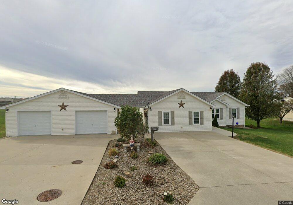
22 Amanda Brook Dr Flemingsburg, KY 41041
Estimated Value: $180,000 - $279,000
3
Beds
2
Baths
1,880
Sq Ft
$127/Sq Ft
Est. Value
About This Home
This home is located at 22 Amanda Brook Dr, Flemingsburg, KY 41041 and is currently estimated at $237,908, approximately $126 per square foot. 22 Amanda Brook Dr is a home located in Fleming County with nearby schools including Fleming County High School.
Ownership History
Date
Name
Owned For
Owner Type
Purchase Details
Closed on
Jun 10, 2011
Sold by
Dearing Larry and Dearing Barbara
Bought by
Dearing Shannon and Thomas Tammy
Current Estimated Value
Purchase Details
Closed on
Aug 12, 2010
Sold by
Cropper Robert J and Cropper Stacey L
Bought by
Dearing Larry and Dearing Barbara
Home Financials for this Owner
Home Financials are based on the most recent Mortgage that was taken out on this home.
Original Mortgage
$60,000
Interest Rate
4.61%
Mortgage Type
Purchase Money Mortgage
Purchase Details
Closed on
Apr 25, 2006
Sold by
Butler Keith and Butler Deanna J
Bought by
Cropper Robert J and Cropper Stacey L
Home Financials for this Owner
Home Financials are based on the most recent Mortgage that was taken out on this home.
Original Mortgage
$112,000
Interest Rate
6.33%
Mortgage Type
Purchase Money Mortgage
Create a Home Valuation Report for This Property
The Home Valuation Report is an in-depth analysis detailing your home's value as well as a comparison with similar homes in the area
Home Values in the Area
Average Home Value in this Area
Purchase History
| Date | Buyer | Sale Price | Title Company |
|---|---|---|---|
| Dearing Shannon | -- | -- | |
| Dearing Larry | $148,000 | -- | |
| Cropper Robert J | $124,250 | -- |
Source: Public Records
Mortgage History
| Date | Status | Borrower | Loan Amount |
|---|---|---|---|
| Previous Owner | Dearing Larry | $60,000 | |
| Previous Owner | Cropper Robert J | $112,000 |
Source: Public Records
Tax History Compared to Growth
Tax History
| Year | Tax Paid | Tax Assessment Tax Assessment Total Assessment is a certain percentage of the fair market value that is determined by local assessors to be the total taxable value of land and additions on the property. | Land | Improvement |
|---|---|---|---|---|
| 2025 | $1,497 | $183,000 | $24,000 | $159,000 |
| 2024 | $1,541 | $183,000 | $24,000 | $159,000 |
| 2023 | $1,369 | $183,000 | $24,000 | $159,000 |
| 2022 | $1,225 | $163,000 | $24,000 | $139,000 |
| 2021 | $1,261 | $163,000 | $24,000 | $139,000 |
| 2020 | $1,275 | $163,000 | $24,000 | $139,000 |
| 2019 | $1,259 | $163,000 | $24,000 | $139,000 |
| 2018 | $1,216 | $163,000 | $24,000 | $139,000 |
| 2017 | $1,213 | $163,000 | $24,000 | $139,000 |
| 2016 | $1,217 | $163,000 | $24,000 | $139,000 |
| 2015 | $1,209 | $163,000 | $24,000 | $139,000 |
| 2012 | $1,029 | $148,000 | $22,000 | $126,000 |
Source: Public Records
Map
Nearby Homes
- 57 Dorothy St
- 19 Russell St
- 61 Emmons Ln
- 205 Highridge Dr
- 904 W Water St
- 330 Crest Ave
- 115 Highland Dr
- 0 Cherry Grove Rd
- 294 W Water St
- 294 W West Water St
- 659 Cherry Grove Rd
- 133 Tulip Poplar - Lot 5 Ln
- 70 Sunflower Rd
- 128 Crestview Rd
- 222 Mary Ave
- 232 Mills Ave
- 418 Dye St
- 528 Foxspring Ave
- 127 Mills Ave
- 320 S Main Cross St
- 41 Amanda Brook Dr
- 12 Dorothy St
- 13 Dorothy St
- 11 Cardinal Ln
- 8 Russell St
- 91 Amanda Brook Dr
- 29 Dorothy St
- 30 Dorothy St
- 102 Amanda Brook Dr
- 26 Russell St
- 44 Dorothy St
- 9 Russell St
- 43 Dorothy St
- 195 High Ridge Dr
- 20 Cardinal Ln
- 42 Russell St
- 47 Cardinal Ln
- 31 Russell St
- 62 Dorothy St
- 56 Russell St