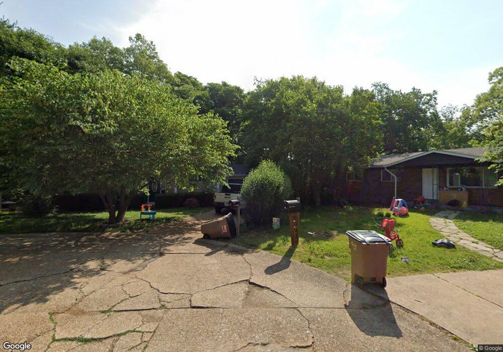
22 Apache Trail Fenton, MO 63026
Estimated Value: $148,000 - $241,000
3
Beds
2
Baths
864
Sq Ft
$234/Sq Ft
Est. Value
About This Home
This home is located at 22 Apache Trail, Fenton, MO 63026 and is currently estimated at $201,915, approximately $233 per square foot. 22 Apache Trail is a home located in Jefferson County with nearby schools including Northwest High School, Messenger Christian School, and St. Paul School.
Ownership History
Date
Name
Owned For
Owner Type
Purchase Details
Closed on
May 22, 2013
Sold by
Secretary Of Hud
Bought by
Veritas Single Properties Holdings Llc
Current Estimated Value
Purchase Details
Closed on
Feb 6, 2013
Sold by
Wells Fargo Bank Na
Bought by
Secretary Of Hud Of Washington D C
Purchase Details
Closed on
Dec 3, 2012
Sold by
S & W Foreclosure Corp
Bought by
Wells Fargo Bank Na
Purchase Details
Closed on
Mar 19, 2002
Sold by
Jones Dustin K and Jones Brooke A
Bought by
Jones Dustin K and Jones Brooke A
Home Financials for this Owner
Home Financials are based on the most recent Mortgage that was taken out on this home.
Original Mortgage
$79,207
Interest Rate
6.87%
Purchase Details
Closed on
Dec 4, 1998
Sold by
Faulkenberry Susan
Bought by
Jones Dustin K and Forir Brooke A
Home Financials for this Owner
Home Financials are based on the most recent Mortgage that was taken out on this home.
Original Mortgage
$80,154
Interest Rate
6.81%
Mortgage Type
FHA
Create a Home Valuation Report for This Property
The Home Valuation Report is an in-depth analysis detailing your home's value as well as a comparison with similar homes in the area
Home Values in the Area
Average Home Value in this Area
Purchase History
| Date | Buyer | Sale Price | Title Company |
|---|---|---|---|
| Veritas Single Properties Holdings Llc | -- | None Available | |
| Secretary Of Hud Of Washington D C | -- | None Available | |
| Wells Fargo Bank Na | $142,976 | None Available | |
| Jones Dustin K | -- | -- | |
| Jones Dustin K | -- | Capital Title |
Source: Public Records
Mortgage History
| Date | Status | Borrower | Loan Amount |
|---|---|---|---|
| Previous Owner | Jones Dustin K | $79,207 | |
| Previous Owner | Jones Dustin K | $80,154 |
Source: Public Records
Tax History
| Year | Tax Paid | Tax Assessment Tax Assessment Total Assessment is a certain percentage of the fair market value that is determined by local assessors to be the total taxable value of land and additions on the property. | Land | Improvement |
|---|---|---|---|---|
| 2025 | $1,329 | $19,900 | $1,800 | $18,100 |
| 2024 | $1,329 | $18,400 | $1,800 | $16,600 |
| 2023 | $1,329 | $18,400 | $1,800 | $16,600 |
| 2022 | $1,323 | $18,400 | $1,800 | $16,600 |
| 2021 | $1,314 | $18,400 | $1,800 | $16,600 |
| 2020 | $1,215 | $16,600 | $1,400 | $15,200 |
| 2019 | $1,213 | $16,600 | $1,400 | $15,200 |
| 2018 | $1,229 | $16,600 | $1,400 | $15,200 |
| 2016 | $1,024 | $15,000 | $1,500 | $13,500 |
Source: Public Records
Map
Nearby Homes
- 800 Mary Lee Ct
- 100 Orchid Dr Unit 100
- 811 Mary Lee Ct
- 818 Mary Lee Ct
- 91 Poppy Dr Unit 91
- 711 Mosely Ct
- 1230 Summit Meadows Dr
- 53 Lois Ln
- 000 Gravois Summit
- 26 W Lakewood Dr
- 927 Gravois Rd
- 1375 Mosswoods Dr
- 52 Glenwood Dr
- 1273 Green Falls Dr
- 916 Tree Trails Ln
- 946 Tree Trails Ln
- 907 Oak Dr
- 831 Oak Dr
- 1835 San Pedro Ln
- 1029 Ginger Root Dr
- 21 Apache Trail
- 23 Apache Trail
- 20 Apache Trail
- 19 Apache Trail
- 24 Apache Trail
- 18 Apache Trail
- 9 Chism Trail
- 25 Apache Trail
- 10 Chism Trail
- 47 Chism Trail Unit B
- 17 Apache Trail
- 11 Chism Trail
- 8 Chism Trail
- 7 Chism Trail
- 26 Apache Trail
- 16 Apache Trail
- 13 Frontier Trail
- 12 Frontier Trail
- 6 Frontier Trail
- 27 Apache Trail
Your Personal Tour Guide
Ask me questions while you tour the home.