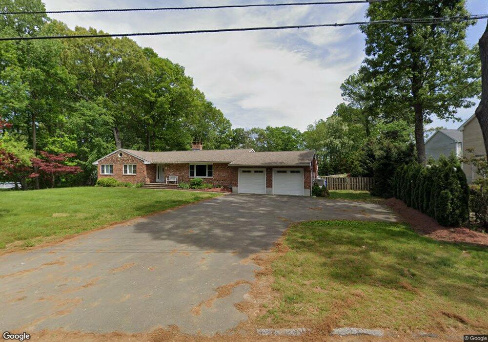
22 Ashwood Cir Shelton, CT 06484
Estimated Value: $609,000 - $670,000
2
Beds
3
Baths
2,029
Sq Ft
$313/Sq Ft
Est. Value
About This Home
This home is located at 22 Ashwood Cir, Shelton, CT 06484 and is currently estimated at $636,019, approximately $313 per square foot. 22 Ashwood Cir is a home located in Fairfield County with nearby schools including Perry Hill School, Shelton Intermediate School, and Shelton High School.
Ownership History
Date
Name
Owned For
Owner Type
Purchase Details
Closed on
Oct 26, 2011
Sold by
Risselo Alexander
Bought by
Quirconi Laura
Current Estimated Value
Purchase Details
Closed on
Nov 21, 2006
Sold by
Rgr Shelton Llc
Bought by
Rissolo Tamara
Home Financials for this Owner
Home Financials are based on the most recent Mortgage that was taken out on this home.
Original Mortgage
$336,124
Interest Rate
6.33%
Create a Home Valuation Report for This Property
The Home Valuation Report is an in-depth analysis detailing your home's value as well as a comparison with similar homes in the area
Home Values in the Area
Average Home Value in this Area
Purchase History
| Date | Buyer | Sale Price | Title Company |
|---|---|---|---|
| Quirconi Laura | $357,000 | -- | |
| Quirconi Laura | $357,000 | -- | |
| Rissolo Tamara | $420,155 | -- | |
| Rissolo Tamara | $420,155 | -- |
Source: Public Records
Mortgage History
| Date | Status | Borrower | Loan Amount |
|---|---|---|---|
| Previous Owner | Rissolo Tamara | $336,124 |
Source: Public Records
Tax History Compared to Growth
Tax History
| Year | Tax Paid | Tax Assessment Tax Assessment Total Assessment is a certain percentage of the fair market value that is determined by local assessors to be the total taxable value of land and additions on the property. | Land | Improvement |
|---|---|---|---|---|
| 2025 | $5,415 | $287,700 | $0 | $287,700 |
| 2024 | $5,518 | $287,700 | $0 | $287,700 |
| 2023 | $5,026 | $287,700 | $0 | $287,700 |
| 2022 | $5,026 | $287,700 | $0 | $287,700 |
| 2021 | $5,903 | $267,960 | $0 | $267,960 |
| 2020 | $6,008 | $267,960 | $0 | $267,960 |
| 2019 | $6,008 | $267,960 | $0 | $267,960 |
| 2017 | $5,951 | $267,960 | $0 | $267,960 |
| 2015 | $5,215 | $233,730 | $0 | $233,730 |
| 2014 | $5,215 | $233,730 | $0 | $233,730 |
Source: Public Records
Map
Nearby Homes
- 184 Kyles Way
- 115 Kyles Way
- 179 Remy Ct Unit 179
- 86 Kyles Way Unit 86
- 15 Orowoc Trail
- 8 Noguchi Trail
- 3 Noguchi Trail
- 11 Pueblo Trail
- 8 Algonkin Rd Unit A
- 82 Kanungum Trail
- 35 Mustang Dr
- 52 Mustang Dr
- 183 Centennial Dr
- 38 Stowe Dr
- 81 Masters Ln
- 89 Masters Ln
- 665 River Rd Unit 11
- 665 River Rd Unit 2
- 33 Happy Hollow Cir Unit C
- 60 Engine House Rd Unit D
- 22 Ashwood Cir
- 22 Ashwood Cir Unit 22
- 20 Ashwood Cir
- 2 Ashwood Cir
- 4 Ashwood Cir
- 6 Ashwood Cir
- 8 Ashwood Cir
- 28 Ashwood Cir
- 26 Ashwood Cir
- 18 Ashwood Cir
- 16 Ashwood Cir
- 16 Ashwood Cir Unit 16
- 14 Ashwood Cir
- 14 Ashwood Cir Unit 14
- 12 Ashwood Cir
- 5 Turner Rd
- 10 Ashwood Cir
- 10 Ashwood Cir Unit 10
- 1 Ashwood Cir
- 3 Ashwood Cir