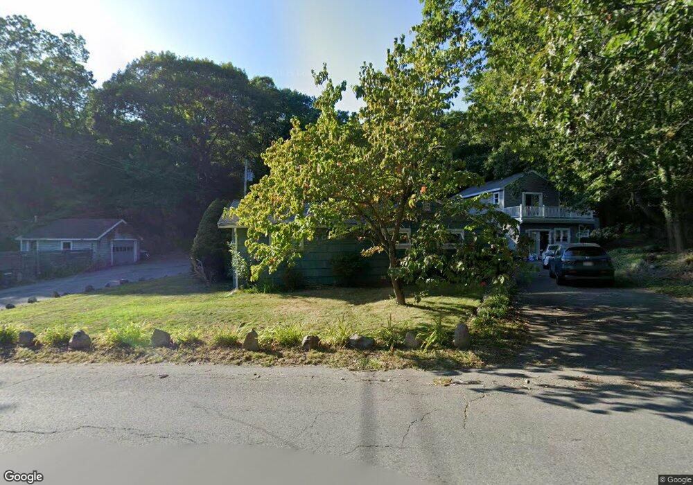
22 Atlantic St Unit 1 Gloucester, MA 01930
West Gloucester NeighborhoodEstimated Value: $558,000 - $665,000
2
Beds
2
Baths
1,224
Sq Ft
$497/Sq Ft
Est. Value
About This Home
This home is located at 22 Atlantic St Unit 1, Gloucester, MA 01930 and is currently estimated at $608,886, approximately $497 per square foot. 22 Atlantic St Unit 1 is a home located in Essex County with nearby schools including West Parish, Ralph B O'maley Middle School, and Faith Christian School.
Ownership History
Date
Name
Owned For
Owner Type
Purchase Details
Closed on
Mar 28, 2007
Sold by
Rangan Leroy Ramani and Bernstein-Rangan Jenny S
Bought by
Johnson Ronald Lee
Current Estimated Value
Home Financials for this Owner
Home Financials are based on the most recent Mortgage that was taken out on this home.
Original Mortgage
$220,000
Outstanding Balance
$134,330
Interest Rate
6.33%
Mortgage Type
Purchase Money Mortgage
Estimated Equity
$474,556
Create a Home Valuation Report for This Property
The Home Valuation Report is an in-depth analysis detailing your home's value as well as a comparison with similar homes in the area
Home Values in the Area
Average Home Value in this Area
Purchase History
| Date | Buyer | Sale Price | Title Company |
|---|---|---|---|
| Johnson Ronald Lee | $275,000 | -- |
Source: Public Records
Mortgage History
| Date | Status | Borrower | Loan Amount |
|---|---|---|---|
| Open | Johnson Ronald Lee | $220,000 |
Source: Public Records
Tax History Compared to Growth
Tax History
| Year | Tax Paid | Tax Assessment Tax Assessment Total Assessment is a certain percentage of the fair market value that is determined by local assessors to be the total taxable value of land and additions on the property. | Land | Improvement |
|---|---|---|---|---|
| 2025 | $4,614 | $474,700 | $0 | $474,700 |
| 2024 | $4,329 | $444,900 | $0 | $444,900 |
| 2023 | $4,156 | $392,400 | $0 | $392,400 |
| 2022 | $4,171 | $355,600 | $0 | $355,600 |
| 2021 | $4,162 | $334,600 | $0 | $334,600 |
| 2020 | $4,282 | $347,300 | $0 | $347,300 |
| 2019 | $4,084 | $321,800 | $0 | $321,800 |
| 2018 | $3,856 | $298,200 | $0 | $298,200 |
| 2017 | $3,646 | $276,400 | $0 | $276,400 |
| 2016 | $3,465 | $254,600 | $0 | $254,600 |
| 2015 | $3,400 | $249,100 | $0 | $249,100 |
Source: Public Records
Map
Nearby Homes
- 30 Atlantic St
- 188 Atlantic St
- 109 Riverview Rd
- 49 Thurston Point Rd
- 5 Samoset Rd Unit A
- 226 Atlantic St
- 7 Leaman Dr
- 368 Essex Ave
- 11 Overlook Ave
- 227 Essex Ave
- 12 Woodward Ave
- 145 Essex Ave Unit 610
- 18 Cherry St
- 587 Essex Ave
- 6 Beauport Ave
- 672 Washington St
- 65 Poplar St
- 196 Washington St
- 19 Mystic Ave
- 15 Harvard St
- 22 Atlantic St Unit 2
- 22 Atlantic St
- 22 Atlantic St Unit A
- 24 Atlantic St
- 20 Atlantic St
- 16 Valley Rd
- 26 Atlantic St
- 26 Atlantic St Unit A
- 21 Atlantic St
- 28 Atlantic St
- 11 Atlantic St
- 56 Hill Top Rd
- 50 Hill Top Rd
- 14 Atlantic St
- 32 Atlantic St
- 9 Atlantic St
- 58 Hill Top Rd
- 40 Hill Top Rd
- 40 Hill Top Rd Unit 1
- 123ABC Opportunity Way