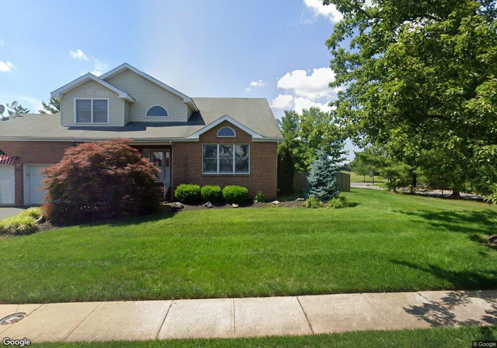
22 Baker Cir Hillsborough, NJ 08844
Estimated Value: $865,815 - $891,000
--
Bed
--
Bath
2,551
Sq Ft
$346/Sq Ft
Est. Value
About This Home
This home is located at 22 Baker Cir, Hillsborough, NJ 08844 and is currently estimated at $882,204, approximately $345 per square foot. 22 Baker Cir is a home located in Somerset County with nearby schools including Hillsborough High School, Brighthorizons at Hillsborough, and Cherry Blossom Montessori School.
Ownership History
Date
Name
Owned For
Owner Type
Purchase Details
Closed on
Aug 20, 2002
Sold by
Bradwein Mark
Bought by
Brown William and Brown Janet
Current Estimated Value
Home Financials for this Owner
Home Financials are based on the most recent Mortgage that was taken out on this home.
Original Mortgage
$300,700
Outstanding Balance
$125,784
Interest Rate
6.39%
Estimated Equity
$756,420
Purchase Details
Closed on
Apr 28, 1993
Sold by
Majestic Knolls Inc
Bought by
Brandwein Mary I and Brandwein Amy D
Create a Home Valuation Report for This Property
The Home Valuation Report is an in-depth analysis detailing your home's value as well as a comparison with similar homes in the area
Home Values in the Area
Average Home Value in this Area
Purchase History
| Date | Buyer | Sale Price | Title Company |
|---|---|---|---|
| Brown William | $381,000 | -- | |
| Brandwein Mary I | $232,700 | -- |
Source: Public Records
Mortgage History
| Date | Status | Borrower | Loan Amount |
|---|---|---|---|
| Open | Brown William | $300,700 |
Source: Public Records
Tax History Compared to Growth
Tax History
| Year | Tax Paid | Tax Assessment Tax Assessment Total Assessment is a certain percentage of the fair market value that is determined by local assessors to be the total taxable value of land and additions on the property. | Land | Improvement |
|---|---|---|---|---|
| 2025 | $14,420 | $734,000 | $347,300 | $386,700 |
| 2024 | $14,420 | $672,900 | $317,300 | $355,600 |
| 2023 | $12,968 | $602,300 | $317,300 | $285,000 |
| 2022 | $12,255 | $548,800 | $277,300 | $271,500 |
| 2021 | $11,734 | $500,300 | $227,300 | $273,000 |
| 2020 | $11,963 | $501,800 | $227,300 | $274,500 |
| 2019 | $11,739 | $488,300 | $212,300 | $276,000 |
| 2018 | $11,108 | $459,200 | $177,500 | $281,700 |
| 2017 | $10,846 | $449,100 | $168,500 | $280,600 |
| 2016 | $10,771 | $446,200 | $164,000 | $282,200 |
| 2015 | $10,873 | $456,100 | $172,300 | $283,800 |
| 2014 | $10,680 | $457,600 | $172,300 | $285,300 |
Source: Public Records
Map
Nearby Homes
- 3 Tunison Close
- 6 Crammer Ln
- 49 Flemming Dr
- 7 Dewitt Ln
- 39 Flemming Dr
- 42 Bateman Way Unit 9
- 2106 Jamestown Common
- 14 Runyon St
- 903A Marlborough Common
- 6 Crestwood Ave
- 12 Cranbrook Ave
- 204 Columbia Common
- 23 Cranbrook Ave
- 232 Wildflower Ln
- 13 Wesley Rd
- 814 Victoria Ct Unit 814
- 3203 Astor Close
- 920 Robin Rd
- 528 Andria Ave Unit 255
- 3301 Astor Close