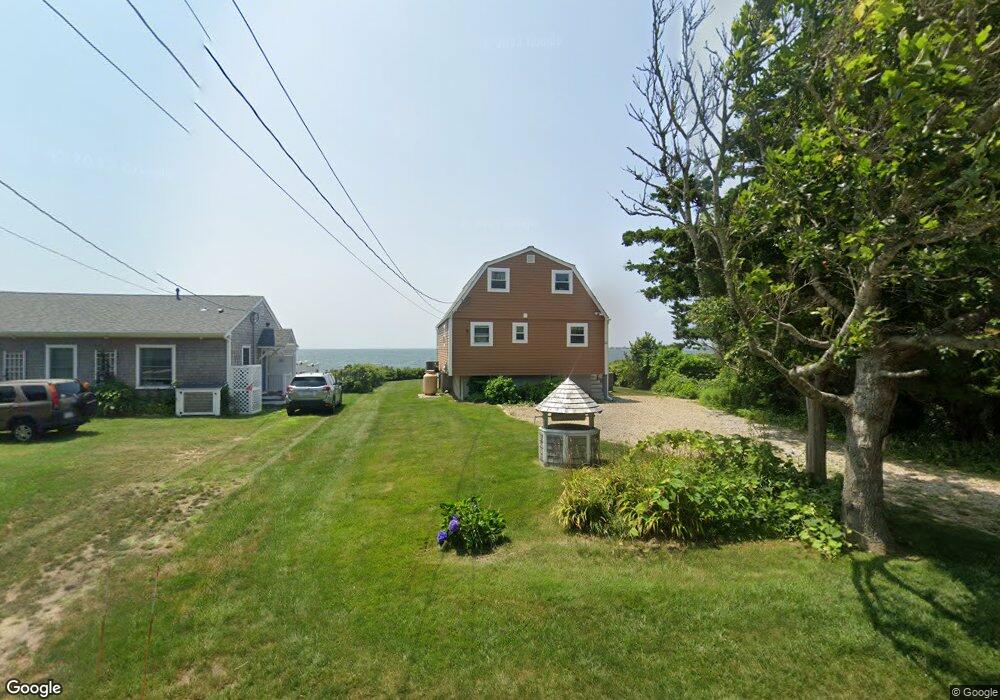
22 Balsam St Unit 22 Fairhaven, MA 02719
West Island NeighborhoodEstimated Value: $1,059,000 - $1,521,000
3
Beds
2
Baths
1,596
Sq Ft
$790/Sq Ft
Est. Value
About This Home
This home is located at 22 Balsam St Unit 22, Fairhaven, MA 02719 and is currently estimated at $1,261,013, approximately $790 per square foot. 22 Balsam St Unit 22 is a home located in Bristol County with nearby schools including Fairhaven High School.
Ownership History
Date
Name
Owned For
Owner Type
Purchase Details
Closed on
Mar 10, 2022
Sold by
Miller Brett M and Miller Jessica
Bought by
Miller 2022 Hawq T J and Miller M
Current Estimated Value
Purchase Details
Closed on
Feb 17, 2017
Sold by
22 Balsam Street Rt and Tumiski
Bought by
Miller Brett M
Home Financials for this Owner
Home Financials are based on the most recent Mortgage that was taken out on this home.
Original Mortgage
$471,200
Interest Rate
4.2%
Mortgage Type
New Conventional
Create a Home Valuation Report for This Property
The Home Valuation Report is an in-depth analysis detailing your home's value as well as a comparison with similar homes in the area
Home Values in the Area
Average Home Value in this Area
Purchase History
| Date | Buyer | Sale Price | Title Company |
|---|---|---|---|
| Miller 2022 Hawq T J | -- | None Available | |
| Miller 2022 Hawq T J | -- | None Available | |
| Miller Brett M | $589,000 | -- | |
| Miller Brett M | $589,000 | -- |
Source: Public Records
Mortgage History
| Date | Status | Borrower | Loan Amount |
|---|---|---|---|
| Previous Owner | Miller Brett M | $471,200 |
Source: Public Records
Tax History Compared to Growth
Tax History
| Year | Tax Paid | Tax Assessment Tax Assessment Total Assessment is a certain percentage of the fair market value that is determined by local assessors to be the total taxable value of land and additions on the property. | Land | Improvement |
|---|---|---|---|---|
| 2025 | $82 | $882,200 | $654,300 | $227,900 |
| 2024 | $8,036 | $870,600 | $654,300 | $216,300 |
| 2023 | $8,266 | $830,800 | $640,700 | $190,100 |
| 2022 | $8,271 | $809,300 | $627,100 | $182,200 |
| 2021 | $6,777 | $600,300 | $449,900 | $150,400 |
| 2020 | $6,639 | $600,300 | $449,900 | $150,400 |
| 2019 | $6,386 | $547,200 | $409,000 | $138,200 |
| 2018 | $7,015 | $539,600 | $409,000 | $130,600 |
| 2017 | $6,095 | $506,200 | $381,700 | $124,500 |
| 2016 | $6,030 | $495,100 | $381,700 | $113,400 |
| 2015 | $5,906 | $486,100 | $374,900 | $111,200 |
Source: Public Records
Map
Nearby Homes
- 91 Balsam St
- 120 Balsam St
- 151 Balsam St
- 59 Starboard Dr Unit 36A
- 58 Starboard Dr Unit 36B
- 55 Starboard Dr Unit 36E
- 54 Starboard Dr Unit 36F
- 56 Starboard Dr Unit 36D
- 57 Starboard Dr Unit 36C
- 8 Sunset Beach Rd
- 389 Sconticut Neck Rd
- 14 Summit Dr
- 19 Smith St
- 28 Brandt Beach Ave
- 7 Mattakiset Rd
- 16 Reservation Rd
- 0 Marina Dr Unit 72497908
- 0 Marina Dr Unit 72497877
- 15 Baxter Ave
- 190 Sconticut Neck Rd